Elevation: 7,660 ft
Prominence: 40
This peak is not in the book. Published November 2022
Mormon Hill is a partially-forested hump that is located just above the Mormon Hill trailhead. There is a footpath that leads to the open summit area. USGS Star Hope Mine
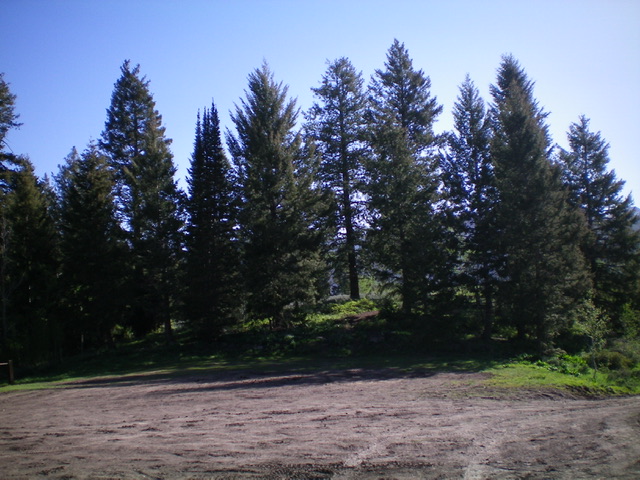
The forested hump of Mormon Hill as viewed from the trailhead parking lot. Livingston Douglas Photo
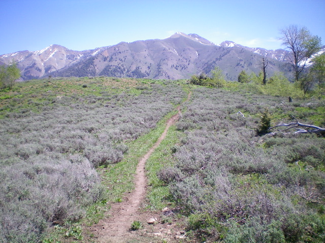
The open summit of Mormon Hill and the foot trail leading to the summit. Livingston Douglas Photo
Access
The Mormon Hill trailhead is located at the top of FSR-130. To reach it, drive north up Copper Creek Road/FSR-134 to a signed junction with the Garfield Canyon Road/FSR-228 (which goes to the Garfield Guard Station and beyond). Go left at this junction to stay on FSR-134. About 0.7 miles farther up FSR-134, reach a signed road junction in a large, open meadow. FSR-134 goes right here and follows Copper Creek. However, it is now closed to motorized vehicles and is only a foot trail. Go left up FSR-130 as it begins its steep climb to the Mormon Hill trailhead. A 4WD vehicle is required but high clearance is not necessary. After 2.3 miles from the open meadow, you reach the large trailhead parking area for the [signed] Mormon Hill trailhead (FST-329). There is a horse rail and a bathroom here (7,625 feet). The road is not too awful and people pull horse trailers all the way up here.
Southwest Face, Class 1
The Climb
From the trailhead parking area, follow a narrow footpath up through a patch of forest to reach the open summit area of Mormon Hill. The high point seems to be a collection of ground boulders. There is no summit cairn.
Additional Resources
Regions: EASTERN IDAHO->Pioneer Mountains
Mountain Range: Pioneer Mountains
Longitude: -113.96579 Latitude: 43.62719