Elevation: 7,705 ft
Prominence: 445
This peak is not in the book. I have included two Steve Mandella photos and Margo Mandella’s GPS track at the bottom of the page. Be sure to read Livingston’s Map Error section which points out significant errors on the maps you may use. Updated January 2023
Mount Manning is located at the head of Buttermilk Draw on the east side of the South Fork of Horseshoe Creek in the Big Hole Mountains west of Driggs. It is a rather inconsequential hump that requires some navigation and unpleasant terrain once you leave FST-219. USGS Garns Mountain
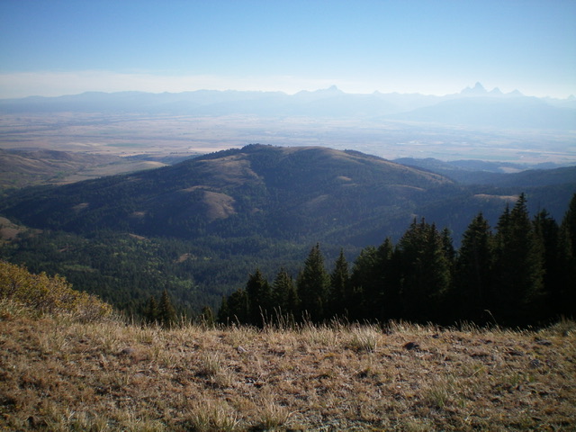
Mount Manning (mid-ground) as viewed from the southwest. Livingston Douglas Photo
Access
From the center of Driggs on ID-33, drive west on Bates Road for 6.3 miles. The road bends right/north and becomes S7000W. Drive north on S7000W for 1.0 mile to an unsigned junction.Reset your odometer here. Go left/west at this junction onto [unsigned] Horseshoe Creek Road/FSR-235. At 0.3 miles, the road bends left/southwest (sign for “Horseshoe Campground” here). At 1.6 miles, reach the Targhee National Forest boundary. At 3.4 miles, reach a road junction and a large trailhead parking lot and bathroom. This junction is shown as “Sam (site)” on the USGS topo map. Park here (6,505 feet). FST-219 (South Horseshoe Creek Trail) is across the road from the parking area.
Map Errors
There are numerous critical map errors on the USGS topo map. First, it shows a road (FSR-235B) heading south from Horseshoe Creek Road no longer exists. Second, the pack trail heading up Bell Creek no longer exists. The first section of that trail is now FSR-219 but only goes a short distance and then crosses a shoulder to the east. Third, FST-219/South Horseshoe Creek Trail is not shown on the map. Fourth, there is no trail heading up Superior Creek to the Superior Mine. The Targhee National Forest map is much more accurate in this area.
West Ridge, Class 2
The Climb
FST-219/Horseshoe Creek Trail is a MC trail that is rarely used by hikers. It is very narrow and is not very good for hiking. From the trailhead, FST-215 immediately crosses the North Fork of Horseshoe Creek on a footbridge and, soon after, crosses to the east side of Bell Creek. The trail heads south along the west side of a shoulder then bends left/southeast to cross the shoulder at a minor saddle. The trail then bends right/south and stays on this shoulder, well above the South Fork of Horseshoe Creek to the east. The trail bends right/southwest and drops to cross Superior Creek on a cut log. This crossing is about a mile from the trailhead.
The trail then heads southeast up over a shoulder to reach the South Fork drainage. The trail reaches an open, grassy area at 6,640 feet just south of a rocky, ridge hump. This area is shown on the USGS topo map as a clearing and is due west of the west ridge of Mount Manning. The clearing is about 0.3 miles southeast of the log crossing of Superior Creek. Much of thewest ridge is open terrain, but not its lower ramparts near the South Fork drainage, which are thickly forested. Leave the trail here and descend open terrain of field grass and brush to reach the thick pine forest that surrounds the South Fork drainage.
Cross the South Fork of Horseshoe Creek on a downed log then bash east up through a steep patch of thick pine forest to reach the open terrain of the west ridge. Unfortunately, the open terrain is thick sagebrush and other brush and is no picnic. Follow the ridge northeast then east to reach the north end of the summit plateau. Skirt the left/west side of the [lower] north summit hump on a weak game trail and then cruise south to the true summit on short grass/scrub. I rebuilt the torn-down summit cairn.
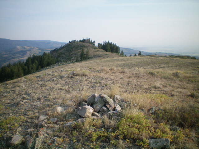
The summit cairn atop Mount Manning, looking northward at the [lower] north summit. Livingston Douglas Photo
Southwest Shoulder, Class 2
The Descent
From the summit, descend southwest on a shoulder in open scrub then west into thicker brush. The shoulder bends right/northwest and enters a pine forest that goes quickly. You will find a weak game/use trail on the shoulder once you enter the forest. Lower down, the shoulder follows a side drainage down to the South Fork of Horseshoe Creek. Cross the creek on a log amidst thick brush and quickly reach FST-219 which is nearby at this point and is about 0.2 miles upstream from the clearing and the trail departure point for the West Ridge Route. Hike 1.5 miles down FST-219 to the trailhead parking lot.
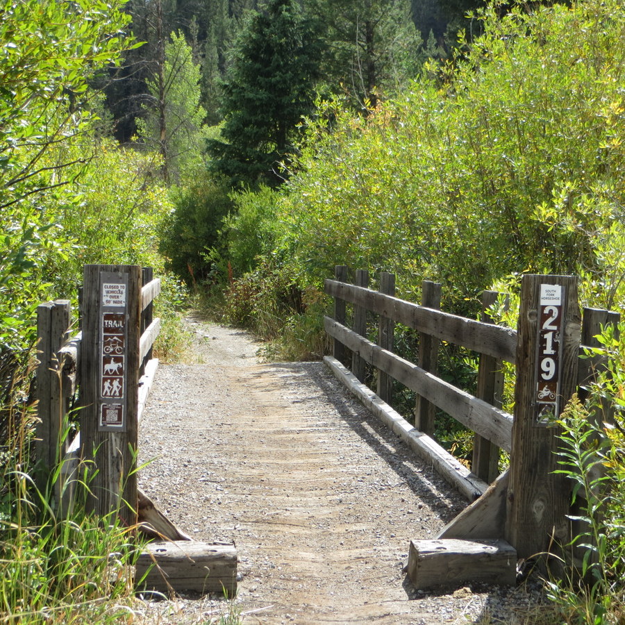
The FST-219 trailhead to access Mount Manning. Steve Mandella Photo
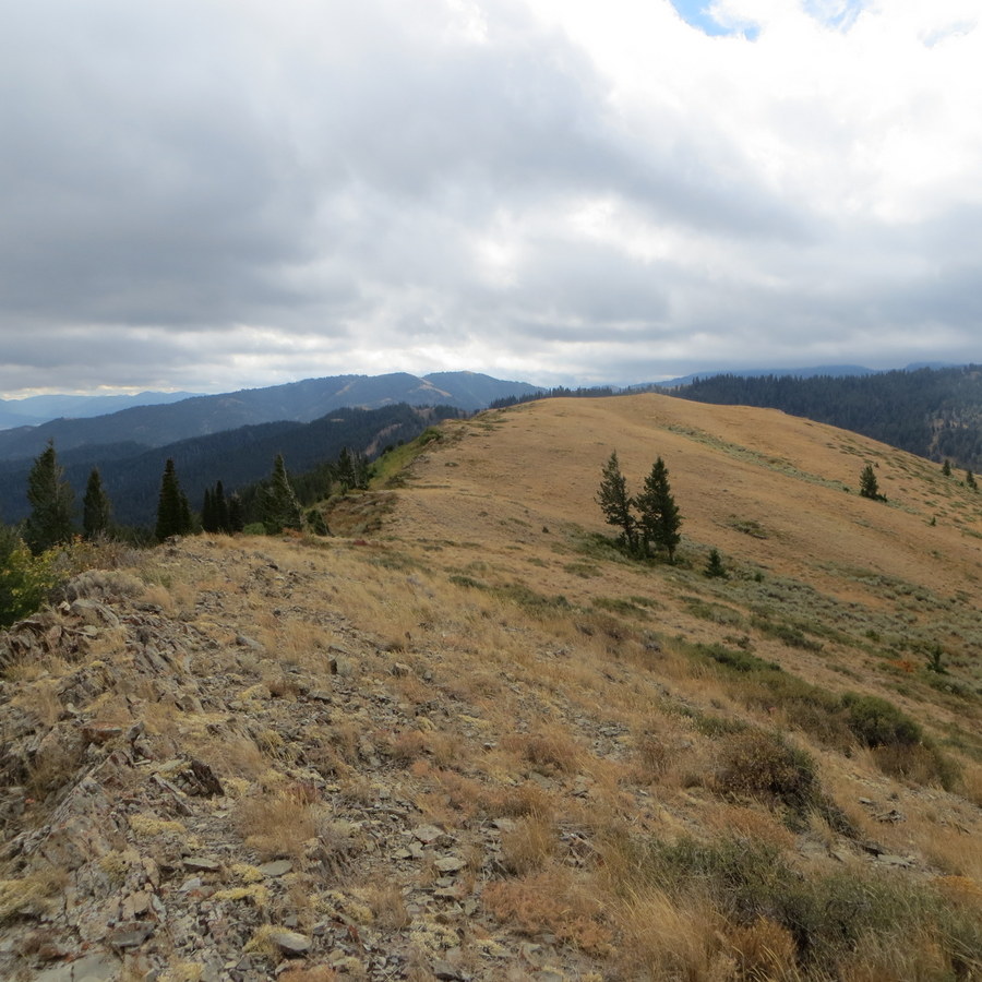
Mount Manning’s gentle summit ridge. Steve Mandella Photo
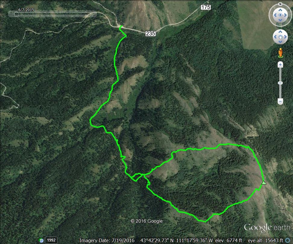
The West Ridge Loop Route on Mount Manning. Trip stats: about 4 miles with 1,200 feet elevation gain. Margo Mandella GPS track
Additional Resources
Mountain Range: Big Hole and Snake River Mountains
Longitude: -111.28669 Latitude: 43.70279