Elevation: 7,122 ft
Prominence: 862
Climbing and access information for this peak is on Page 38 of the book. Updated August 2025
Myrtle Peak is one of the easier Selkirk Peaks to climb as a trail leads to its summit and the road to the trailhead is better than many Selkirk roads. USGS The Wigwams
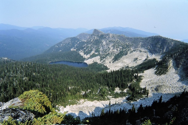
Myrtle Lake & Peak from Myrtle Lake Trail. Chic Burge Photo
Use the Inland NW Route and Hike North Idaho links below for updated route information.
Access and Route
To reach the trailhead from Bonners Ferry, drive east to the Kootenai National Wildlife Refuge. From this point, take the Westside Road 1.3 miles to Myrtle Creek Road/FSR-633 and continue for 10.0 miles. Turn right onto FSR-2406. It is 3.0 miles to the trailhead. A 4WD is required. Follow the trail for 3.0 miles and, just before the summit, you will find a side trail that leads the last few feet to the summit. The trail continues on past the peak to Myrtle Peak. The summit offers great views and, perhaps, the best view of Lions Head. Click here for a nice write up for this peak.
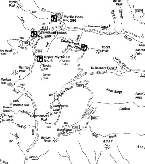
This Forest Service map will help orient you for the approach. Use a Panhandle National Forest map and a USGS topo for the hike.
The website Inland NW Routes is an exceptional resource for northern Idaho. More importantly the website has an extensive section on the Selkirk Mountains: The American Selkirks
Additional Resources
Regions: NORTHERN IDAHO->Selkirk Mountains
Mountain Range: Selkirk Mountains
Longitude: -116.64319 Latitude: 48.74869