Elevation: 8,870 ft
Prominence: 1,350
This peak is not in the book. Livingston Douglas added a route up the peak’s northeast face to complement the north ridge route. Updated November 2023
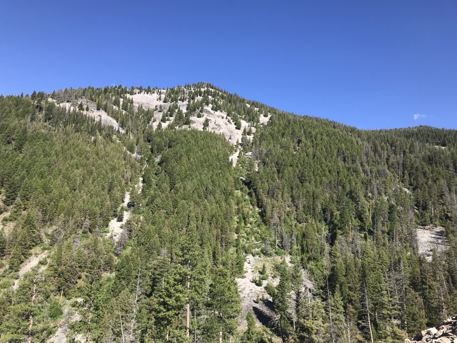
N Mountain is located west of the main Beaverhead Mountains Crest above Fourth of July Creek. A recent forest fire partially burned trees on the north ridge. The views of the Beaverhead Crest are outstanding. USGS Shewag Lake
N Mountain as viewed from the south
Access
Access from US-93 is via the well signed Fourth of July Creek Road/FS-071 [(A)(2) on Page 328]. This road is paved at first, then gravel and finally a narrow 4WD road that eventually leads to the Stein Mountain fire lookout. Take the road to the saddle on the peak’s north ridge. This drive covers 13.2 miles and climbs 4,740 feet.
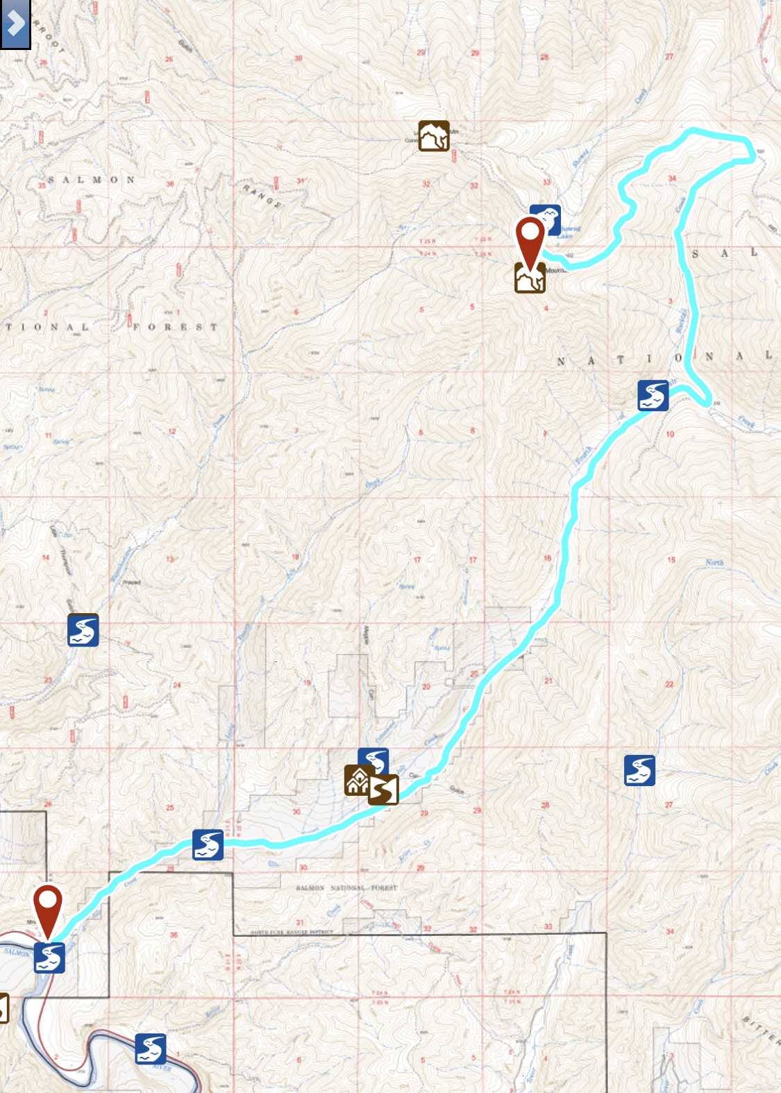
An overview of the road approaches
North Ridge, Class 2
From the road, follow the north ridge to the summit. A trail of sorts is developing in a fire break built to stop the spread of the recent fire. Round trip stats: 1.0 mile with about 300 feet of elevation gain.
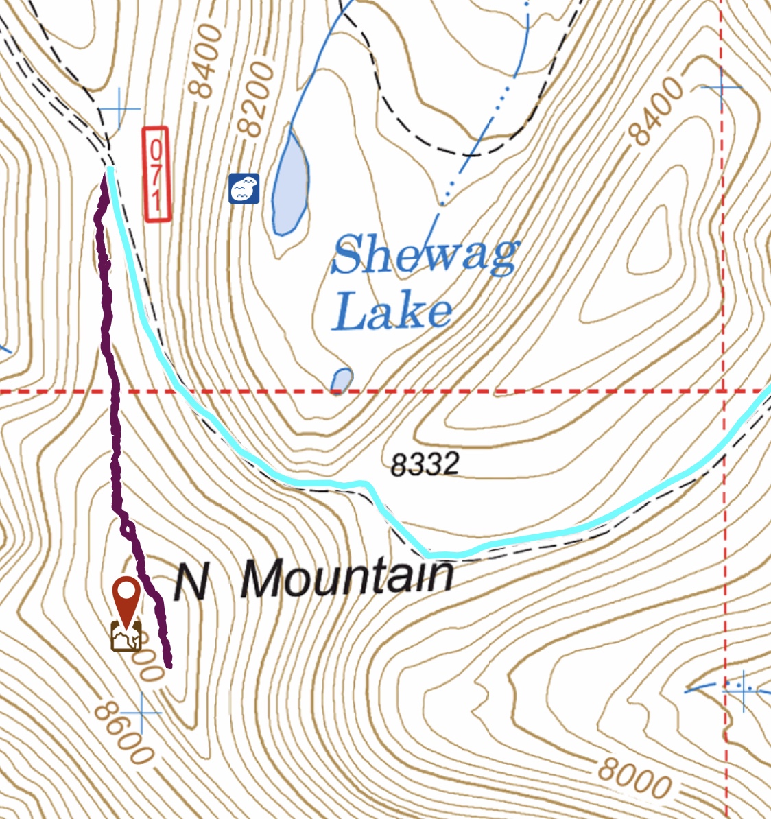
The route up the north ridge
Northeast Face by Livingston Douglas
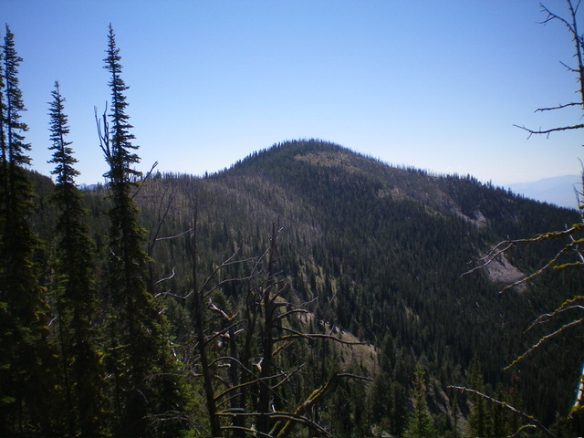
N Mountain as viewed from the northwest. The north ridge (my descent route) is left of center. Livingston Douglas Photo
Access
From US-93 north of Salmon, turn right/northeast onto [signed] Fourth of July Creek Road/FSR-071 [(A)(2) on Page 328] and drive 10.4 miles to a [signed] junction with FSR-256 on a high ridge crest. From the [signed] junction of FSR-071 and FSR-256 on the high ridge crest, drive 2.3 miles west then southwest on FSR-071 (the service road to the Stein Mountain fire lookout) to a saddle at the base of the northeast face of N Mountain. Park in a pullout here (8,332 feet; 45⁰26’40”N, 113⁰51’32”W).
Northeast Face, Class 2
The Climb
From the roadside pullout, walk a short distance west up FSR-071 to a good entry point for the northeast face. Leave the road and scramble southwest directly up the steep slope of live pines/firs, scrub, and deadfall (not too difficult). Higher up, enter a burn area and scramble up more open terrain to reach the ridge crest just right/north of the high point. Walk around fallen, charred timber to reach the summit (a charred tree). There is a small cairn nearby. I replaced this cairn with a larger cairn next to the tree. Views are limited due to the standing snags. However, the view to the south is magnificent (see photo).
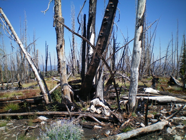
The charred summit of N Mountain. Livingston Douglas Photo
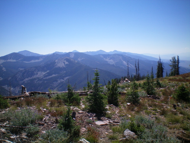
Summit view from atop N Mountain. Livingston Douglas Photo
Additional Resources
Regions: Beaverhead Range->EASTERN IDAHO
Mountain Range: Beaverhead Range
Year Climbed: 2019
Longitude: -113.86389 Latitude: 45.44289