Elevation: 7,444 ft
Prominence: 49
This hill is not in the book. Published November 2023
Napoleon Hill is located at the north end of a long north-south ridgeline that separates Moose Creek (t the west) from the Salmon River (to the east). Both the north summit and south summit are 85 feet above the saddle at the base of the south ridge, more than the 50 feet that the USGS topo map indicates. Based on altimeter measurements, the unofficial/south summit seems to be a few feet higher than the [measured] north summit. USGS Napoleon Hill
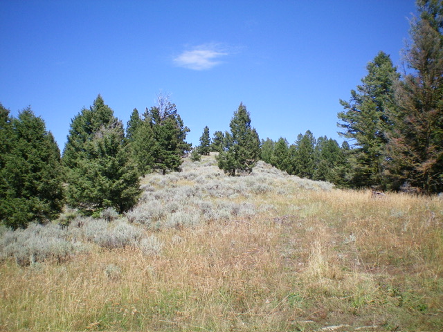
Napoleon Hill as viewed from the base of its south ridge, my ascent route. Livingston Douglas Photo
Access
From the Sinclair Gas Station at the north end of Salmon on US-93, drive 3.1 miles north on US-93 to a signed junction with Diamond Creek Road at the Lemhi County Fairgrounds. Turn left/west onto Diamond Creek Road and reset your odometer. At 0.5 miles, the road bends hard right/north. At 0.8 miles, reach a “Y” junction. Go left onto [signed] FSR-023.
At 11.6 miles, reach a 4-way signed junction on a saddle. Turn right/north here and drive north on FSR-020/Ridge Road for 3.4miles to a signed road junction at the base of the south ridge at a minor saddle. Park here (7,395 feet; 45⁰20’33”N, 114⁰00’12”W). FSR-020 gets narrow and quite rocky as you approach Napoleon Hill. It has several drivable mud holes along the way.
South Ridge, Class 2
The Climb
From the road junction, bushwhack north up the rounded ridge crest in a mix of grass, scrub, scattered pines, and patches of talus/scree. The south summit has a massive cairn atop it but it is not the official summit. Continue north along the [much narrower] ridge to reach the north/official summit with a 15-foot drop along the way. There is a USGS benchmark on the north summit but no summit cairn. There are nice, open views from the north summit. The south summit appears, and measures, to be slightly higher than the north summit. Stand atop both just to be sure that you have stood on the high point of Napoleon Hill. Why this minor ridge hump is named after Napoleon baffles me. Perhaps because both the hill and Napoleon are short in stature.
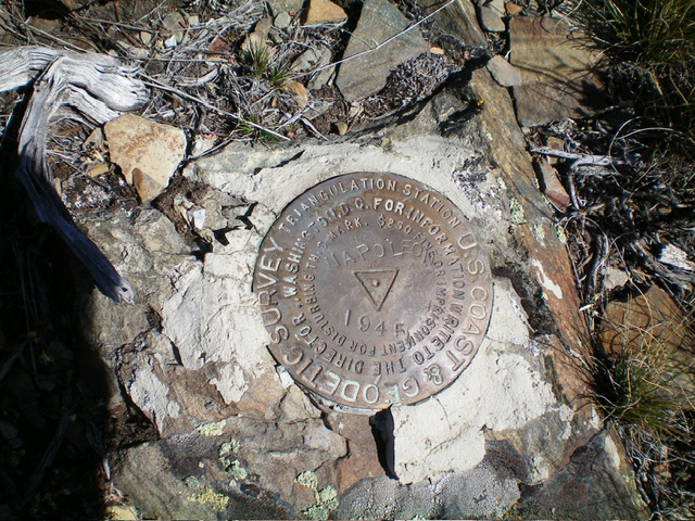
The USGS benchmark atop Napoleon Hill. Livingston Douglas Photo
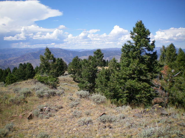
Summit view from the official/north summit of Napoleon Hill. Livingston Douglas Photo
Additional Resources
Mountain Range: Eastern Salmon River Mountains
Longitude: -114.0041 Latitude: 45.3455