Elevation: 7,373 ft
Prominence: 353
This peak is not in the book. Published November 2022
Nip Benchmark sits above Nip and Tuck Creek to its south. It is at the headwaters of Kelly Creek to its north. Nip Benchmark separates Joes Gulch from Stanley Creek. It is easily climbed via its south ridge from Nip and Tuck Road. USGS Basin Butte
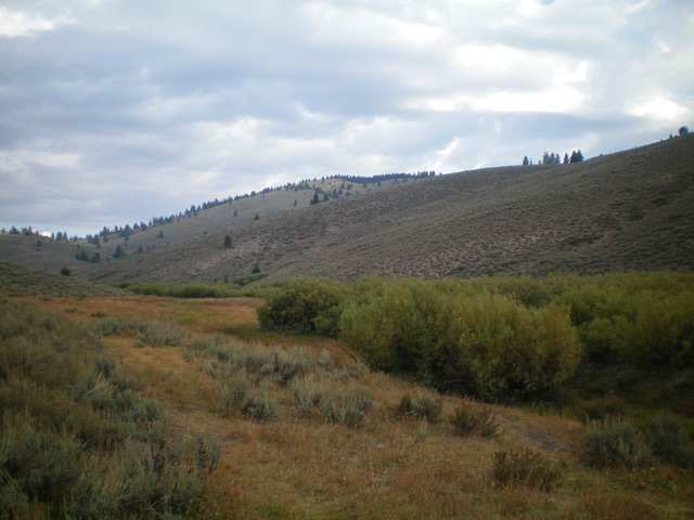
Nip Benchmark as viewed from the gully on Nip and Tuck Road (start of climb). The south ridge is on the right side of the photo. The forested summit is in the distance (dead center). Livingston Douglas Photo
Access
Nip and Tuck Road/FSR-633 is located in the center of Lower Stanley along ID-75. It is unsigned and is a narrow, one-lane road that heads west up an obvious gulch (Nip and Tuck Creek). Drive 1.4 miles up FSR-633 to a dry gully with a nearby pullout. Park here (6,425 feet). GPS coordinates: 44⁰14’10”N, 114⁰56’42”W.
Map Errors
The USGS topo map and trails maps fail to show the [decent and helpful] 2-track road on the south ridge of Nip Benchmark. The USGS topo map also fails to show FSR-141 which comes up to the summit of Nip Benchmark from the northeast.
South Ridge, Class 2
The Climb
From the base of the gully, scramble northeast up a steep-ish sagebrush slope with gaps (not too bad) to reach the crest of the south ridge. Follow a 2-track jeep road on the ridge crest all the way to the forested summit. There are two minor ups and downs along the way. The summit of Nip Benchmark has a USGS benchmark, a broken triangulation tripod laying on the ground, and two broken-down triangulation cairns with triangulation wiring. I rebuilt the highest cairn and stuck a nice post in the cairn. The 2-track jeep road on the south ridge begins along Nip and Tuck Road at the 0.8 mile point up from Lower Stanley. This junction is unsigned and the road is in very rough shape there and is probably not drivable. But you could hike Nip Benchmark from there and keep this climb at Class 1.
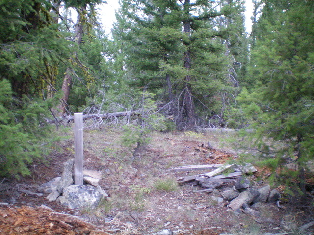
The forested summit of Nip Benchmark. Livingston Douglas Photo
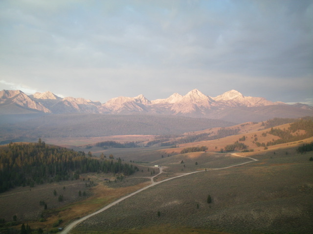
View of the Sawtooths from the south ridge of Nip Benchmark. Livingston Douglas Photo
Additional Resources
Regions: Eastern Salmon River Mountains->Salmon River Mountains->Southeast Corner Peaks->WESTERN IDAHO
Mountain Range: Eastern Salmon River Mountains
Longitude: -114.94039 Latitude: 44.25189