Elevation: 10,820 ft
Prominence: 880
Climbing and access information for this peak is on Page 286 of the book. Livingston Douglas has provided two new routes for this peak. Updated November 2021
One of the shorter climbs in the Lost River Range, Octoberfest Peak is the gateway to view many of the great peaks north of Pass Creek Summit. USGS Massacre Mountain
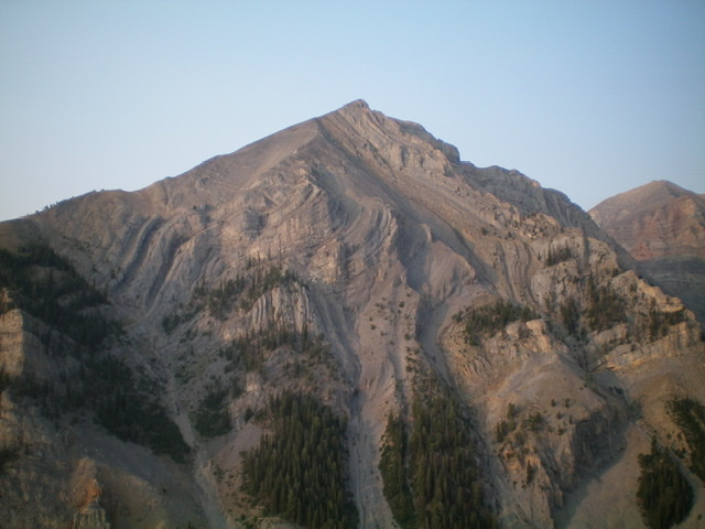
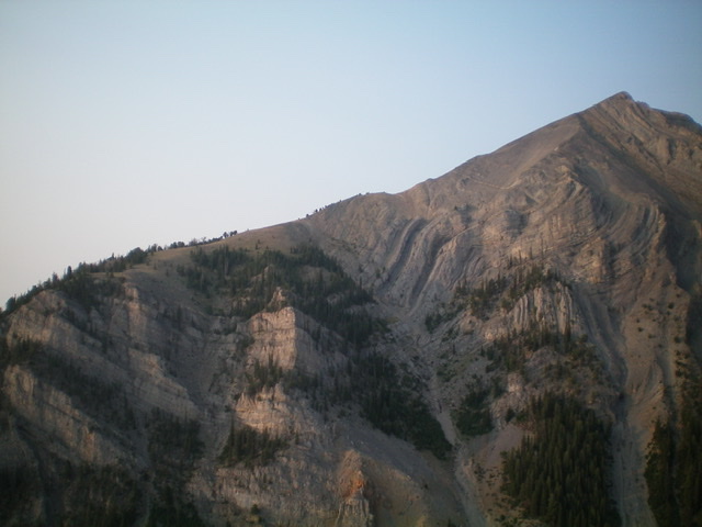
Octoberfest Peak and its unclimbed, magnificent north face. Livingston Douglas Photo
New Routes by Livingston Douglas
Here are two new routes on Octoberfest Peak. The first one climbs the east spur to the south summit, rather than climbing the “unnamed drainage” mentioned in the book (which is on the north side of the east spur), then follows the south ridge down to a saddle and onward to the true summit. The descent route follows the northeast ridge down to FST-092.
Access
Pass Creek Road/CR-122 is located along US-93 south of Mackay and is signed as 3900W. This junction is exactly 7.4 miles south of Main Street in Mackay and 18.3 miles north of the junction of US-93 and US-20 in Arco. Turn north onto [signed] Pass Creek Road and reset your odometer. At 11.5 miles, reach Pass Creek Summit and cross a cattle guard. Turn left/west here onto [unsigned] FSR-539 and drive 2.1 miles to the signed trailhead for FST-4092 (a MC trail). Park in a pullout across from the trailhead (8,020 feet).
East Spur/South Ridge, Class 2
The Climb
From the trailhead, hike southwest then south up narrow FST-4092 to reach a 9,020-foot saddle southwest of Warren Mountain. Leave the trail here. Head west across an open grassy field then bushwhack northwest up through a patch of pine forest that is somewhat steep and has some blowdown to navigate. Emerge from the pine forest onto the magnificent, open ridge of the east spur. The unobstructed views of the south summit (Point 10400+) and Octoberfest Peak are stunning.
Follow the rounded ridge west-southwest on stable talus/scree and embedded rock. There is a short section of gravel high up (with a game trail that switchbacks up through it). The top of Point 10400+ has a large cairn. You are now on the south ridge of Octoberfest Peak and the summit is dead ahead. Drop northward 50 vertical feet to an elongated saddle. From the saddle, it is an easy grind up broken scree to the small ridgeline summit. There is a modest cairn on top.
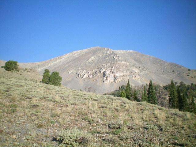
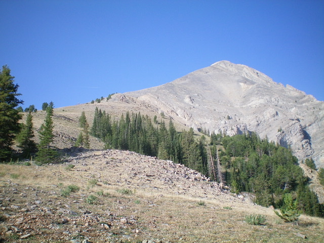
Octoberfest Peak as viewed from the base of the east spur. Livingston Douglas Photo
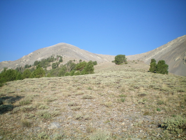
Looking up the east spur from the entry point. It heads up to Point 10400+ (left of center). Livingston Douglas Photo
Northeast Ridge, Class 2+
The Descent
From the summit, follow the ridge crest a short distance to the top of the northeast ridge. Descend east then northeast on the ridge crest. The ridge terrain is initially steep, loose rock of all sizes (talus, scree, gravel) but has a narrow goat trail in much of it. There are a few minor rock bands to downclimb. At tree line, the terrain changes to easy, open pine forest. A bit farther down (at 9,000-9,300 feet), there are some wicked rocky outcrops and cliffs on the left/northwest side of the ridge crest. Below this mess is a steep pine forest that goes quickly. At about 8,500 feet, however, the ridge loses its definition. Just keep heading northeast. After hiking up over Point 8400+, descend east on a ridge that soon bends left/north. Drop east off this ridge to reach FST-4092. Follow FST-4092 for a short distance back to the trailhead.
The northeast ridge (left skyline) of Octoberfest Peak. This was my descent route. Livingston Douglas Photo
Looking back up the northeast ridge from the halfway point. The summit is right of center. Livingston Douglas Photo
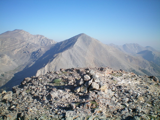
View of Last Lost Peak (dead center) from the summit of Octoberfest Peak. Livingston Douglas Photo
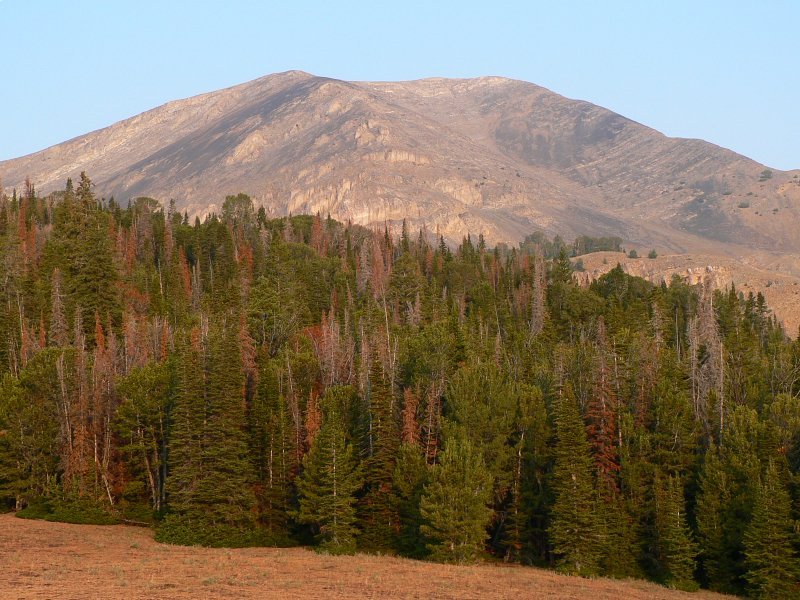
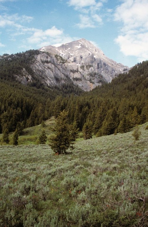
Octoberfest Peak. Dan Robbins Photo
Octoberfest Peak as viewed from the northeast.
Additional Resources