Elevation: 8,325 ft
Prominence: 265

This peak is not in the book. Published December 2020
Old Baldy Peak is the northernmost hump on Bald Mountain in the Caribou Range. It towers above McCoy Creek to the north, Iowa Creek to the west, and Fish Creek to the east. Old Baldy Peak can be easily reached via FST-453, a trail that is open only to foot/horse travel. USGS Tincup Mountain
Old Baldy Peak as viewed from the southeast. Livingston Douglas Photo
Access
From the junction of US-89 and Greys River Road in Alpine, WY (Alpine Market and Family Dollar are nearby), drive south on US-89 for 3.1 miles to a signed junction with McCoy Creek Road. Turn right/west onto McCoy Creek Road/FSR-087 and reset your odometer. At 6.6 and 6.8 miles, reach the two entrances to the McCoy Creek Campground.
At 15.0 miles, turn left/south onto unsigned FSR-137. This side road is located about 50 yards before the left turn for the side road that leads to the Bald Mountain Guard Station (which is visible from McCoy Creek Road). Drive 0.3 miles up FSR-137 to a horse corral. Park in a large open area next to the horse corral (6,240 feet) since there is no parking (or turnaround) at the trailhead for FST-453 about 0.1 mile farther up the road.
North Ridge/East Face, Class 2
The Climb
Only the final scramble up to the summit from the road is Class 2. From the trailhead, hike up FST-453 southeast then south up the north ridge of Old Baldy Peak. FST-453 follows an old 2-track jeep road that is now overgrown with tall field grass. The road has four shortcuts (each is on the left side of the road) to reduce the mileage created by a couple of long switchbacks. The USGS topo map fails to show the long switchbacks. Each shortcut is a narrow footpath that goes up through a forested section of the ridge.
FST-453 skirts the right/east side of Old Baldy Peak. Leave the trail when it crests directly east of the summit area. Bushwhack west about 0.1 miles (and 150 vertical feet) through easy scrub to reach the rocky summit perch. The summit of Old Baldy Peak has a USGS benchmark. It had no summit cairn so I built one. It is about four miles from the trailhead to the top of Old Baldy Peak.
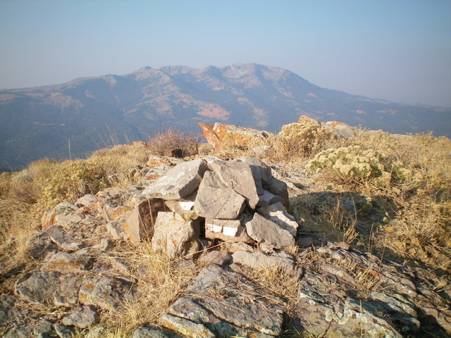
The newly-built summit cairn atop Old Baldy Peak, looking west. Livingston Douglas Photo
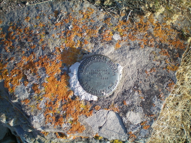
The USGS benchmark atop Old Baldy Peak. Livingston Douglas Photo
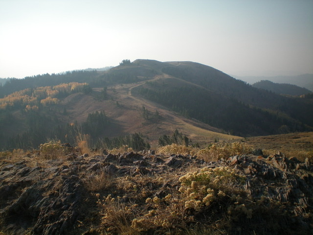
Looking south along the Bald Mountain ridge crest from the summit of Old Baldy Peak. Livingston Douglas Photo
South Ridge, Class 2
The Descent
From the summit, descend the open south ridge on easy scrub to rejoin FST-453 at an 8,060-foot saddle. This concludes the first leg of today’s two-peak journey. Bald Mountain is up next.
Additional Resources
Regions: Caribou Range->SOUTHERN IDAHO
Mountain Range: Caribou Range
Longitude: -111.21689 Latitude: 43.11939