Elevation: 7,219 ft
Prominence: 439
This peak is not in the book. Published November 2020
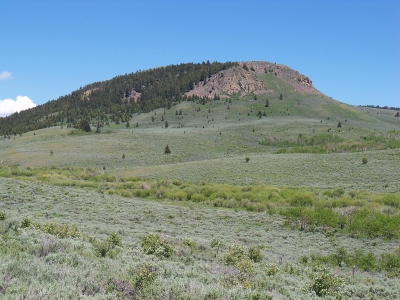
Opal Mountain is the high point in a heavily-mined area northeast of Spencer, ID. It separates East Threemile Creek from West Fork Rattlesnake Creek. It requires a short bushwhack up its north side to reach the summit. The south side of Opal Mountain is privately-owned and has several old mines on it. USGS Lookout Point
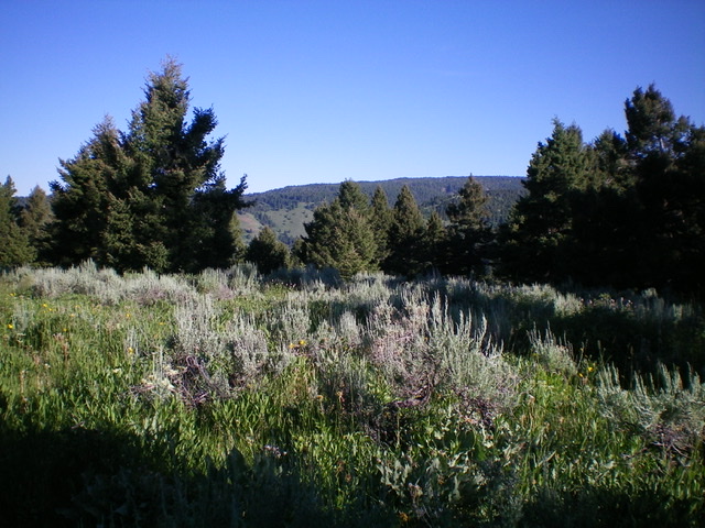
The semi-open summit of Opal Mountain. Livingston Douglas Photo
Access
From Exit 180/Spencer on I-15, drive east a short distance to the frontage road on the east side of I-15. Turn left/south and drive 1/8 mile to a junction. Go left/east onto [unsigned] Threemile Creek Road/FSR-021. Reset your odometer here. Follow FSR-021 across the railroad tracks and continue for 2.5 miles to the National Forest boundary. At 5.2 miles, reach a junction with FSR-477 (left turn). Go straight to stay on FSR-021. At 5.5 miles, reach an [unsigned] junction with a spur road just after crossing a cattle guard. Park here (6,755 feet).
North Ridge, Class 2
The Climb
Hike briefly south up the spur road past a campsite and up a weak 2-track road that is blocked by a massive downed tree. Follow this 2-track road south for about 0.2 miles to a semi-open area. Leave the road here and bushwhack right/southwest to the [visible] north ridge. This bushwhack is thick with brush/veg and blowdown and is not fun. But once you reach the ridge crest, life gets easier. Follow the crest of the ridge (or its right/west side) south in more open, easier terrain. The summit area is an open meadow with forest nearby. This is the high point.
Just to be sure, I hiked west to a forested rise that is almost as high, but nothing else was close. Based on the map positioning of the high point, the open area on the east side of the open summit area IS the high point. My altimeter showed no reason to think differently. When you descend the ridge, remember to move to the right/northeast when the ridge becomes more of a face and the slope flattens considerably. Then head north to intercept FSR-021. You may or may not be able to find the old 2-track road in the forest, but that’s not necessary to get back to your parked vehicle.
Additional Resources
Regions: Centennial Range->EASTERN IDAHO
Mountain Range: Centennial Range
Longitude: -112.08569 Latitude: 44.38929