Elevation: 8,082 ft
Prominence: 862

Climbing and access information for this peak is on Page 345 of the book. The access for this peak detailed in the book is now blocked by a “No Trespassing” sign. The new access route leaves from the top of Toy Pass. Also see the Owyhee Mountains Peaks List for all of the peaks in this range. Updated June 2019
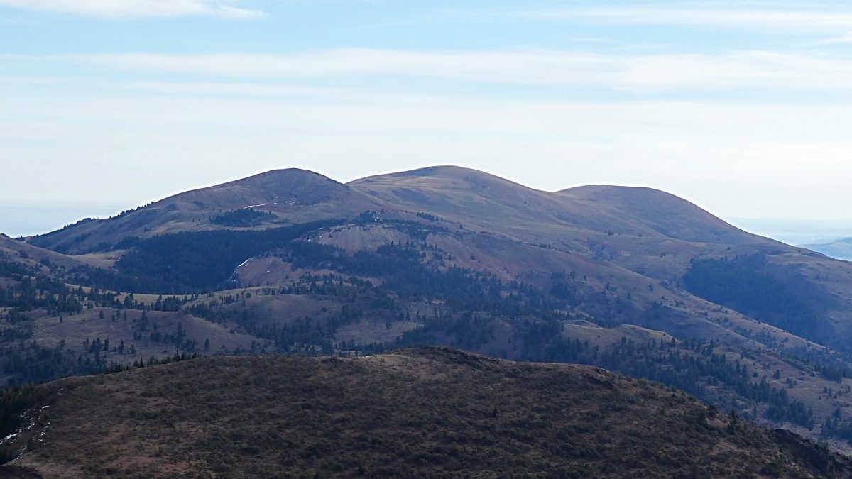
While not the highest Owyhee Mountains summit, it is the most distinctive with its three humps clearly visible from Boise. This is my favorite Owyhee peak. It is far enough away from Silver City that you will seldom run into people on your climb. It also has a great view of the Snake River plain. USGS Cinnabar Mountain
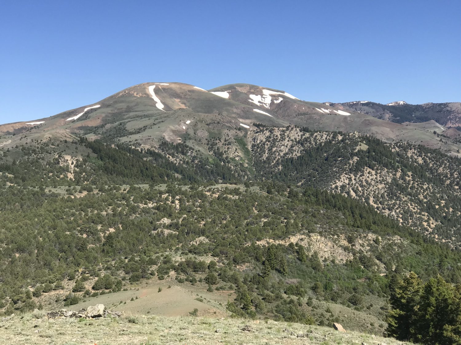
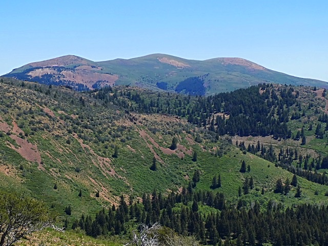
Quicksilver Mountain as viewed from Peak 6499.
Access
Toy Pass [A](3) on Pages 346-347]
Southeast Ridge from Toy Pass, Class 1-2
At the top of Toy Pass, just south of the cattleguard, a 4WD/ATV road leaves the main road and heads west through the junipers. Follow this road west as it quickly contours to a ridge above the next drainage where there is a gate. Cross through the gate. From this point, the road swings around the drainage to saddle on the main crest. After this point, the road drops downhill heading to God knows where. There is a range fence in the saddle. This fence leads along the ridge to Peak 6499/Mercury Peak.
You can cross through a gate at the saddle and follow the ridge toward Peak 6499 or you can follow the fence line on its south side. Eventually, if you stay south of the fence, you will come to an ATV trail designated C310. This ATV trail runs nearly over the summit of Peak 6499 and then drops into the saddle below Quicksilver’s Southeast Ridge. The ATV trail has several ups and downs that will lengthen the ordeal. Alternatively, if you go through the gate you can stay near the ridge top following the occasional cattle trail and avoid a few ups and downs but you will need to cross the fence without a gate before reaching Peak 6499.
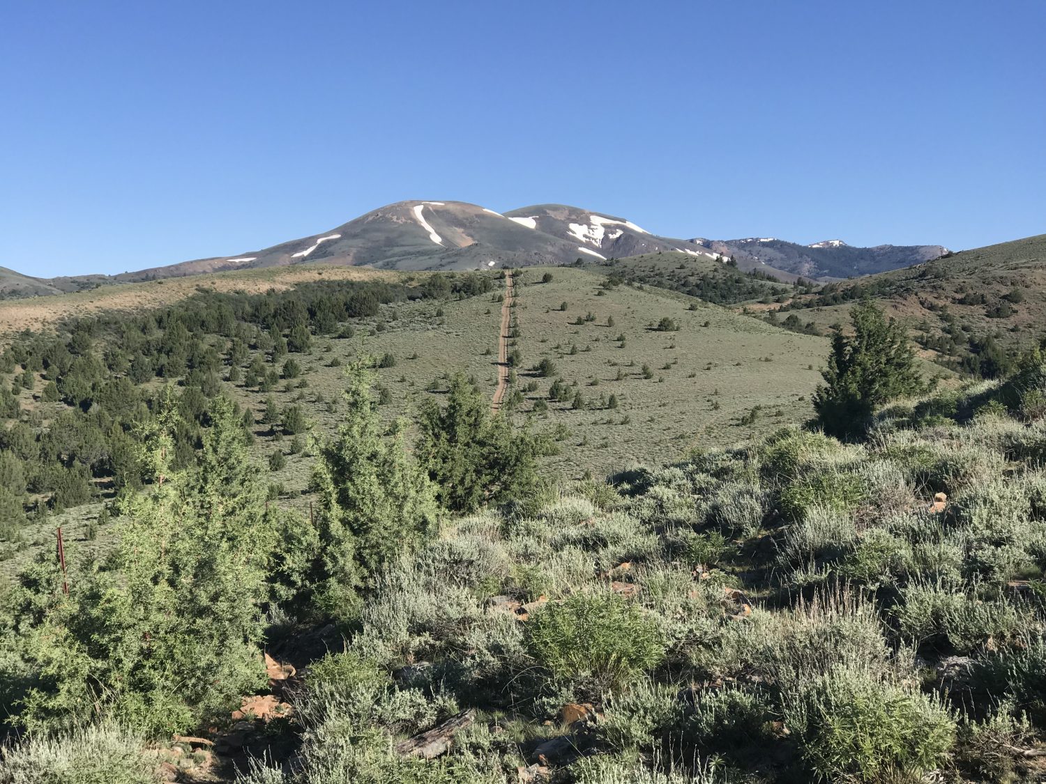
The ATV trail #C310 climbing up the ridge between Toy Pass and Peak 6499/Mercury Peak.
Dave Pahlas’ excellent trip report is linked below. Dave measured the trip at 13.0 miles with 3,600 feet of gain round trip. His route crossed over Peak 6499.
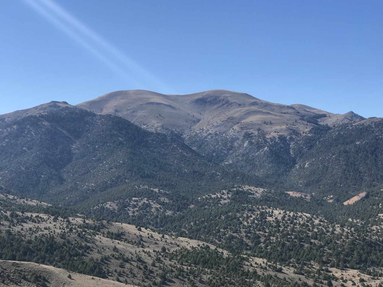
Quicksilver Mountain as viewed from Peak 8021.
Quicksilver Mountain viewed from Red Mountain.
Quicksilver Mountain viewed from the southwest.
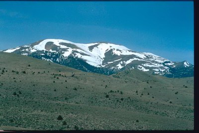
Quicksilver Mountain as viewed from the north.
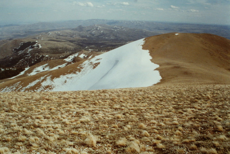
Quicksilver Mountain’s summit ridge.
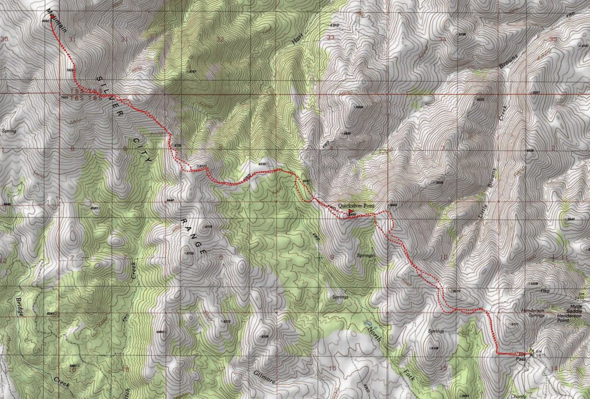
Dave Pahlas’s GPS track
Additional Resources
Regions: Owyhee Mountains->Silver City Range->SOUTHERN IDAHO
Mountain Range: Owyhee Mountains
Year Climbed: 1994