Elevation: 6,020 ft
Prominence: 360
This peak is not in the book. The summit is located on State of Idaho Land which should be open to the public. However, the status of this particular State of Idaho land is not clear. The State of Idaho often leases its land to private entities under terms that prohibit public access. In this case, there are no fences between the State land and the adjacent private property land and there are “No Trespassing” signs at the only gate close to the peak.
Livingston Douglas provided the route set out below which apparently avoids the aforementioned access problems. Updated November 2019
Packer Butte is an attractive summit located northeast of Bennett Mountain and close to US-20 and the Mount Bennett Road. USGS Cat Creek Summit
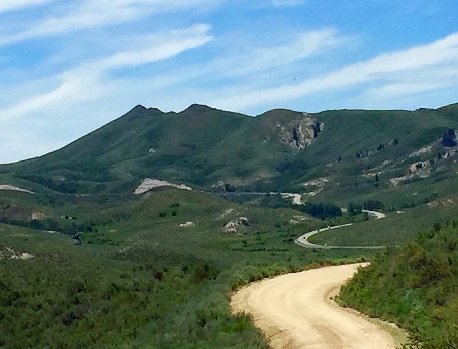
Packer Butte as from the north along Castle Rock Road.
South Face, Class 3 by Livingston Douglas
Access
From US-20 (just west of Mile Marker 126), go right/south onto [signed] Mount Bennett Road for 2.6 miles (bearing right at an unsigned junction at about the 1.0-mile mark) to reach a pullout on the south side of the road at the base of the south face of Packer Butte. Park here (5,620 feet). There are “No Trespassing” signs across the road and well to the east of the south face of Packer Butte but there is absolutely nothing indicating any private land issues with the south face itself.
The Climb
From the parking pullout, climb straight up the steep south face, crossing a dilapidated cattle fence early on. The terrain is thick scrub and sagebrush. Higher up, scramble up through a steep section of large, somewhat unstable boulders with brush mixed in for good measure. Using your hands is mandatory here.
You will quickly reach the small, boulder-and-scrub summit. There is a cross (made of triangulation posts) on the summit high point. This route is probably the steepest, shortest route to the top of Packer Butte. While there are sections of private land along Mount Bennett Road leading to Packer Butte, there are no signs of private land (no orange paint, no “NO TRESPASSING” signs) on this route. This land is State of Idaho land and presents no issues so enjoy the climb!
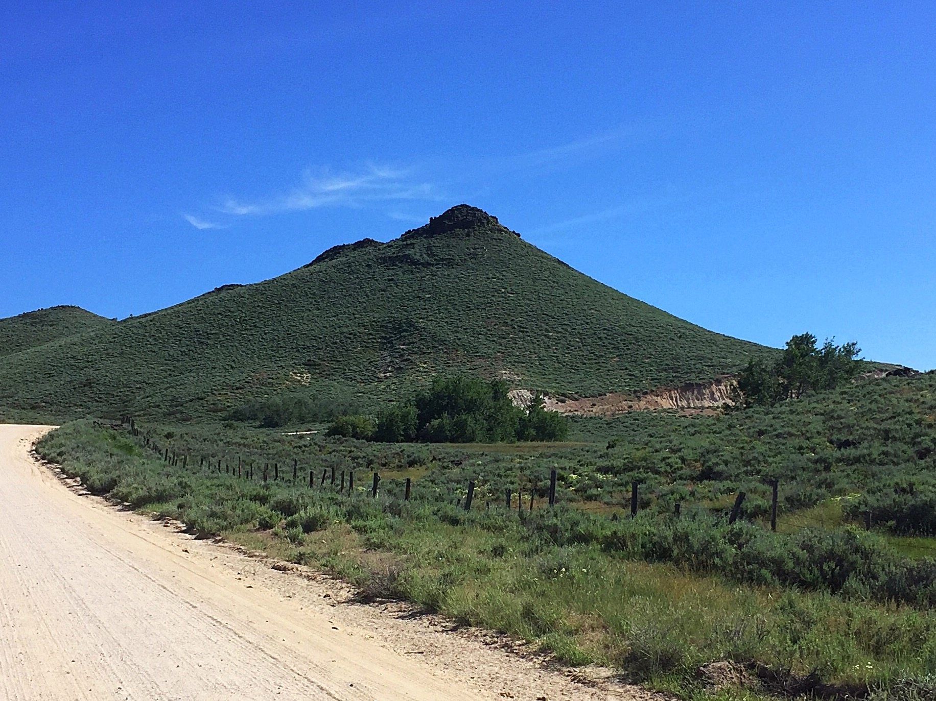
Packer Butte as viewed from the east on Mount Bennett Road.
Access
The Mount Bennett Road (no, this road does not go anywhere close to Bennett Mountain) cuts across the east slopes of the peak. Access this signed, well-graded gravel road from US-20 at one of two places. The first, if you are coming from the east, is just west of Mile Marker 126. The second, if you are coming from the west, is roughly two miles past the turnoff for the signed Castle Rocks Road where US-20 makes a sharp turn to begin its ascent to Cat Creek Summit. Turn right at this point onto a well-graded gravel road. Follow the road for about a mile to a fork to its [signed] junction with the Mount Bennett Road.
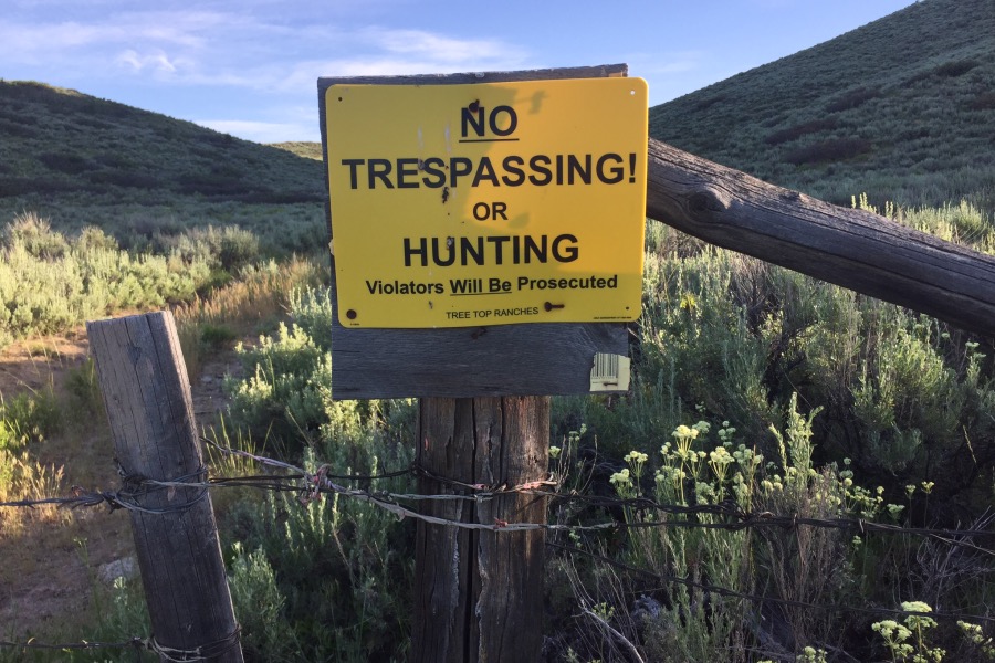
A no trespassing sign on the south side of Packer Butte.
Additional Resources
Regions: Bennett Mountain Hills->WESTERN IDAHO
Mountain Range: Bennett Mountain Hills
Longitude: -115.32619 Latitude: 43.28669