Elevation: 10,045 ft
Prominence: 545
Climbing and access information for this peak is on Page 310 of the book. Livingston Douglas provides a new descent route below but, be forewarned, he doesn’t recommend it. Use the link below to Larry Prescott’s trip report for additional photos of this peak. Updated December 2019
Marshalls Mount is located on the main Lemhi Ridge Crest south-southeast of the Uncle Ike/Pass Creek Pass. Its location makes the peak a great place to orient oneself to the lay of the southern Lemhi Range. USGS Fallert Springs
Access
The fastest access to Marshalls Mount is from Uncle Ike Creek [(B)(10) on Page 318]. The east approach is via the Pass Creek drainage [(A)(2)(a) on Page 313].
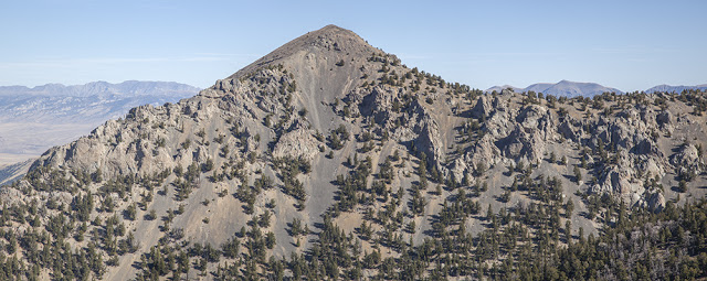
Marshalls Mount as viewed from the west. Larry Prescott Photo
South Ridge/Southeast Face, Class 4 by Livingston Douglas
Access
From Howe, drive north on the Little Lost River Highway for 13.4 miles to an [unsigned] junction with Uncle Ike Road. This junction is 0.8 miles north of the signed junction for North Creek Road. Turn right/east onto Uncle Ike Road and drive 5.0 miles up the somewhat-rough, 2-track desert road to the Challis National Forest boundary (signed). Park shortly after this point in a grassy pullout.
If the road is too rough, you can probably make it 4.9 miles up the road and park in a pullout on the left/north side of the road only 0.1 miles before the National Forest boundary. The elevation at the National Forest boundary is about 6,180 feet. If you have an ATV, you can shorten this climb considerably by riding up the Uncle Ike Creek ATV Trail (FST-4341) for several miles.
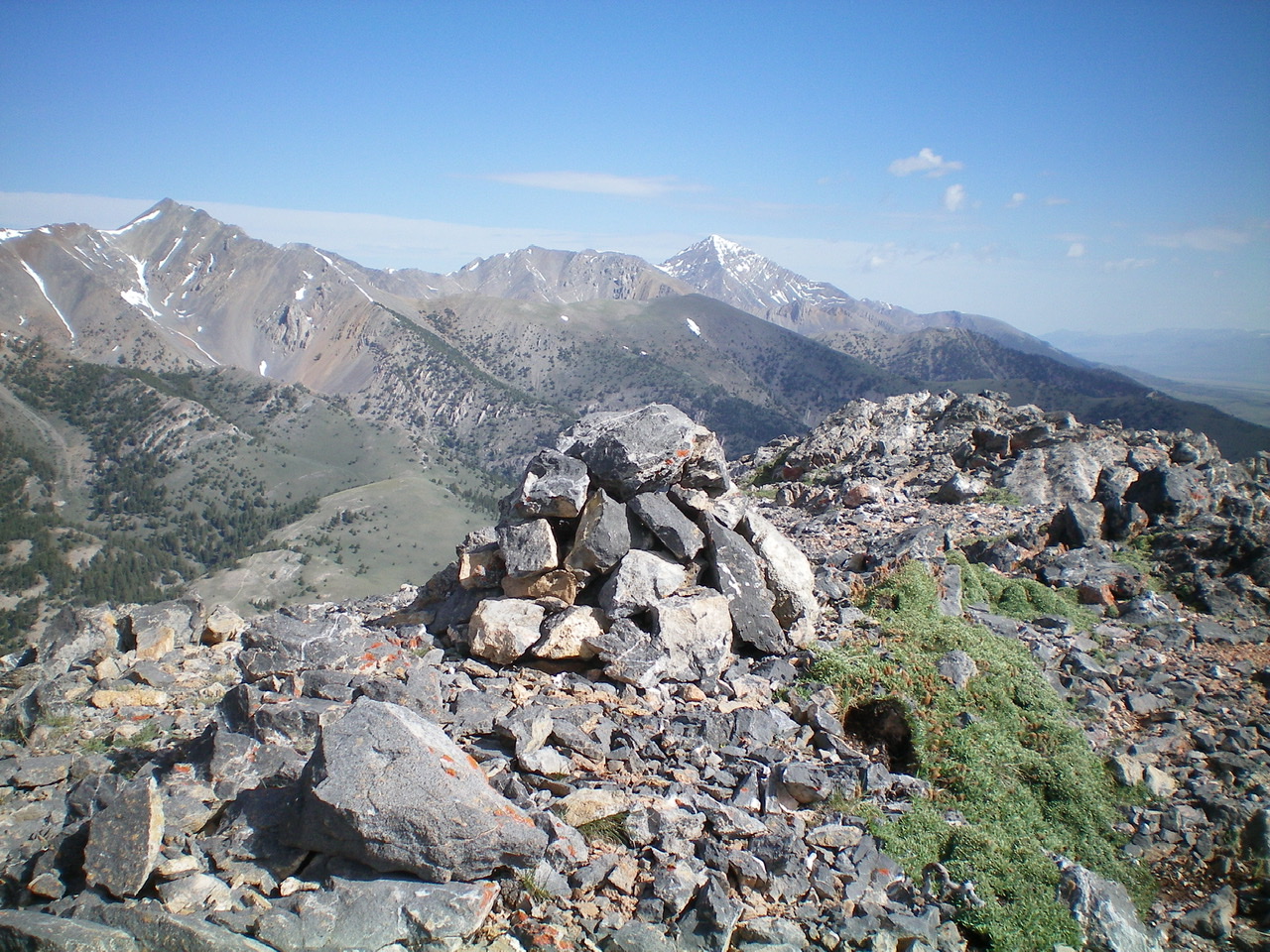
The summit cairn atop Marshalls Mount with snow-capped Diamond Peak just right of center in the distance. Livingston Douglas Photo
The Descent
This descent is the final leg of a loop route that begins and ends at the mouth of Ike Creek Canyon. I first climbed Peak 8979 and did a ridge traverse from Peak 8979 to the summit of Marshalls Mount via the north ridge. From the summit, descend the rocky, but not difficult, south ridge to a flat, open area. Look for a large, wide scree/gravel gully heading down the southeast face. Leave the south ridge and boot-ski down this loose terrain to a level about 100 vertical feet before reaching the sheer cliff face on the southeast face.
You are about to reach an impassable cliff (trust me), so angle left/south to reach the next potential weakness in the southeast face. Descend a steep, narrow chute (Class 4 down-climb) to reach the lower cliff face. Down-climb narrow ledges on the cliff face (Class 4) to reach the lower scree/gravel slope. Once you reach the lower slope, boot-ski down to FST-4238 (an ATV road/trail). Descend the steep trail to its junction with the Ike Creek Trail/FST-4341. Follow FST-4341 down Ike Creek to the National Forest boundary and your parked vehicle.
Additional Resources
Regions: EASTERN IDAHO->Lemhi Range
Mountain Range: Lemhi Range
First Ascent Information:
- Other First Ascent: South Ridge/Southeast Face —Descent
- Year: 2019
- Season: Summer
- Party: Livingston Douglas
Longitude: -113.02479 Latitude: 44.04349