Elevation: 10,201 ft
Prominence: 621

This peak is discussed on Page 262 of the book. This entry replaces the inaccurate information in the book. Published November 2021
Peak 10201 is located on the east side of Mammoth Canyon and is northeast of the main White Knob Crest. It is most easily climbed from FSR-517/Mammoth Canyon Road and the northwest ridge. The book’s commentary is a bit misleading, as discussed below. USGS Shelly Mountain
Peak 10201 in the distance left of center from Peak 10529. Haylee Stocking Photo
Access
From the junction of Main Street and US-93 in Mackay, drive 2.4 miles south on US-93 to a signed junction with Houston Road. Turn right/south onto Houston Road and drive 2.0 miles to an unsigned junction with Alder Creek Road. Turn right/south onto Alder Creek Road and drive 1.6 miles to an unsigned junction at a private ranch and a sharp right/southwest turn in the road. Reset your odometer here. From the unsigned junction, drive southwest on Alder Creek Road.
At 2.9 miles, reach the Challis National Forest boundary. At 7.7 miles, reach a signed junction. Go straight/northwest onto FSR-517/Mammoth Canyon Road. FSR-517 is narrower, rockier, and more rutted than Alder Creek Road, so drive up it slowly. A 4WD vehicle with good tires is required but high clearance is not necessary. Drive 0.8 miles up Mammoth Canyon Road to a signed junction with FSR-516/Stewart Canyon Road. Park at this junction (8,310 feet). From here, FSR-517/Mammoth Canyon Road is a narrow jeep road with some rocky sections and would require an ATV or a high-clearance 4WD jeep with good tires.
Southwest Face/Northwest Ridge, Class 2
The Climb
From the road junction, hike (or drive) about 1.3 miles up Mammoth Canyon Road and reach a large clearing on the right/northeast side of the road at about 8,890 feet. Leave the road and scramble diagonally left/north to skirt the left/west side of a rocky buttress in open scrub and tree stumps. After passing the buttress, bushwhack straight/northeast up the forested slope to reach the crest of the northwest ridge at a minor saddle (9,780 feet).
This is a steep scramble up through an open forest of aspens and short pines with a loose gravel/sand base. You will find diagonal elk trails in the soft, loose terrain to expedite this climb. Once on the ridge, go right and scramble east-southeast up the ridge crest to the rocky summit outcrop. The ridge terrain is a combination of embedded boulders and short scrub with a few minor rocky outcrops and talus/scree patches. The summit high point is a large boulder. There is a small summit cairn nearby.
It might be tempting to shorten this climb by scrambling up the southeast ridge instead. However, based on what I saw from the summit, the southeast ridge has a major collection of difficult ridge towers at a complicated ridge point southeast of the true summit. It would be difficult to navigate through or around these ridge towers, so I would avoid the southeast ridge as a potential route of ascent or descent.
You can continue hiking up Mammoth Canyon Road all the way to near the Mammoth Site and then scramble a short distance in open terrain up onto the northwest ridge. From there, head southeast on the ridge crest and navigate a few rocky ridge points to intercept the ridge entry point described under the Southwest Face/Northwest Ridge Route earlier.
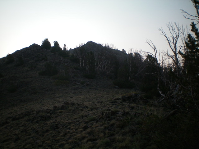
An early morning photo of the rocky summit of Peak 10201 (just left of center) as viewed from high on the northwest ridge. Livingston Douglas Photo
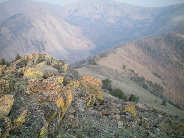
Looking down the northwest ridge from the summit. Note the significant burn areas. Livingston Douglas Photo
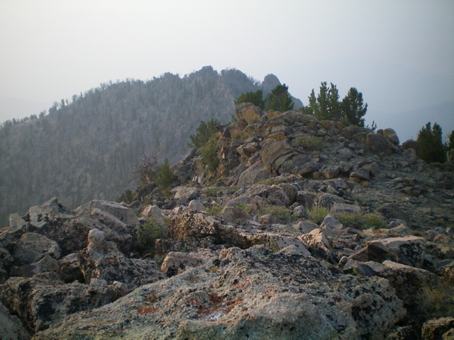
Looking southeast from the summit. The pinnacles of the [lower] southeast summit are in the distance. Livingston Douglas Photo
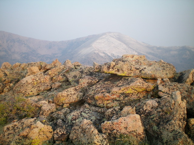
The summit rocks of Peak 10201, looking northwest at White Knob Mountain (dead center). Livingston Douglas Photo
Additional Resources
Regions: EASTERN IDAHO->White Knob Mountains
Mountain Range: White Knob Mountains
Longitude: -113.69409 Latitude: 43.86549