Elevation: 10,271 ft
Prominence: 291
This peak is not in the book. The elevation and prominence figures are based on recent LiDAR updates. The USGS quad shows an elevation of 10,274 feet. Published October 2025
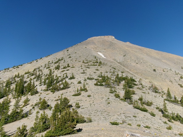
Peak 10271 is an unranked, rocky peak located on the high ridge that connects Rainbow Mountain (10,163 feet) to Mount Perspiration (10,698 feet). It is most easily climbed from Coal Kiln Canyon to its northeast. USGS Coal Kiln Canyon
Peak 10271 (dead center) as viewed from the upper reaches of Coal Kiln Canyon to its northeast. Livingston Douglas Photo
Access
Same as for Rainbow Mountain.
Coal Kiln Canyon/East Ridge, Class 2
The Climb
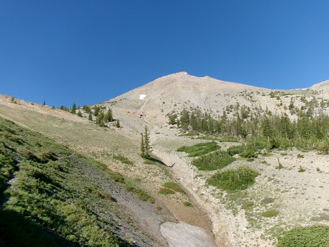
From the Coal Kilns parking area (7,365 feet), hike north briefly on the main road (FSR-188) to reach a signed junction with FSR-840. Go left/west onto the rougher FSR-840 and follow it up to about 7,600 feet, just past a sharp left/southwest bend in the 2-track road. Leave the road here and bushwhack west-northwest across a sagebrush gully (a bit thick in sections). Contour slightly higher as you go (by about 45 vertical feet in total) to reach, and cross, a ridge that is forested to the left/south. From this ridge, descend 150 vertical feet through steep, but easy, pine forest to reach jeep/ATV trail in Coal Kiln Canyon.
Follow this jeep road west up Coal Kiln Canyon as it steepens and turns into an ATV trail (FST-018). This ATV trail is rocky and narrow. It bends sharply left/south to follow Coal Kiln Canyon southward and abruptly ends in a meadow. Continue south up the easy meadow and quickly find a National Forest road closure gate. Continue south on the remnants of an old road (which soon disappears and/or becomes very faint) then follow a good game trail up the right/west side of Coal Kiln Canyon. The canyon is dry and offers easy forested terrain with lots of open, short grass meadows.
Higher up, the game trail crosses to the left/east side of the steepening, narrowing canyon. The trail ends about 100 vertical feet below a ridge saddle at the head of the canyon. Scramble south up steep-ish, clumpy ground to reach the saddle. From the ridge saddle, scramble west-southwest directly to the summit block area. Use some gravelly game trails, stable ground rock, and tundra to advance up this steep ridge of loose talus, scree, and gravel.
Move slightly left/south near the top to advance through a few rock strata and reach the ridgeline summit. The high point is just right/north of the top of the east ridge, which is a ridge corner. I built a nice cairn atop the highest boulders. The summit offers a magnificent view of the surrounding peaks (Rainbow Mountain, Mount Perspiration, Bell Mountain).
Looking up the steep east ridge from just above the saddle. This was the final leg of my ascent route. Livingston Douglas Photo
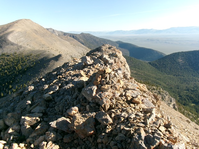
The rocky summit of Peak 10271 with its newly-built summit cairn. Livingston Douglas Photo
Additional Resources
Regions: EASTERN IDAHO->Lemhi Range
Mountain Range: Lemhi Range
Longitude: -113.22785 Latitude: 44.29277