Elevation: 10,163 ft
Prominence: 707
Climbing and access information for this peak is on Page 305 of the book. Also included on this page are Steve Mandella’s GPS track and photos and Larry Prescott’s Northeast Face Route. The peak’s elevation and prominence are now updated with LiDAR figures. Updated November 2024
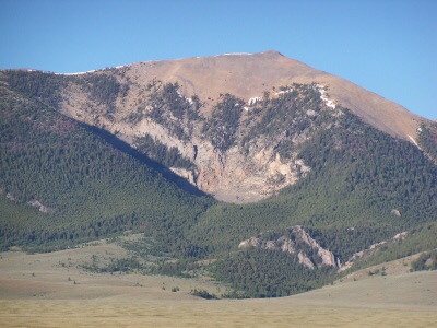
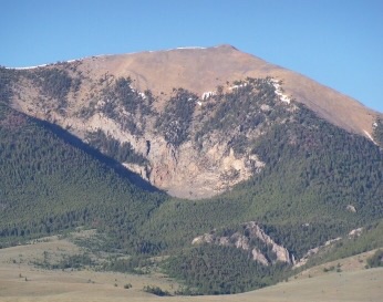
Rainbow Mountain is not the most imposing Lemhi Range peak when viewed from the valley, but is an enjoyable climb via its southeast ridge and a challenging Class 4 climb via its northeast face. USGS Coal Kiln Canyon
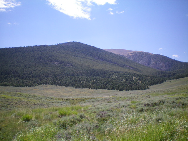
Rainbow Mountain as viewed from Peak 9149 to its north. Livingston Douglas Photo
Access
From ID-28, drive west on Coal Kiln Road/FSR-188 (signed for the Coal Kilns) for 5.1 miles to reach the parking/picnic area and bathroom for the Coal Kilns. The road junction is at MM61 on ID-28 and is 3.4 miles north of [signed] Nicholia Road. Park at the Coal Kilns parking area (7,365 feet; 44⁰18’37”N, 113⁰10’48”W). The road gets much rockier, overgrown, and primitive past this point. This climb covers 7.0 miles with 2,925 feet of elevation gain round trip.
Map Errors
Both the National Forest Map and the USGS topo map fail to show that FSR-840 (unlabeled on both maps) continues west across a major gulch to God-Knows-Where. The USGS topo map shows a side road heading south from FSR-840 to “Springs.” That road no longer exists.
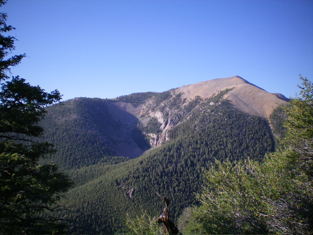
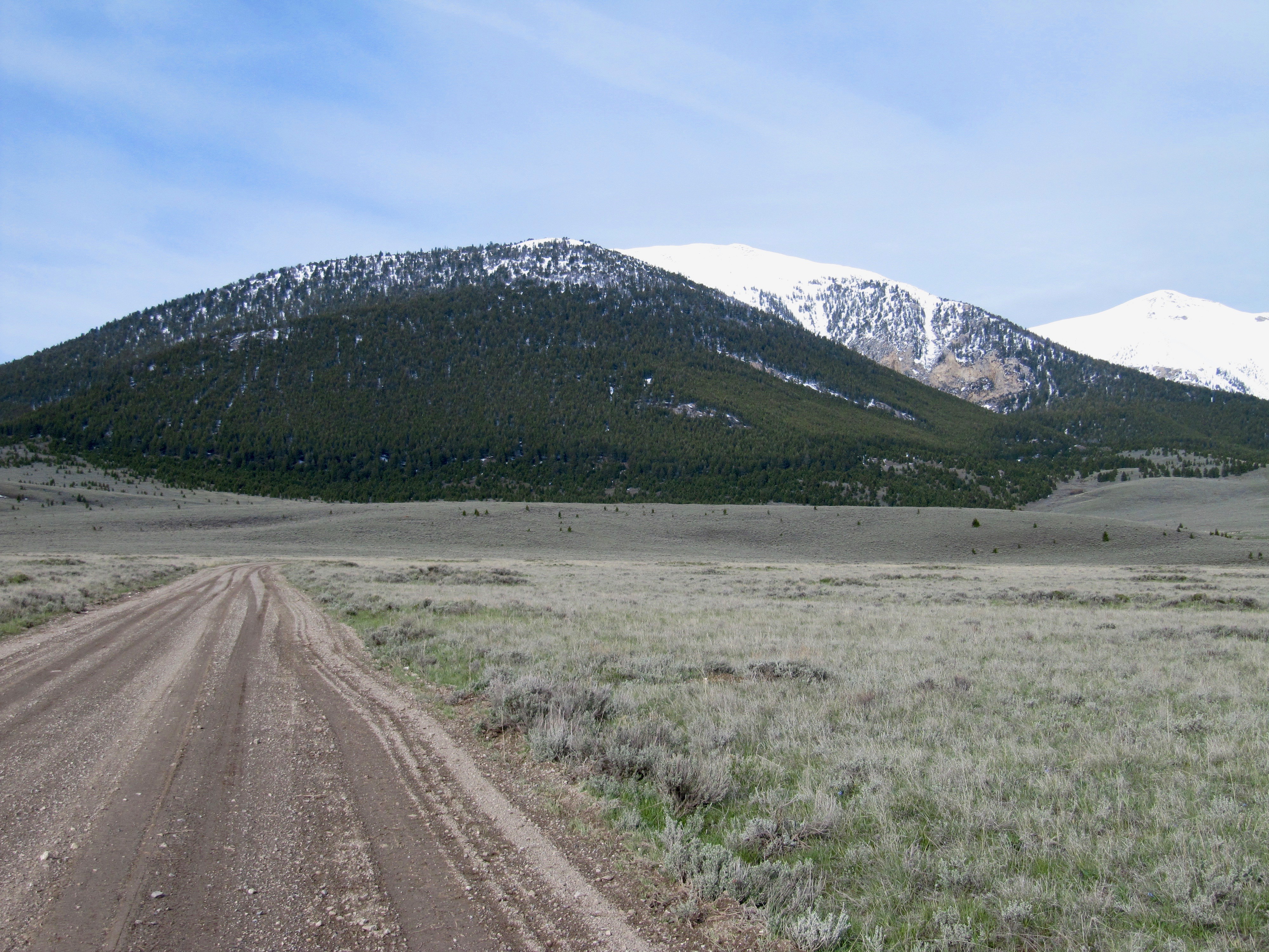
Rainbow Mountain as viewed from the northwest. Livingston Douglas Photo
North Face/Southeast Ridge, Class 2
The Climb
From the Coal Kilns parking lot, hike north briefly on the main road (FSR-188) to reach a signed road junction. Go left/west onto FSR-840 and follow it as it weaves a bit early on but heads generally west then southwest up the north face of Rainbow Mountain. Follow the narrowing, more overgrown 2-track road into the forest until it bends right/west to cross a major gully and leave the north face. Leave the road here and bushwhack south up the forested face.
There is a use trail (briefly) then some diagonal and lateral game trails in the early section of this bushwhack. As you climb the north face, a rocky, narrow shoulder emerges and tracks the large dry gully to its right/west. Scramble near the crest of this shoulder but skirt it in the nearby pine forest when it becomes too rocky. Use open lanes/trails to get through the thick forest up to 8,500 feet or so. The forest thins out as you gain elevation and is easier (albeit steep) with some deadfall but not too much.
Higher up, the terrain opens up and becomes a mix of scattered pines, short grass/scrub, and broken rock. The trees eventually disappear before reaching a ridge juncture at Point 9883. From Point 9883, descend northwest for 45 vertical feet to a ridge saddle then continue northwest up the easy, open ridge to the summit. The summit of Rainbow Mountain had a small cairn which I built up considerably. The summit offers magnificent views of Diamond Peak and nearby Peak 9149, Mount Perspiration, and Mount Inspiration.
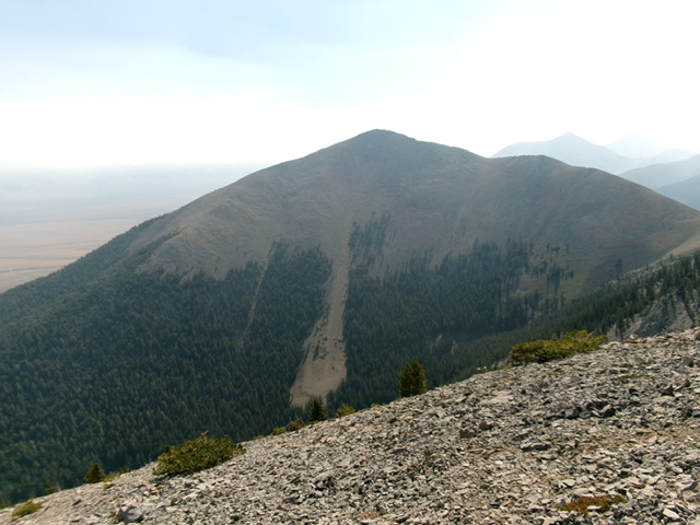
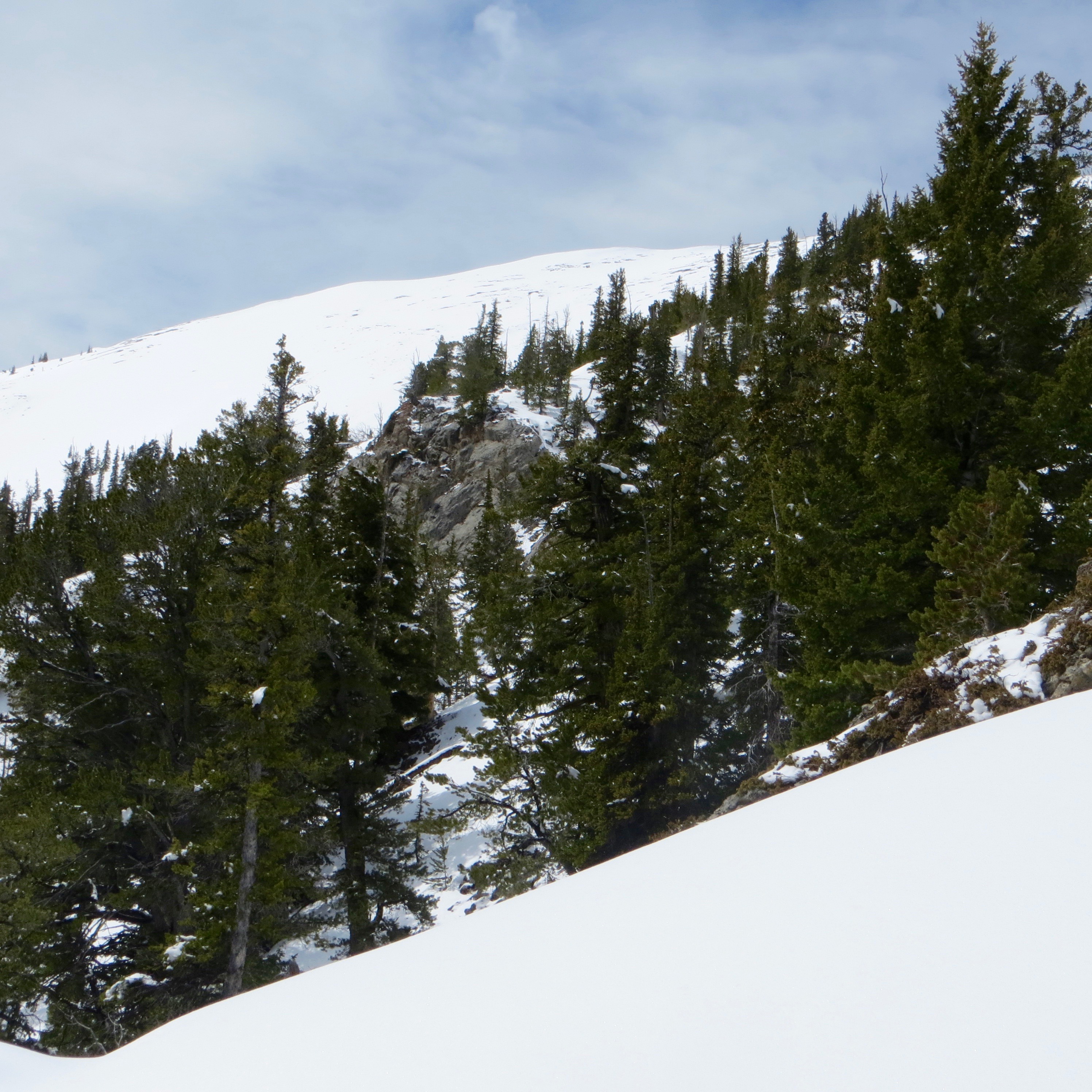
The summit of Rainbow Mountain as viewed from Point 9883. The southeast ridge is in dead center. Livingston Douglas Photo
Rainbow Mountain and its two humps: Forested Point 9509 (left of center) and the bare, true summit (right of center). Bushwhack up over Point 9509 to reach the high, open southeast ridge to the summit. Livingston Douglas Photo
Steve Mandella GPS Track and Photos
Rainbow Mountain and its snow-covered summit. Steve Mandella Photo
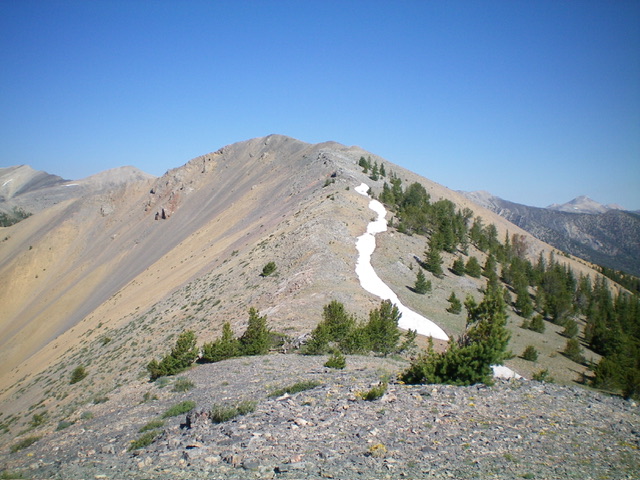
Approaching the summit from the southeast ridge. Steve Mandella Photo
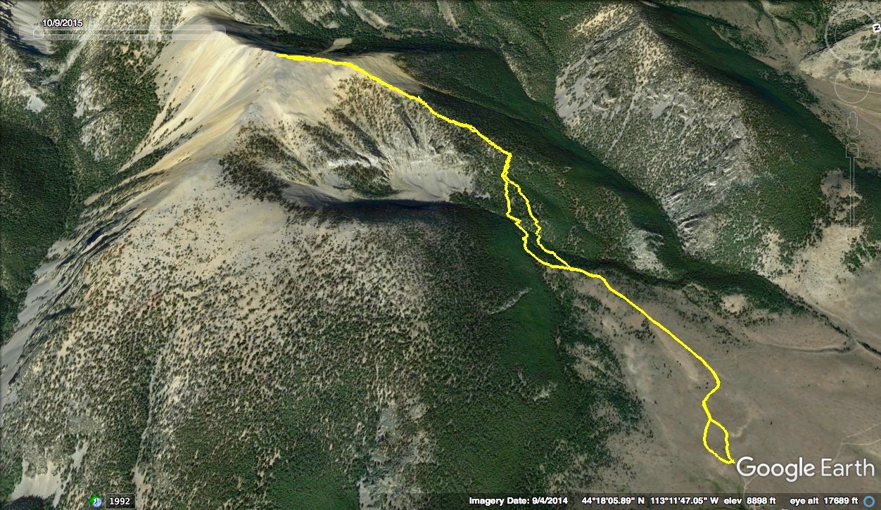
Southeast ridge GPS Track. Margo Mandella Map
Larry Prescott Northeast Face Route
Northeast Face, Class 4
Larry Prescott climbed Rainbow Mountain from the Coal Kiln Road and the peak’s east face. Turn left off ID-28 at the signed road for the kilns and follow the road past the kilns, proceeding as far as your vehicle will allow. From the end of the road, a trail leads to a basin at the base of the northeast face.
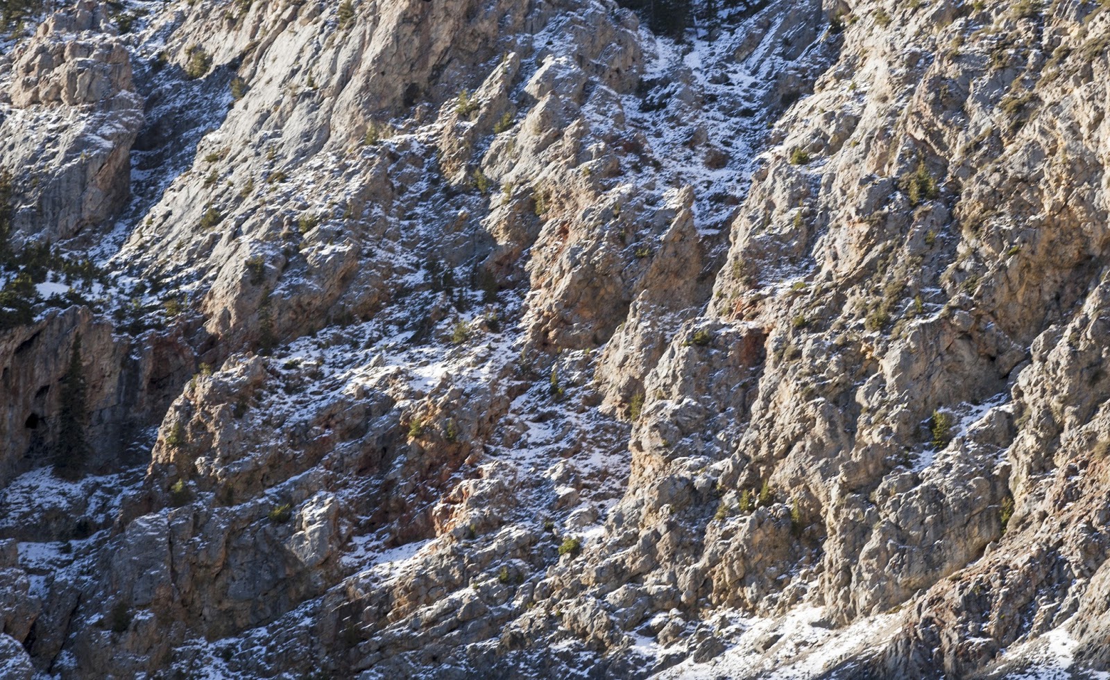
The northeast face of Rainbow Mountain
Larry reported: “I decided to take a more challenging route up the face directly to the summit. The crux was finding a route through the tall cliff band guarding the face. Making the route even more difficult was a few inches of snow.” Larry rated the route through the cliff band at Class 3-4. Based on his photos, I would rate the route a solid Class 4. Use the link below to read Larry’s trip report.
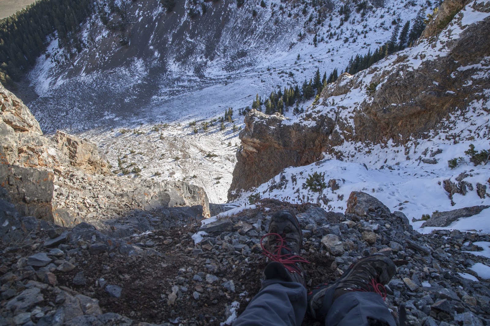
Looking down the northeast f-ace. Larry Prescott Photo
The cliff band on the northeast face. Larry Prescott Photo
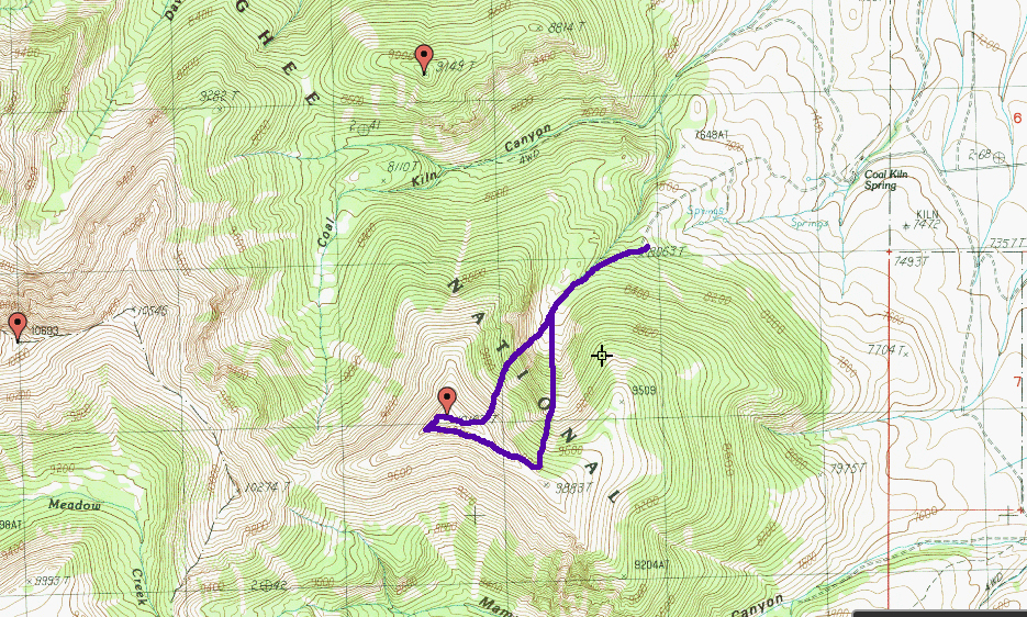
Larry’s route up and down Rainbow Mountain
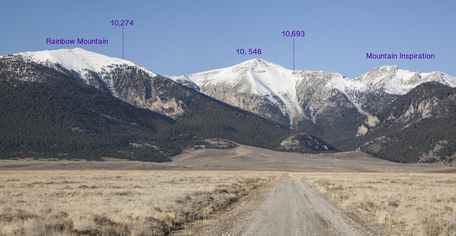
The Lemhi peaks running north from Rainbow Mountain to Mount Inspiration. Peak 10693 was later named “Prescott Peak” after Larry’s untimely passing near its summit in October 2016. Larry Prescott Photo
Additional Resources
Regions: EASTERN IDAHO->Lemhi Range
Mountain Range: Lemhi Range
Year Climbed: 2005
First Ascent Information:
- Other First Ascent: Northeast Face
- Year: 2016
- Season: Summer
- Party: Larry Prescott
Longitude: -113.21139 Latitude: 44.29701