Elevation: 10,446 ft
Prominence: 386
This peak is not in the book. Brett Sergenian has provided additional beta which is set out below.
Peak 10446 is located 2.1 miles west of Ryan Peak and east of Peak 10450. I climbed Peak 10446 on June 24, 1979. USGS Ryan Peak
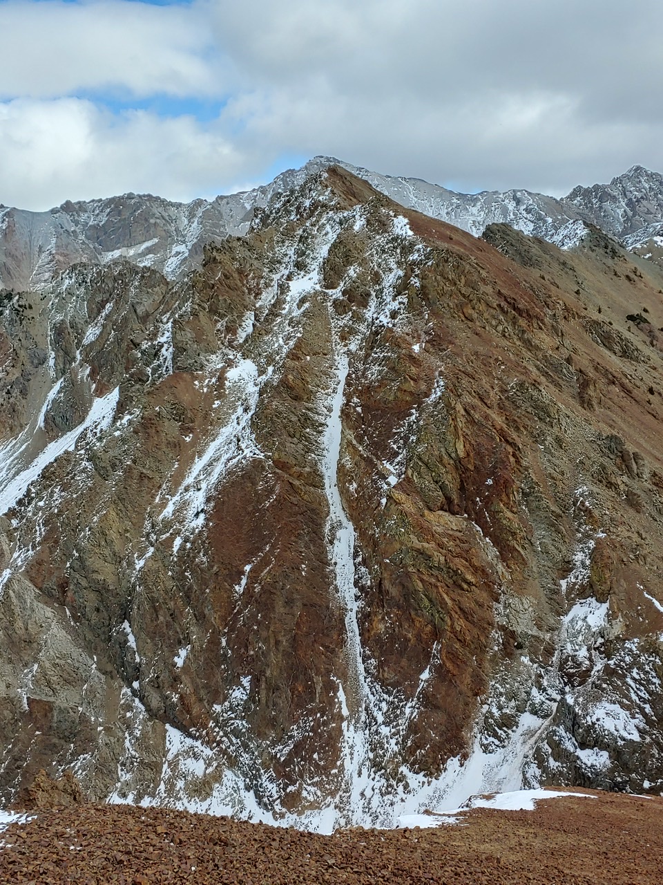
Peak 10446 as viewed from Peak 10450. Brett Sergenian Photo
Access
North Fork of the Wood River Trailhead [(A)(9)(a) on Pages 241-242]
Point 10368/East Ridge, Class 2+
From the North Fork Big Wood River trailhead, hike to the junction with the West Pass Trail at the 7,200-foot contour. Leave the trail and climb due north up the rib that leads to Point 10386. Follow the connecting ridgeline west to the summit.
Peak 10450-to-Peak 10446 Traverse, Class 3
Brett Sergenian made this traverse in late October 2019. His GPS track shows the route.
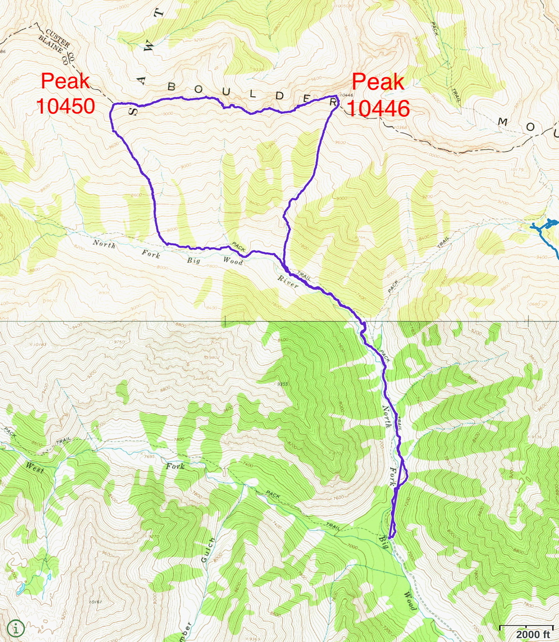
Brett’s GPS track for the traverse from Peak 10450 to Peak 10446. Round-trip stats: 9.89 miles with 4,100 feet of elevation gain.
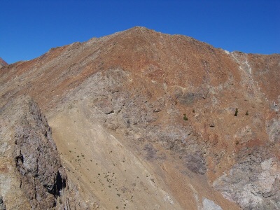
Peak 10446. Rick Baugher Photo
Additional Resources
Regions: Boulder Mountains->EASTERN IDAHO
Mountain Range: Boulder Mountains
Year Climbed: 1979
Longitude: -114.44389 Latitude: 43.89729