Elevation: 10,500 ft
Prominence: 600
Climbing and access information for this peak is on Page 256 of the book. The elevation has been updated to 10,500 feet. Posted private property BLOCKS ACCESS directly from the mouth of the Argosy Creek drainage. In addition to updating this page, Livingston Douglas provided a trip report of a 4-peak ridge traverse found at the following link: The Argosy Adventure. Updated October 2025
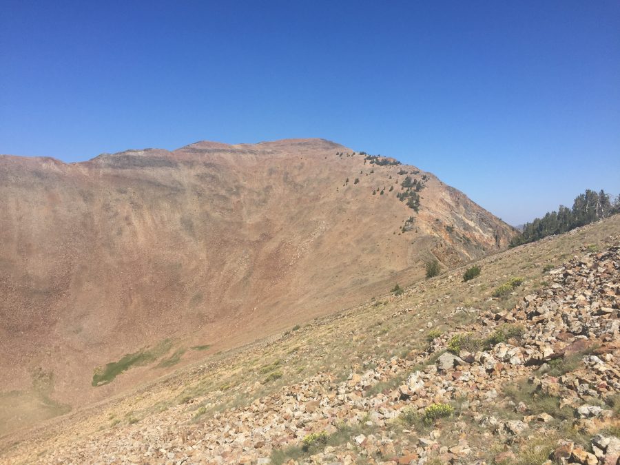
Peak 10500 sits on a high ridge corner above Fishpole Lake. Its north face is wickedly steep and impressive. It can be climbed from Fishpole Lake or in combination with nearby Pion Peak from the Argosy Creek drainage and its southeast ridge. Peak 10500 is best climbed from Argosy Creek. It may be possible to climb the peak from the Left Fork Antelope Creek from the Fishpole Lakes [(D)(1)(a.1) on Pages 260-261]. However, the side facing this drainage is much steeper than the slopes above Argosy Creek. USGS Smiley Mountain
Peak 10500 as viewed from Pion Peak
Access
Muldoon Creek Road/FSR-126 [(E)(1.1) on Page 261]. From Copper Creek Road, drive east then northeast up [unsigned] Muldoon Creek Road/FSR-126 for 2.4 miles to a minor pullout at the base of the east face of Muldoon Ridge. Park here [6,925 feet; 43°35’31.3”N, 113°53’11.3”W]. This is the same launch point as Tom Lopez used for his climb of Pion Peak/Err Peak/Argosy Peak.
Do not attempt to climb this peak from the mouth of the Argosy Creek drainage. There is posted, gated private property there along Muldoon Creek Road. This is the first leg of a 4-peak adventure that includes Peak 10500, Pion Peak, Err Peak, and Argosy Peak. It covers 10.5 miles with 5,300 feet of elevation gain round trip. This is Peak #1 in The Argosy Adventure.
Approach Climb Up Argosy Creek, Class 2
The Climb
From the improvised pullout on Muldoon Creek Road, drop 25 vertical feet in easy, open field grass and pine forest to cross Muldoon Creek. Use cattle trails to reach and exit the creek drainage. Contrary to Tom Lopez, I found no difficulty getting through a few willows to the creek directly below the pullout spot. However, crossing the creek was more challenging. A short distance downstream, I found a few tree branches across the creek and crossed it there. I used a hiking pole to keep from falling into the creek here, so be advised.
Once across the creek, follow a good cattle trail up out of the drainage. Contour southeast then east on a cattle trail to reach the north side of the Argosy Creek drainage. Immediately find a cattle trail (there is no longer an old road here as shown on the USGS topo map) that heads up the left/northwest then west side of Argosy Creek. There are some remnants of the old road bed occasionally here but not for long. The cattle trail becomes a game trail as you advance farther up Argosy Creek. It crosses [small] Argosy Creek a few times on the way.
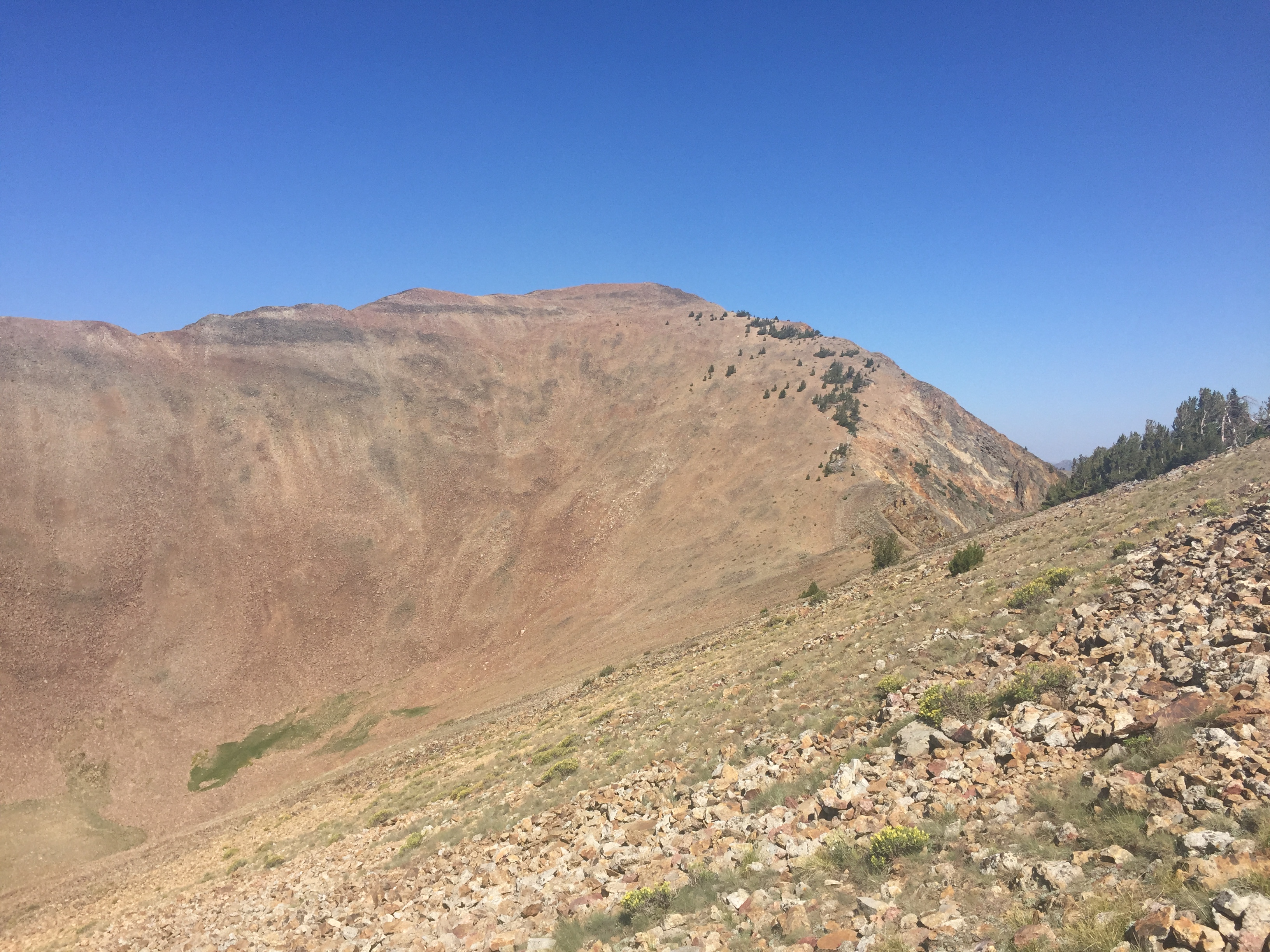
Higher up, the pine forest ends and the terrain is open, thick-ishscrub. Argosy Creek becomes a very small stream. The game trail narrows but is still there. The terrain becomes ribs of scrub next to the stream. As you gain more elevation, the terrain becomes easy, short scrub and a series of shoulders in the wide drainage. You pass by the wickedly rocky and steep west face of Argosy Peak on the way. Get a good look at a nice, wide gully that heads right/east up to the south ridge of Argosy Peak as you work your way up through the Argosy Creek drainage. I descended it after completing the four peaks of today’s adventure.
Once past Argosy Peak, the drainage really widens quite a bit. The terrain is short scrub that morphs into a rockier mix as you approach the head of the massive drainage. You could climb Peak 10500 via the southeast side of its southwest ridge but the slope is steep and very loose. The better option is to continue up the drainage to its terminus at the 9,900-foot connecting saddle between Peak 10500 and nearby Pion Peak (10,700 feet). The final, steep-ish push up to this small saddle is on a mix of tundra, short scrub, and easy talus/scree. Avoid the larger patches of talus and scree that are nearby.
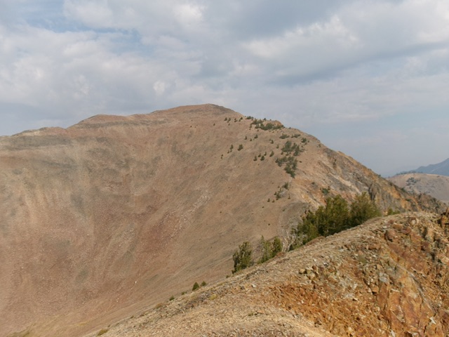
Peak 10500 as viewed from Pion Peak to its southeast. The southeast ridge is the skyline right of center. This was my ascent route. Livingston Douglas Photo
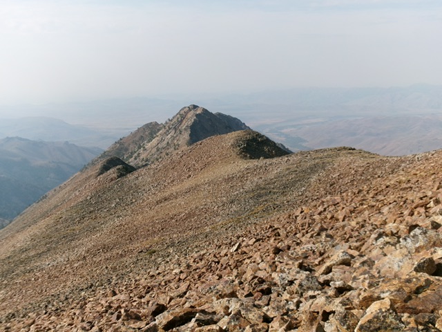
Looking down the rugged south ridge from the summit. Livingston Douglas Photo
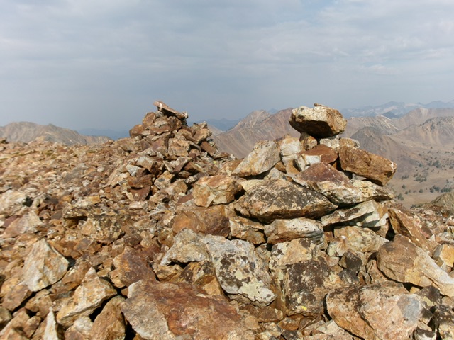
The multiple large cairns atop Peak 10500. Livingston Douglas Photo
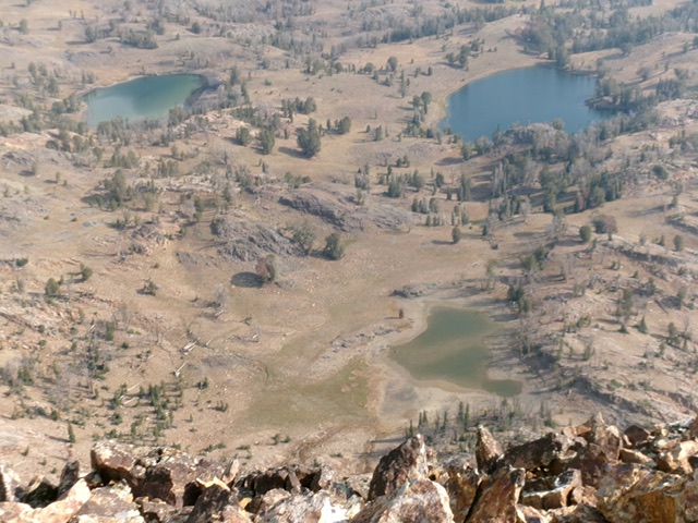
Fishpole Lake (and a few other nearby lakes) as viewed from the summit. Livingston Douglas Photo
Southeast Ridge, Class 2
The Climb
From the 9,900-foot connecting saddle between Pion Peak and Peak 10500, you still have 600 feet of uphill left to reach the summit. Scramble north then northwest in relatively stable scree/gravel with scattered pines early on. The summit of Peak 10500 has three large cairns close to each other but the high point may be a bit farther to the southwest, so I built a small summit cairn there. Stand atop both potential high points “just to be sure.” The view down to Fishpole Lake is stunning. I hope you don’t suffer from acrophobia. Return back to the 9,900-foot connecting saddle to begin the climb of Pion Peak. Pion Peak is up next.
Additional Resources
Regions: EASTERN IDAHO->Pioneer Mountains
Mountain Range: Pioneer Mountains
Longitude: -113.85859 Latitude: 43.63369