Elevation: 10,600 ft
Prominence: 436

Climbing and access information for this peak is on Page 311 of the book. Larry Prescott and Livingston Douglas provided the route updates set out below. Elevation and prominence figures reflect LiDAR updates. Updated December 2024
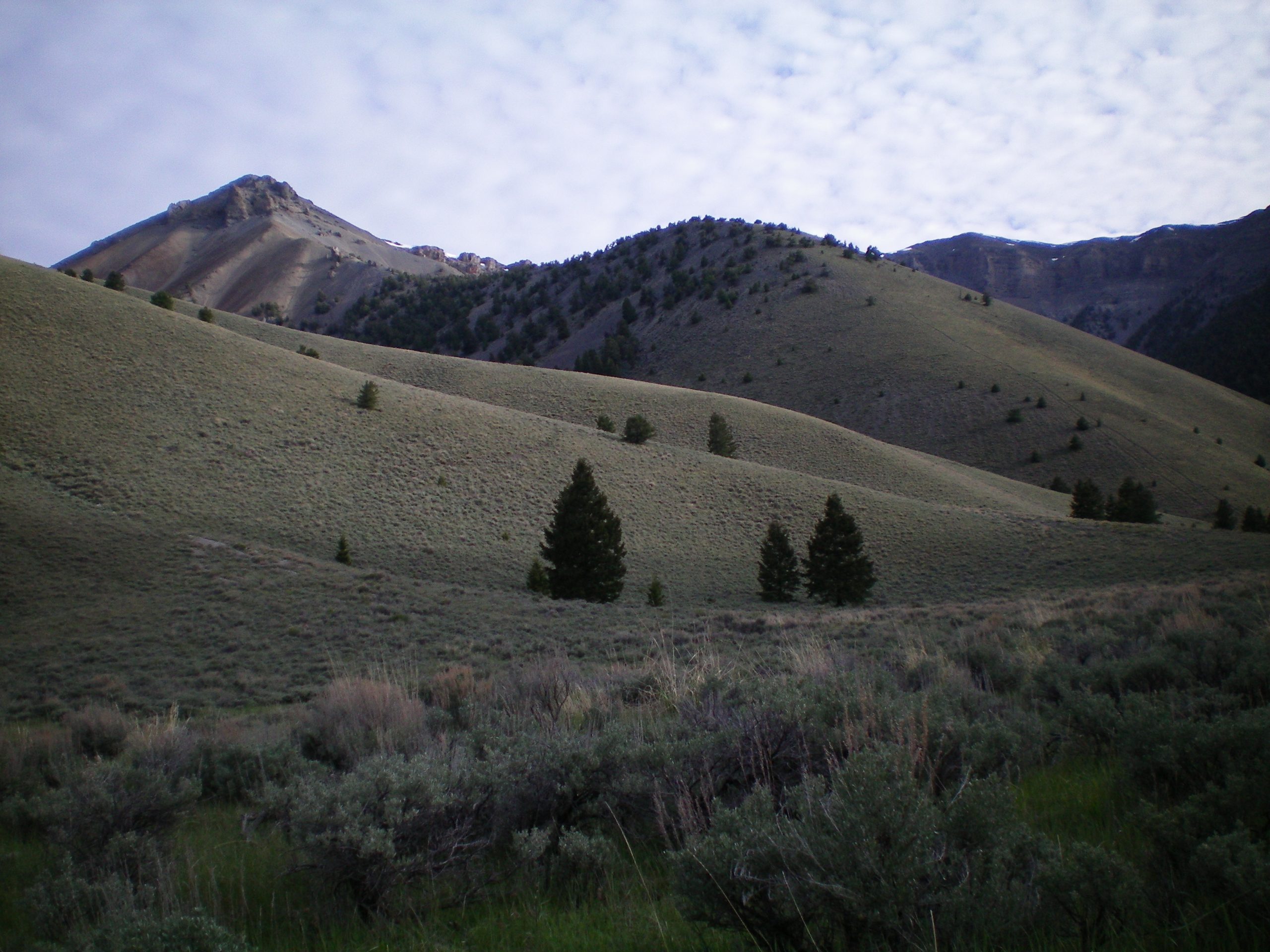
Gloved Peak is one of the many peaks surrounding Mormon Gulch. It is a worthy goal best reached via the mining road that leads from North Creek to the high Lemhi valley north of the peak. USGS Fallert Springs
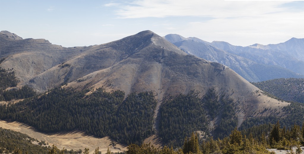
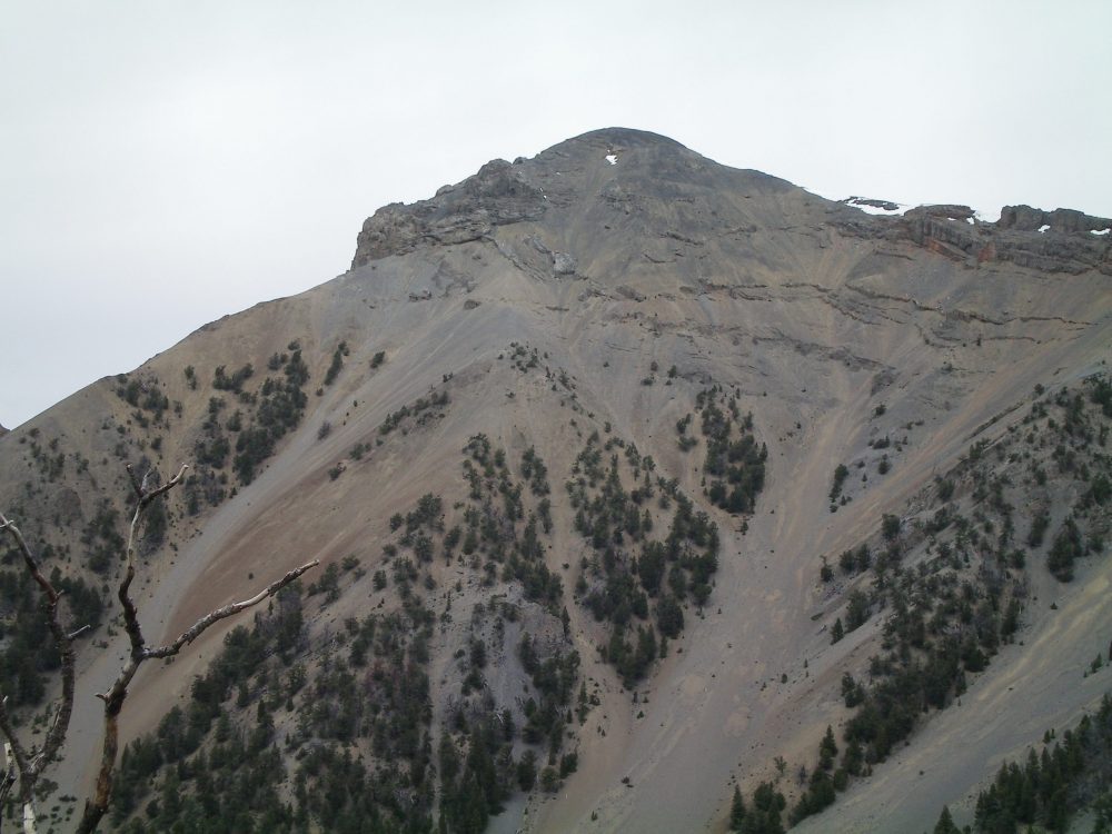
Gloved Peak as viewed from the north. Larry Prescott Photo
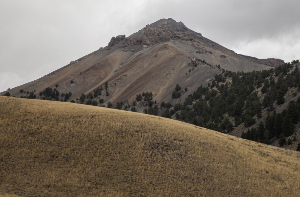
Gloved Peak as viewed from North Creek. Larry Prescott Photo
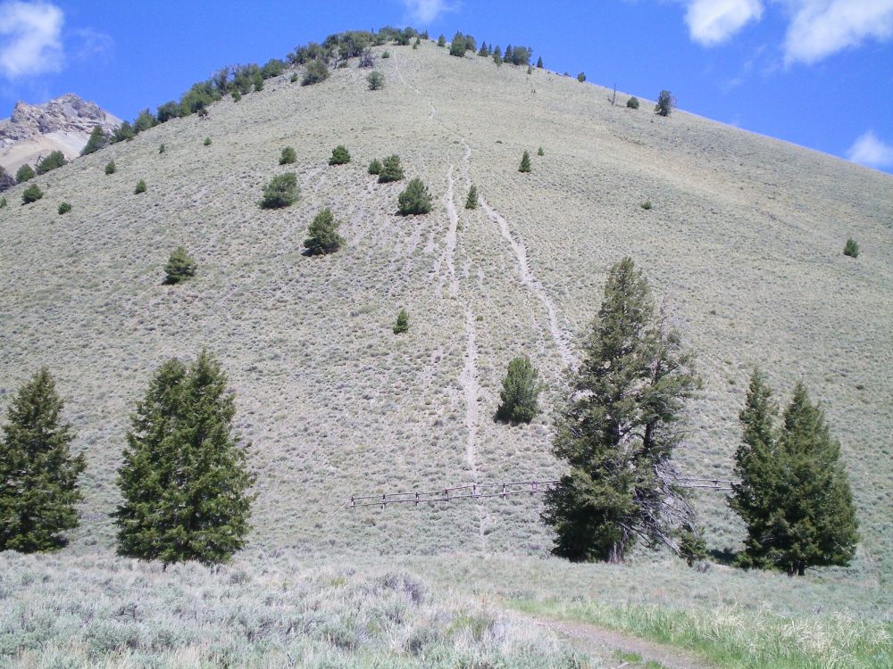
Southwest Rib, Class 2+ by Larry Prescott
Access
Climb from the North Creek Road [(C)(12) on Page 318]. Follow this graded road six miles to the ranch at the mouth of North Creek Canyon. Park alongside the road. From this point, the road is closed to passenger vehicles. ATVs can make it up the rough road. Larry Prescott drove an ATV up to the shoulder of Peak 10640. Larry reported “The trail/road we traveled was is remarkably good condition. It wound up the mountain and eventually would crest the ridge west of the summit.”
Route
Larry and his son Ben climbed the southwest rib, aiming towards two small towers. Thanks to the ATV vehicle assist, their ascent covered about a half mile to the summit with 1,000 feet of elevation gain. Larry commented: “The relentless sliding scree up the nearly 1,000 feet of elevation gain made the sweet approach a memory. Thank goodness for trekking poles. We muscled our way up the mountain on all fours. Climbing between the two towers, we made our way to the summit.”
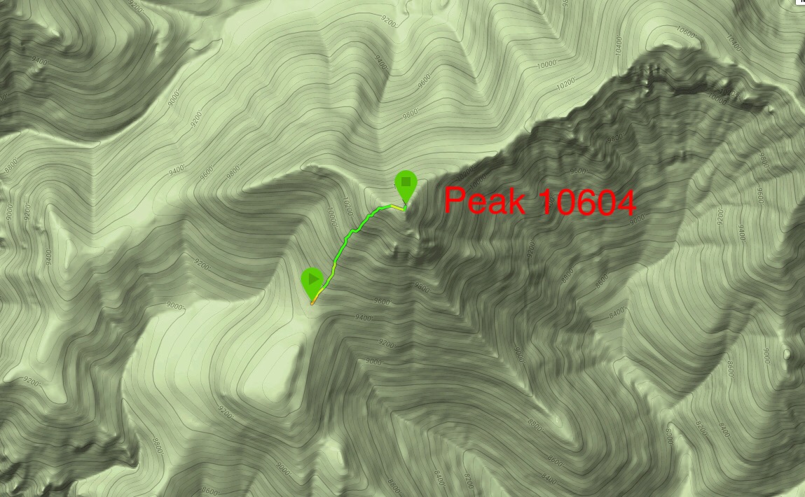
Larry Prescott’s GPS track up the southwest rib.
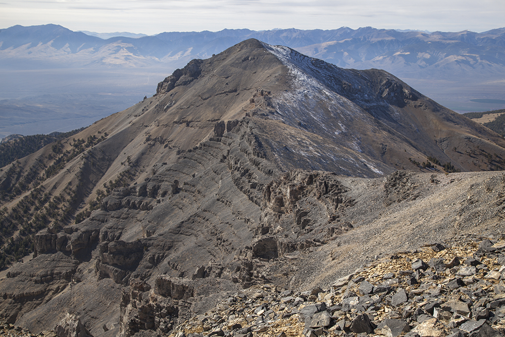
Gloved Peak. Larry Prescott Photo
Southeast Ridge, Class 4 by Livingston Douglas
Access
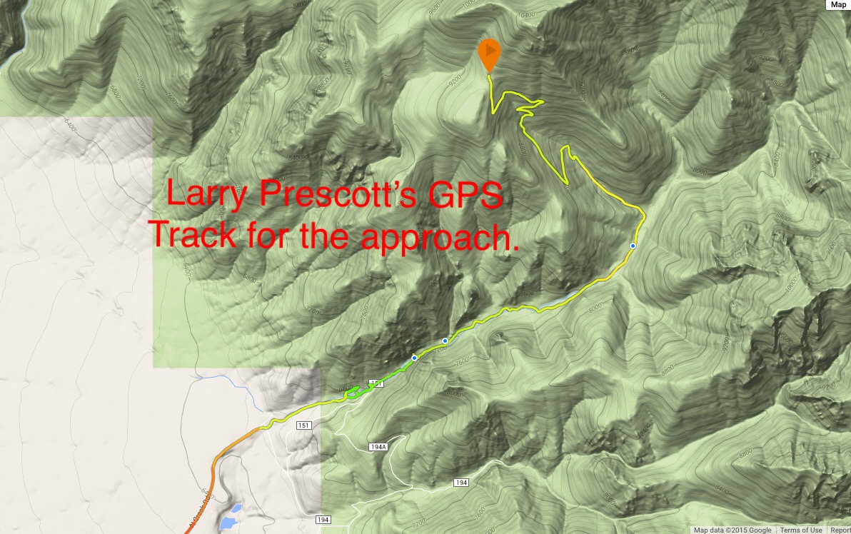
North Creek Road is located 12.6 miles north of Howe on the [paved] Little Lost River Highway. Turn right/east onto [signed] North Creek Road. Drive 5.5 miles on North Creek Road to an unsigned dirt road on the right/south side of the road. Park here (6,495 feet). The road ends at a private ranch 0.1 farther up. The small, unmarked parking area is on BLM land and is at the junction of two ATV trails next to North Creek. Let’s call this the “trailhead.” You reach the Challis National Forest about ¼ mile upstream. The Challis National Forest map is accurate in its placement of the roads/trails here, but it is a bit difficult to decipher in the small area at the mouth of North Creek Canyon.
Please note that the USGS topo map is incorrect in its placement of the roads at the mouth of North Creek Canyon. The main road ends at a ranch on the north side of North Creek. It does not continue up into the canyon and cross to the south side of the creek. That part of the road is gone. The actual jeep road (ATV Trail #4209) that goes up into North Creek Canyon is located on the south side of the creek and follows the creek upstream to the “Tailings Ponds” shown on the map. While there aren’t any tailings ponds anymore, there are remnants of old mines in that area. From that point on, the USGS topo map is accurate.
This is the first leg of a 3-peak adventure that includes Gloved Peak, Shril Benchmark (10,694 feet), and Striped Peak (10,608 feet). It covers 13.0 miles with 5,450 feet of elevation gain round trip.
The Climb
From the parking area, follow an ATV trail (FST-4209) that crosses North Creek and follows the creek upstream. This trail is not “hiker friendly.” It fords North Creek six (6) times before reaching a meadow at the base of the southeast ridge of Peak 10604. I’m still pulling stinging nettles out of my legs from those crossings. No, there are no footbridges. May God have blessed you with an ATV.
The North Creek Trail/FST-4209 makes a sharp left/northwest turn at an unsigned junction in a large meadow at a prominent fork in the canyon. The elevation here is 7,740 feet. A weak 2-track jeep road continues straight/northeast up the main fork of North Creek Canyon and is useful for the descent of the south ridge of nearby Shril Peak. Leave the North Creek Trail at this junction in the meadow. The toe of the southeast ridge of Peak 10604 is at this junction. Follow an illegal MC trail (now officially “closed” to motor vehicles with a fence) north-northwest up the steep scrub and scree/gravel slope of the southeast ridge for 900 vertical feet to a forested area on the ridge.
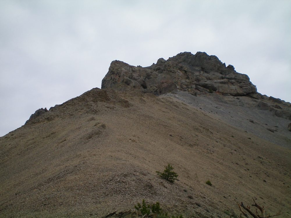
The ridge bends left-ish/northwest here. Bushwhack up the much narrower and better-defined ridge through a pine forest (briefly) with a scree/scrub base. Once back in open terrain, the ridge becomes a grind up loose scree/gravel, though there are sections that are firm. You will find several bighorn sheep beds in the gravel on the ridge. The ridge steepens and now includes some rocky outcrops on the ridge crest. At just over 10,000 feet, you reach the base of the imposing ridge cliffs that block access to the easier summit terrain above.
This is the crux of the climb. Most of the climbing here is Class 3 but there are a couple of Class 4 moves required. Move right/east to skirt the whole block of cliffs. Turn the corner and find a large chute/gully area on the southeast side of the massif. This is the mountain’s weakness. Climb up chutes, go across/up ledges, and then friction-climb a right-leaning slab. From the top of the slab, go right across ledges to reach a U-shape notch in an arete. After you pass through this notch, you pop out on much easier terrain. Go left-ish to work your way up the arete to get back onto the ridge crest. Grind out the final 200 vertical feet on easy gravel to reach the small, gravel/scree summit hump. There is a small cairn atop the peak.

The southeast ridge route
The bottom section of the southeast ridge and the illegal MC trail that goes straight up the steep slope. Livingston Douglas Photo
The rolling southeast ridge as viewed from the meadow at its base. The summit of Gloved Peak is left of center. Livingston Douglas Photo
The massive, 350-foot crux of the southeast ridge as viewed from just below it on the ridge. Livingston Douglas Photo
The southeast ridge of Gloved Peak (left skyline) and its difficult, rocky ridge obstruction. Livingston Douglas Photo
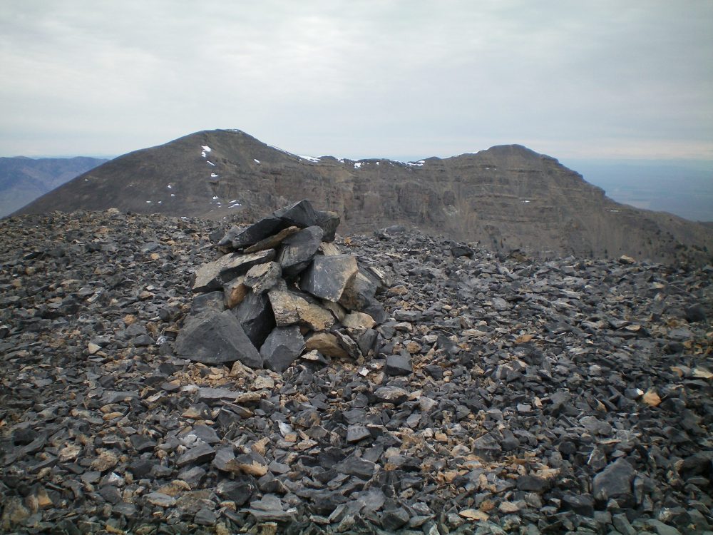
The small summit cairn atop Gloved Peak with Shril Peak (left) and Striped Peak (right) in the distance. Livingston Douglas Photo
Additional Resources
Regions: EASTERN IDAHO->Lemhi Range
Mountain Range: Lemhi Range
First Ascent Information:
- Other First Ascent: Southeast Ridge
- Year: 2019
- Season: Summer
- Party: Livingston Douglas
Longitude: -113.00829 Latitude: 44.00949