Elevation: 10,776 ft
Prominence: 346

Climbing and access information for this peak is on Page 325 of the book. The access directions in the book are no longer valid due to a road closure. Use the access information set out below. Updated November 2020
Tuscany Peak is a ragged jumble of broken rock that is located 0.8 mile northwest of Italian Peak. USGS Scott Peak
Access by Livingston Douglas
From the junction of ID-28 and ID-33 in Mud Lake, drive north on ID-28 for 42.5 miles to [signed] Nicholia Road. Nicholia Road is located 6.1 miles north of the Kaufman Picnic Area on ID-28. Turn right/north-northeast onto Nicholia Road and drive 3.1 miles to an unsigned junction with a dirt road that runs south at the base of the mountains. Drive 4.5 miles south on this dirt road to reach an unsigned left turn for Scott Canyon. You will pass two turnoffs for Eidelman Canyon (at 0.9 miles and 1.6 miles), a turnoff for Italian Canyon (at 2.5 miles), and a sign for Irish Canyon (at 3.7 miles) on the way.
At 4.5 miles, reach an unsigned left turnoff for Scott Canyon Road. Reset your odometer here. At 0.3 miles, enter the Targhee National Forest (signed). The road is now officially FSR-190. At 1.8 miles, pass Blind Canyon (signed on left). At 2.9 miles, reach an unsigned road junction. FSR-190/Scott Canyon Road is badly rutted past this point. You may want to park on this old side road if necessary (7,509 feet). If your vehicle and road conditions permit, drive another mile to the end of FSR-190 at 3.9 miles. This is the parking area for two trails: FST-006 and FST-174. FST-006 is a MC trail that heads up Scott Canyon. The trailhead parking area is a large grassy meadow at a fork in the canyon. There are some shaded, dispersed campsites on the right/south side of the meadow.
On 8/9/01, Rick Baugher followed the route described in the book. Here is his report.
“From a locked gate at 7,200 feet in Scott Canyon on the Idaho side of the Beaverhead Mountains, follow a single-track motorcycle trail up Scott Canyon. Off trail, ascend rubbly gully north to reach a 10,020-foot saddle. This is the southwest spur of Italian Peak. Having already done Italian Peak, I opted for a debatable shortcut by doing a longish side-hilling ascent to the 10,420-foot Italian/Tuscany saddle on the Continental Divide. From here, I followed a game trail northwest on the ridge until faced with gnarly rotten limestone towers.”

I passed around these obstacles by finding a ledge system along the headwall of the Nicholia Creek drainage on the Montana side. Rick Baugher Photo and Commentary
“With a little Class 3 climbing, I gained the 10,776-foot summit of Tuscany Peak. Built a cairn and left a register on this remote summit. Found something like a nylon gasket, indicating someone in the recent past had been up here. Farther to the northwest, on Point 10645, was an iron Stateline Milepost Marker (MP 576) placed by the Carpenter Stateline Survey in 1905.”

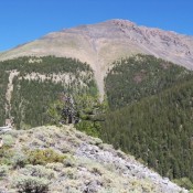
The southwest aspect of Tuscany Peak as seen from “Little Caesar” (9,041 feet) and the forks of Italian Canyon (7/29/11). The summit of Tuscany Peak is on the right, about in the center of a ragged portion. Rick Baugher Photo

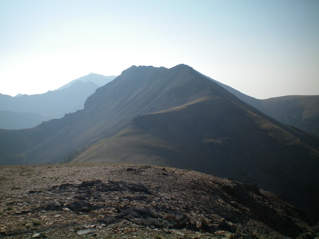
Tuscany Peak (10,776 feet) as viewed from Peak 10340 to the northwest on the Continental Divide. The easy, early section of the climb from here is deceiving as the ridge gets very rough and choppy for the final 1/2 mile to the summit. Livingston Douglas Photo
Additional Resources
Regions: Beaverhead Range->EASTERN IDAHO
Mountain Range: Beaverhead Range
Longitude: -112.8642 Latitude: 44.3699
