Elevation: 10,848 ft
Prominence: 510

This peak is not in the book. Based on LiDAR measurements, this peak’s elevation is now 10,848 feet (USGS quadrangle measurement is 10,817 feet). Updated February 2024
Railroad Peak is, in reality, the high point of Railroad Ridge though LOJ considers it a separate peak that is NOT on Railroad Ridge (10,425 feet). Railroad Peak is one of two ranked summits that sit above the headwaters of both Jim Creek and Gunsight Creek. Peak 10734 is its sister peak to the east and is a newly-ranked summit, according to LiDAR. The view of Gunsight Lake, Dike Lake, Tincup Lake, and Quartzite Lake is splendid from both of these peaks. USGS Livingston Creek
Access
Same as for Railroad Ridge. This is the second leg of a 2-peak adventure that includes Railroad Ridge (10,425 feet) and Railroad Peak (10,848 feet). It covers 12.0 miles with 3,825 feet of elevation gain round trip. The mileage and elevation gain can be significantly reduced if you are able to drive up Jim Creek Road.
North Ridge, Class 1
The Climb
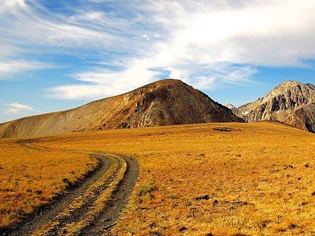
From the 10,300-foot connecting saddle with Railroad Ridge (10,425 feet), follow a good climber’s trail (not shown on maps) that leads southwest then south up the ridge to the summit. The terrain is a combination of talus, scree, and tundra. The high point has a tall cairn and offers splendid views of nearby rugged White Cloud peaks to the south and west. The climber’s trail passes a few false summits before reaching the true high point of Railroad Peak.
East Ridge/Northeast Gully, Class 2
The Descent
From the summit, descend east down the rounded ridge of talus to reach the 10,420-foot connecting saddle with Peak 10734. This saddle is a wide, gentle affair of chip rock. Move to the east side of the saddle and descend northwest down a tundra slope that leads into the center of the headwaters of the Jim Creek drainage. Head north then northeast in more tundra, skirting the left/west side of a marsh. Reach the north side of the Jim Creek drainage and look for an unmapped jeep track northwest of the Livingston Mine buildings. Follow this old 2-track eastward back to the 3-way junction with Jim Creek Road. Head east down Jim Creek Road for about 3.5 miles to Big Boulder Creek Road and the large trailhead parking area.
Additional Resources
Regions: EASTERN IDAHO->White Cloud Mountains
Mountain Range: White Cloud Mountains
Longitude: -114.5999 Latitude: 44.1312
