Elevation: 10,850 ft
Prominence: 350
This peak is not in the book. The following route information and photo were provided by Rick Baugher.
Sheep Pen Peak is one of the most visible of the high peaks as seen from Challis and Round Valley. It is the northernmost 10,000-foot summit in the Pahsimeroi Subrange of the Lost River Range. It is believed to be the last 10er to be climbed in the Lost River Range. USGS Meadow Peak

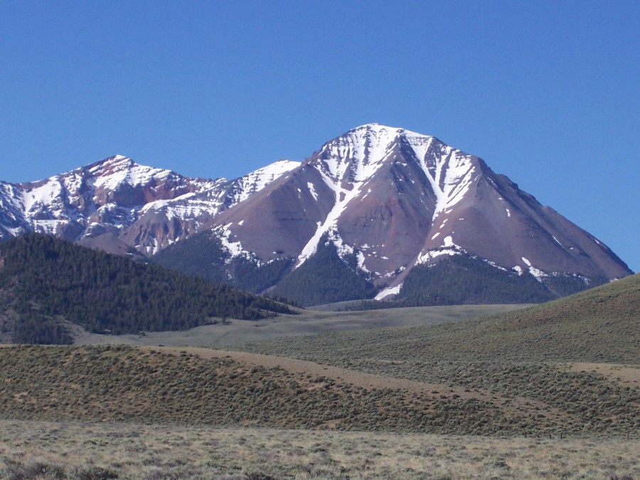
The view is SSW from the Pahsimeroi Valley with Grouse Creek Mountain (left) and Sheep Pen Peak (right). The low point on the 1.2-mile connecting ridge is 10,500 feet, giving Sheep Pen Peak a prominence of 350 feet. This summit has had 3 different spot elevations over the years. The 1935 Borah Peak 30-minute quad showed 10,876 feet. The elevation was lowered on the 1956 Doublespring 15-minute quad to 10,843 feet. The current elevation as shown on the 1989 Meadow Peak 7.5-minute quad as 10,850 feet.
Additional Resources
Regions: EASTERN IDAHO->Lost River Range->Pahsimeroi Range
Mountain Range: Lost River Range
Longitude: -113.91749 Latitude: 44.38079