Elevation: 11,195 ft
Prominence: 307
This peak is not in the book. This summit was remeasured by LiDAR and recently identified as a ranked peak. Derek Percoski wrote the first entry for this peak. Steve Grantham added the North Ridge entry which undoubtedly will become the most popular route on this peak. His report is located down the page after Derek’s photos. Updated August 2024
Ibex Creek Peak is located northwest of Culmination Peak on a ridgeline that runs north and ends at the confluence of the South Fork East Fork of the Salmon River and Ibex Creek. First known ascent (10/7/23): Derek Percoski and Taylor Amato. USGS Galena Peak
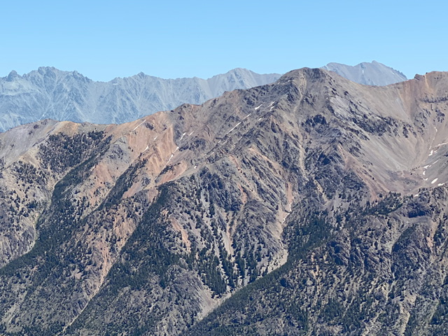
The west face of Ibex Creek Peak as viewed from Peak 10835. Derek Percoski Photo
Until October 2023, it was not known this was a ranked 11er so this peak had not been thoroughly explored. Taylor Amato and I climbed the west/northwest rib, primarily because of our choice to approach the peak from Pole Creek on e-bikes via the Grand Prize motorcycle trail instead of driving all the way to the East Fork Salmon River. Future climbers will likely choose other routes due to practicality of access. For those, I can only offer speculative insights. While the mountain likely has a few purely Class 2 options, the best routes probably all involve a few Class 3 sections, essentially traveling on stable ridges rather than loose faces.
Access
The most direct access to the peak is from the Bowery Trailhead [(C)(2) on Page 242]. Note that, as of 2022, the owner of the last private property out East Fork Salmon has started locking their gate and allowing only non-motorized access to pass through. This means an extra 1.5 miles of road hiking each way. USFS hopes to negotiate a new easement. The most direct route from this access is the north ridge, which *APPEARS* to be almost all Class 2. To access the west rib, continue on the Grand Prize trail to the South Fork East Fork Salmon Trail.
For those with serious stamina: the approach from the Grand Prize Trailhead via Pole Creek [(A)(1.1.1)(a) on Page 229]. This is a 17-mile, 3,000-foot elevation gain round trip of immaculate trail, in addition to the 4,000-foot ascent of the mountain. Another option is the 1.5-mile ridge connection from Culmination Peak and back, which also *APPEARS* to be mostly Class 2 with one Class 3 section in the middle. Both of these approaches involve serious mileage.
Northwest Rib, Class 3
From 1/2 mile up the South Fork East Fork drainage, begin ascending the west face just south of an unnamed creek. We found an excellent game trail that led us exactly where we want to go up through the forest section. Once the trees end, the rib begins to take shape. There are short scrambling sections along the way. Most or all could be avoided with a detour onto the west face if that’s your style. For the descent, we chose to scree ski down the west face for 1,000 vertical feet before returning to the west rib.
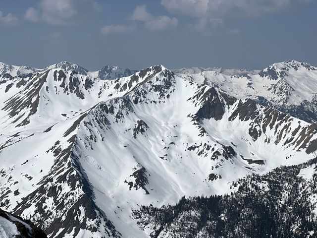
The northeast face of Ibex Creek Peak as viewed from Roaring Peak. Derek Percoski Photo
The north ridge of Ibex Creek Peak as viewed from Peak 10405. Derek Percoski Photo

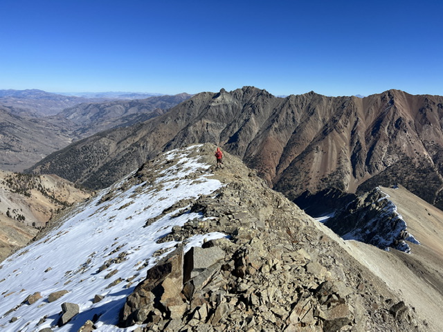
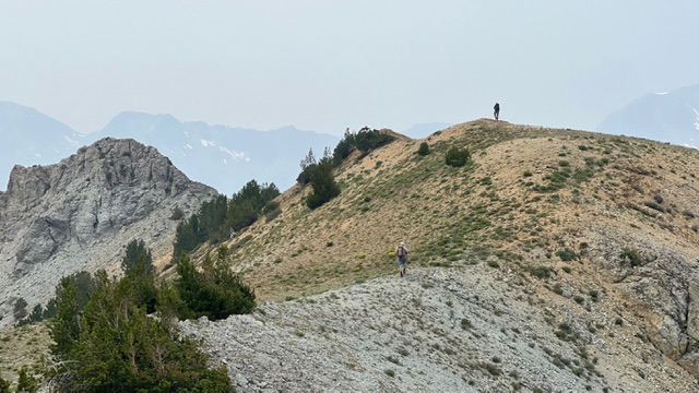
Ascending the northwest rib. The summit in the background. Derek Percoski Photo
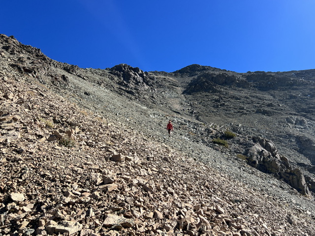
Looking down the northwest rib. Derek Percoski Photo
Looking down the north ridge toward the East Fork Salmon River. This is potentially the ideal way to climb the mountain. Derek Percoski Photo
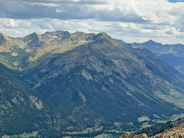
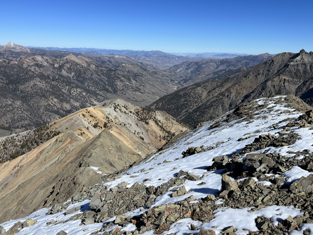
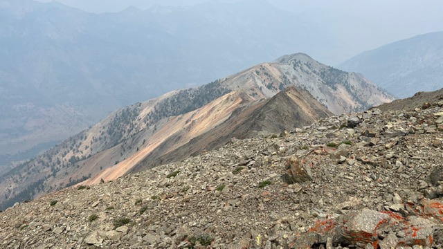
View southeast along the connecting ridge to Culmination Peak. Derek Percoski Photo
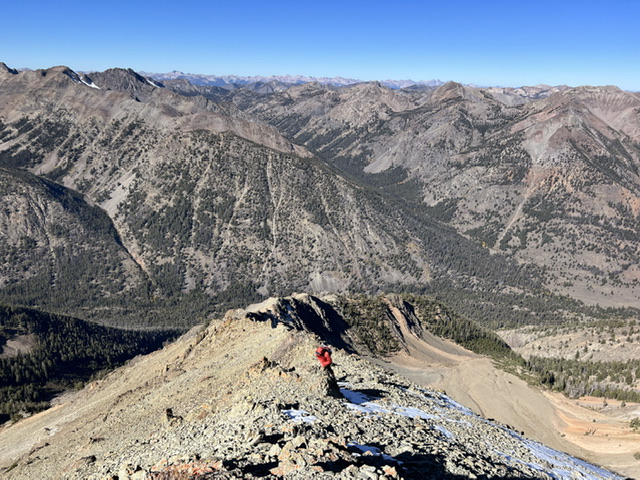
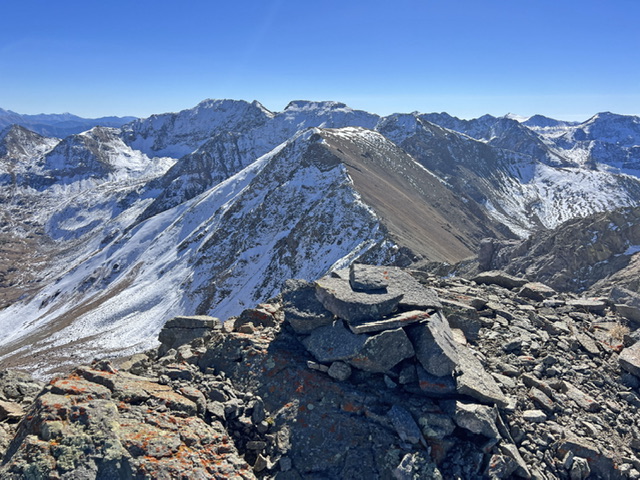
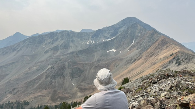
Summit view looking at Roaring Peak. Derek Percoski Photo
After scree-skiing down the west face a ways, we side-hilled back to the northwest rib at around 10,300 feet. Derek Percoski Photo
The northwest rib route
North Ridge by Steve Grantham
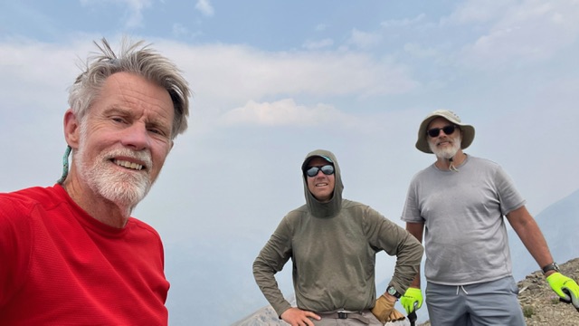
On Saturday, July 27, 2024, Michael Pelton, Alex Feldman and I made what we believe to be the first ascent of the north ridge of Ibex Creek Peak, which appears to be the most direct and shortest route available. As described above, Derek Percoski and Taylor Amato had made the first recorded ascent of the peak in October 2023 by riding electric mountain bikes from the Stanley Valley up Pole Creek and the Grand Prize Trail to access the northwest rib. Brett Sergenian made the second ascent a week later from the North Fork of the Big Wood river by traversing over Culmination Peak and up the south ridge.
Access
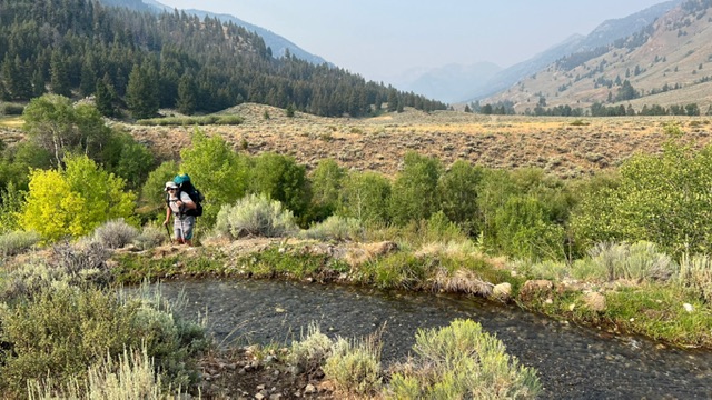
Access is from the East Fork Salmon River Road [(C)(4) Page 242]. Because the East Fork Salmon River Road has now been closed by a private landowner about 1.5 miles before the Bowery guard station, and because we are not exactly young folks, we decided to backpack in to a campsite near the confluence of Ibex Creek and the East Fork on Friday afternoon. It’s an easy hike of about 4.4 miles, but there are 3 major stream crossings, so sandals or river shoes are needed.
Note also that there is some confusion as to whether one is allowed to walk the closed road through the private land. An SNRA representative told us that her latest info was that foot and bicycle traffic is still allowed on the road, but the sign on the locked gate was less welcoming, saying, “No Trespassing/Firearms in Use/KEEP OUT”. Fortunately, from a parking spot just before the gate it is easy to walk along the southeastern boundary of the private property, following braided cow paths through the sagebrush.
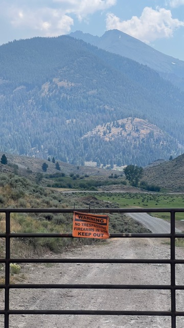
Locked gate on East Fork Salmon River Road with stern warning. Peak 11,458 (Roaring/Barracuda) in the background. Steve Grantham Photo
Irrigation canal above crossing of West Pass Creek. Steve Grantham Photo
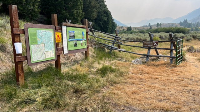
Kiosk at end of E Fork Road near Bowery GS. Trail 112 takes off just left of sign. Steve Grantham Photo
The first stream crossing, across two branches of West Pass Creek and a small irrigation canal, comes right before you pass the southern end of the private property. You then rejoin the road for a short stretch to a gate right before the Bowery guard station, where FST-112 (the Grand Prize trail) takes off uphill on the left. The trail crosses the river in a bit over a mile. A little over a mile after that, about where the trail veers right uphill, you need to start looking for a good place to leave the trail and cross back to the southeast side of the river, just above its confluence with Ibex Creek. We crossed a bit too soon (below the confluence) on the hike in and ended up thrashing through some willows.
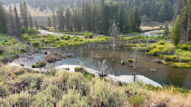
Huge beaver pond and lodge along E Fork Salmon on hike up to Ibex Creek. Steve Grantham Photo
North Ridge, Class 3
We began the ascent Saturday morning by heading due south, staying just west of Ibex Creek at first. We almost immediately encountered a totally unexpected scenic bonus, as the ordinary creek bed soon became a very deep, narrow gorge with several impressive waterfalls. After a few minutes we angled away from the gorge towards the ridge proper—but we definitely recommend taking a look at the beautiful gorge before diverging from it!
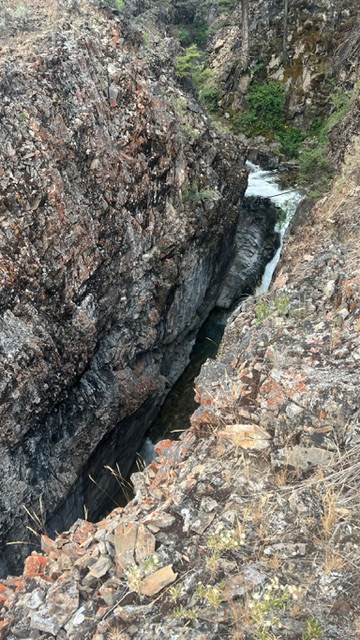
Looking down into deep narrow gorge of Ibex Creek. Steve Grantham Photo

Impressive waterfall in Ibex Creek gorge. Steve Grantham Photo
After about 800 vertical feet of easy walking through open forest, the ridge got steeper and more choked with brush and deadfall for the next 800 feet or so, then the forest thinned out again and gave way to the customary talus slopes with a few cliff bands. At an elevation of about 9600 feet a series of towers blocked the ridge, so we traversed over to the next spur to the west, regained the main ridge about 200 feet higher and soon reached point 10,304.
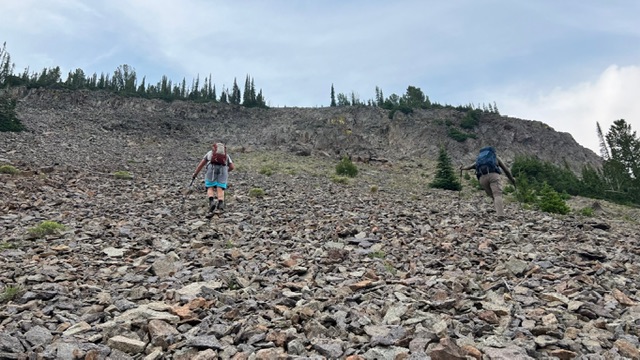
Alex and Michael leaving the dense forest starting up the talus at around 9000′. Steve Grantham Photo
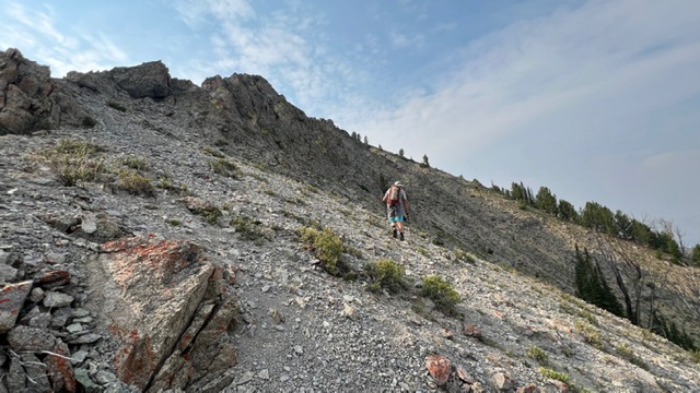
Alex traversing right to avoid towers on ridge. Steve Grantham Photo
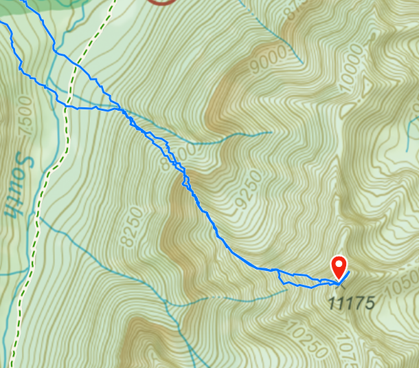
On the topo map it looked like the upper stretch from point 10,304 to the summit would be fairly straightforward, but it turned out to be the most challenging part of the route, with a lot of ups and downs over airy ridges and/or talus-strewn sidehills. It’s still mostly Class 2, with a few Class 3 moves here and there. A little rain and thunder made the final stretch a bit more spicy, but Michael reached the summit a little after noon, with us two 67 year olds staggering up about 40 minutes later. Total distance from camp to summit was about 3.3 or 3.4 miles with a little over 4000’ vertical gain.
First couple of ups and downs between point 10,340 and summit. Steve Grantham Photo
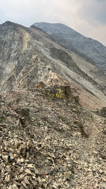
Upper part of summit ridge. True summit is at right end of flattish ridge in background. Steve Grantham Photo
View from point 10,340 towards summit. Steve Grantham Photo
Unfortunately it was quite smoky all day, so our views were not as spectacular as they might have been, but we still got impressive glimpses of the nearby peaks. On the descent we did take a brief look at the broad cirque that drops off to the east from about 10,200’ towards the upper part of Ibex Creek. It looked like it might provide a fast scree descent for the first 1000 feet or more, but it was hard to guess what the terrain might look like lower down, so we decided to play it safe and retrace our steps. It took us about 12 hours camp to camp, though younger, fitter folks would probably be considerably faster. We spent the night at our same campsite, then backpacked out on Sunday morning.
Looking back down ridge to point 10,340. Route below that point follows left hand ridge. Steve Grantham Photo
Overall, the north ridge route was about as we expected, fairly typical for the Boulder Mountains, though the talus is not as bad as some peaks in the range. It does seem like the easiest approach if you don’t mind the fairly long drive down the East Fork road, and we’re guessing it will become the standard route for those who want to (re)complete the Idaho 11ers.
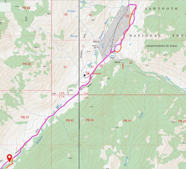
Steve’s GPS track from the locked gate to their campsite.
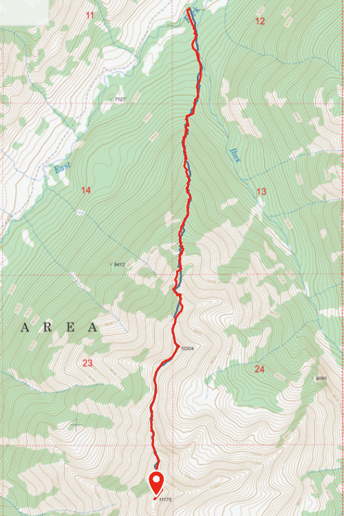
Stece’s GPS track Ibex Creek Peak North Ridge.
Steve Grantham Photo
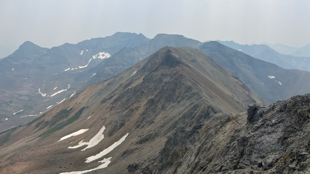
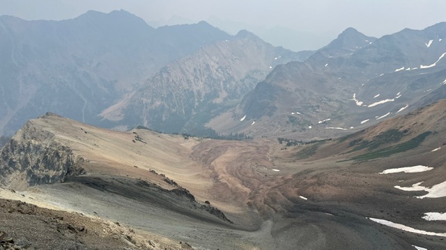
View along south ridge towards Culmination Peak, Down East Peak, etc. Steve Grantham Photo
View down into cirque on east side of summit ridge. This MIGHT make a good descent route, but hard to tell what’s around the corner in upper Ibex Creek. Steve Grantham Photo
Additional Resources
Regions: Boulder Mountains->EASTERN IDAHO
Mountain Range: Boulder Mountains
First Ascent Information:
- First Ascent Year: 2023
- Season: Fall
- Route: Northwest Rib
- Party: Derek Percoski and Taylor Amato
Longitude: -114.53242 Latitude: 43.91032