Elevation: 3,168 ft
Prominence: 588

This peak is not in the book. Published November 2023
Peak 3168 is a forested hill that sits above both Luby Bay and Shoshone Bay on the west side of Priest Lake. The summit can be reached via the Woodrat Trail/FST-235. Unfortunately, the summit is thickly forested and offers no views. USGS Priest Lake SW
The summit of Peak 3168 with its newly-built wooden cairn. Livingston Douglas Photo
Access
From ID-57 about 0.5 miles northwest of Lamb Creek, ID, turn right/northeast onto [paved] Luby Bay Road (signed for “Luby Bay”) and drive 1.3 miles to an unsigned “T” junction with CR-35. Turn right/southeast and drive 0.2 miles to a signed junction with FSR-1048 (signed for “Woodrat Trail”). Drive 0.1 miles south on this dirt road to the signed trailhead for FST-235/Woodrat Trail. Park at the trailhead (2,510 feet; 48⁰32’07”N, 116⁰55’21”W).
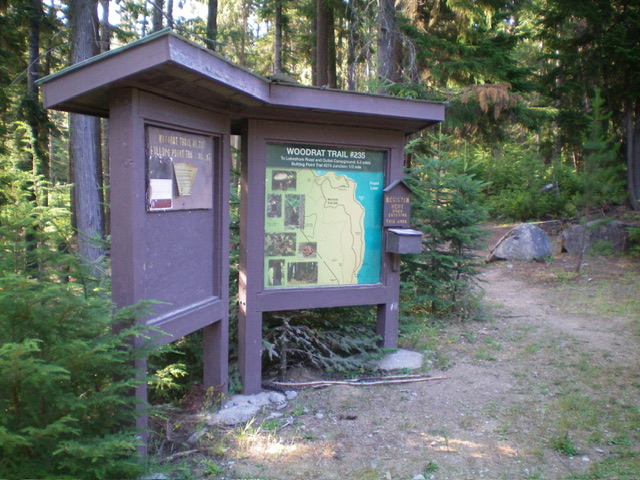
The Woodrat Trail sign at the trailhead. This trail gets you close to the summit of Peak 3168. Livingston Douglas Photo
Map Errors and Trail Positions
The USGS topo map incorrectly positions the first ¼ mile of FST-235 and fails to show FST-48. The National Forest Map correctly shows the current trails in this area (FST-48/Beach Trail, FST-235/Woodrat Trail, and FST-274).
Northwest Face/West Ridge, Class 2
The Climb
This climb is mostly Class 1. From the trailhead, hike east on the narrow but well-maintained trail for ½ mile to a signed junction with FST-274. Go right/south at this junction to continue along Woodrat Trail. Hike south then southeast then south (with a few minor ups and downs) up the trail to a sharp left/east turn high up. Continue to the crest in the Woodrat Trail on the summit area of Peak 3168.
Bushwhack about 40 feet right/south in semi-open pine forest to the high point. I built a log cairn with several pieces of timber available nearby and used the highest tree stump as the high point. You can also drive farther up FSR-1048 to where it is very close to FST-235 and shorten this climb considerably. A short bushwhack up east up through the pine forest and brush will put you on FST-235 pretty high up.
Additional Resources
Regions: NORTHERN IDAHO->Selkirk Mountains
Mountain Range: Selkirk Mountains
Longitude: -116.9088 Latitude: 48.5246