Elevation: 4,123 ft
Prominence: 343
This peak is not in the book. Published October 2023
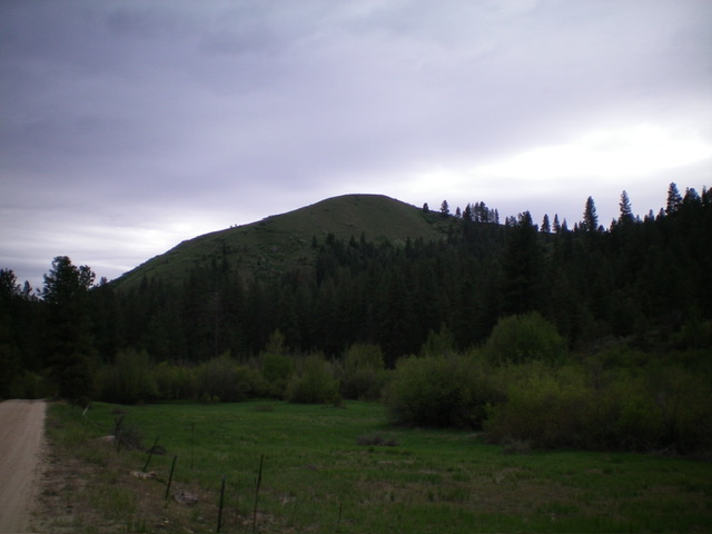
Peak 4123 is a handsome hump that sits above the Cottonwood Guard Station and massive Arrowrock Reservoir in the Boise Mountains. It is often overlooked by climbers due to its low elevation but is a wonderful scramble from the Guard Station. USGS Arrowrock Reservoir NE
Peak 4123 (dead center) as viewed from FSR-377 to its north. Livingston Douglas Photo
Access
From ID-21 at the bridge crossing of Lucky Peak Reservoir, go right/east onto FSR-268/Middle Fork Road [(C) on Page 154] and drive 15.2 miles to a signed junction with FSR-377/Cottonwood Creek Road. Turn left/north onto FSR-377 and drive 0.8 miles to the Cottonwood Guard Station. Park at the first cabin in this Guard Station complex near a junction with two other unsigned side roads on the left/west side of FSR-377. The elevation here is 3,440 feet.
Northeast Ridge, Class 2
The Climb
From the parking pullout, hike southwest up the south-most side road to a barn and beyond it a short distance, passing through two cattle gates. Leave the road and bushwhack left/south up through somewhat dense willows in steep, loose dirt/grass to reach the open scrub of the crest of the northeast ridge. Grind your way up the ridge through the scrub and scattered willows (early on). Use a game/use trail to help you reach the ridge crest. Once on the open ridge crest, follow it southwest in easy scrub to reach the open, small summit hump.
On the descent, take an easier line. From the summit, descend the open/semi-open scrub on the ridge crest (or on its right/east side) and find a loose dirt trail on the crest about halfway down that leads quickly down to FSR-377 about 1/8 mile south of (and 55 vertical feet below) the Guard Station. Hike north up the good road back to the Guard Station and your parked vehicle.
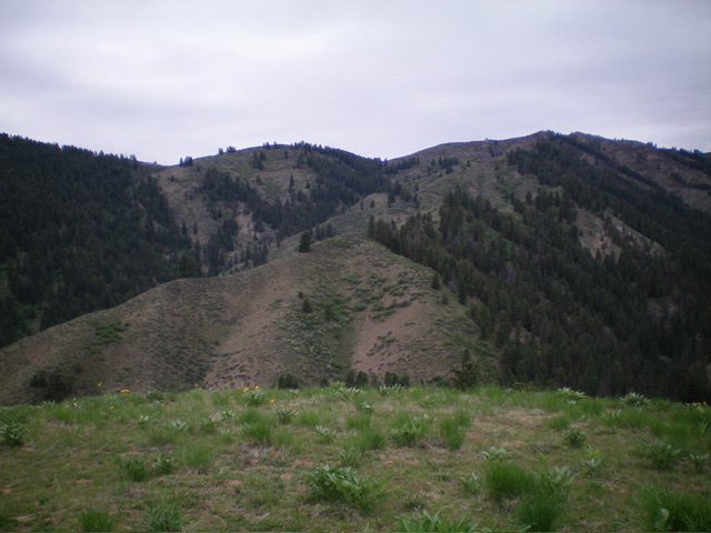
The gentle summit of Peak 4123, looking west at the higher ridgelines and peaks. Livingston Douglas Photo
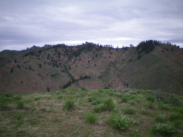
Looking across the Cottonwood Creek drainage from the summit of Peak 4123. Livingston Douglas Photo
Additional Resources
Regions: Boise Mountains->WESTERN IDAHO
Mountain Range: Boise Mountains
Longitude: -115.8329 Latitude: 43.6345