Elevation: 4,210 ft
Prominence: 350
This peak is not in the book. Published October 2023
Osprey Point is located along ID-21 and above the confluence of Mores Creek and Minneha Creek in the Boise Mountains. It is most easily climbed from FSR-238/Minneha Creek Road. The summit is on private land but there is no fencing or signage to prohibit entry. USGS Dunnigan Creek
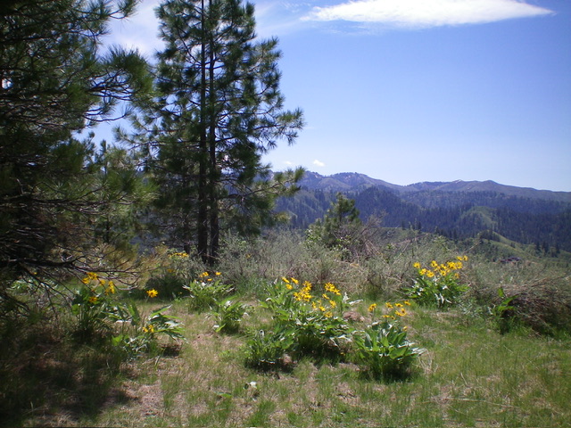
The summit of Osprey Point. Livingston Douglas Photo
Access
Park at the base of [unsigned] FSR-238 along ID-21 at a bridge crossing of Mores Creek. This parking area is at 3,360 feet and is 0.8 miles east of [signed] Grimes Creek Road.
Map Errors
There are many more old roads on the north side of Osprey Point than the USGS topo map shows. This makes the bushwhack a more difficult navigational effort. Pay more attention to the terrain than to the numerous confusing 2-tracks.
North Gully/East Ridge, Class 2
The Climb
From the parking area, hike up through the gated road closure for FSR-238. Follow the jeep road east then southeast. Go straight at a signed junction with FSR-238D to remain on FSR-238. Go right/south at the next signed junction onto FSR-238B. Follow FSR-238B uphill to a signed junction with FSR-238B2. Go right/west onto FSR-238B but leave it quickly to bushwhack southwest up a dry gully to reach the east ridge. Bushwhack up the densely-forested, brushy east ridge to reach the semi-open summit of Osprey Point. The summit had no summit cairn and showed no signs of previous ascent.
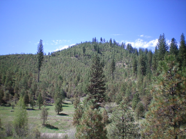
View of forested Point 4000+ (dead center) from the northeast. This shows much of my ascent route. Osprey Point is not yet visible. Livingston Douglas Photo
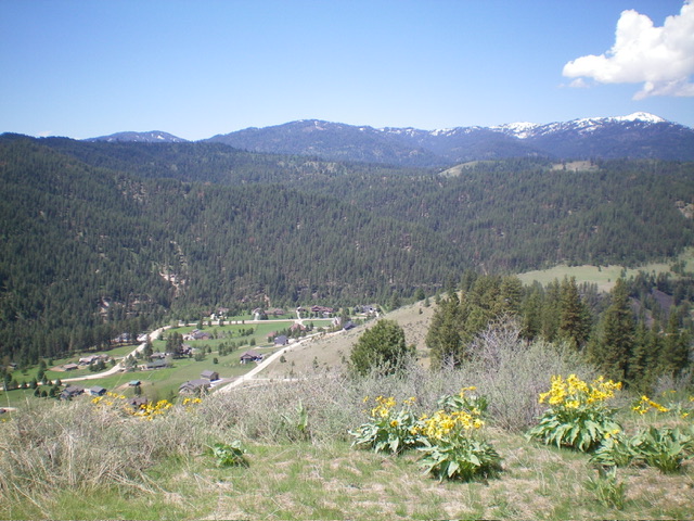
Summit view from Osprey Point. Notice the expensive homes in the valley. Livingston Douglas Photo
Additional Resources
Regions: Boise Mountains->WESTERN IDAHO
Mountain Range: Boise Mountains
Longitude: -115.9386 Latitude: 43.7207