Elevation: 4,788 ft
Prominence: 368
This peak is not in the book. Published November 2023
Peak 4788 is a rugged, triangular-shaped summit that towers over the confluence of Owl Creek and the Salmon River. It is most easily climbed from the Salmon River Road. This area is a mix of private and public land, so be careful. This climb is entirely on National Forest land. USGS Bighorn Crags
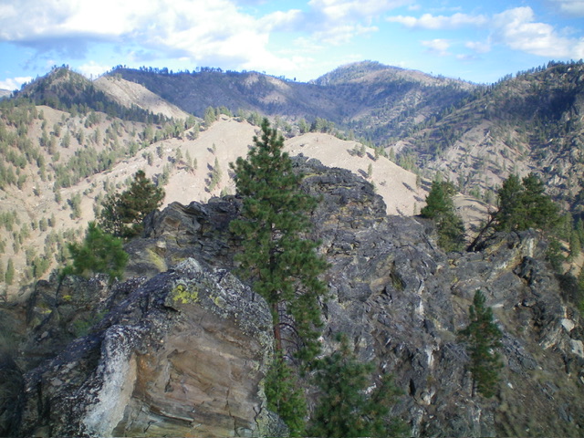
The rocky summit hump (the darkish rock in foreground) of Peak 4788 as viewed from the [lower] east summit. Livingston Douglas Photo
Access
From US-93 at North Fork, drive 30 miles west on FSR-030/Salmon River Road to a large pullout on the right/north side of the road. This pullout is 4 miles west of Panther Creek Road. Park here {3,155 feet; 45⁰18’59”N, 114⁰28’24”W).
Southwest Gully/Southwest Ridge, Class 3
The Climb
From the roadside pullout, walk about 0.1 miles northeast on Salmon River Road to reach the mouth of Skull Gulch. This gulch is at the east end of the final residence on the south side of the road. Leave the road and bushwhack northwest briefly up Skull Gulch in grass and brush, following a decent use trail for much of this short segment. Find a steep, but manageable, dry gully heading diagonally right/northeast where Skull Gulch gets thick with brush and trees.
Climb the dry gully on steep boulders, talus, and gravel in chutes and on slab/face rock. Move to either side of the gully on ribs as necessary to make upward progress. This is Class 3 work and is steep and loose, so be careful to not lose your footing. Reach the top of the narrow gully and the crest of the south spur of the southwest ridge. Follow the short spur north-northwest to a ridge corner in easy field grass. The ridge corner is on the southwest ridge.
From the ridge corner, head right/north-northeast then northeast to reach the rocky summit area. Skirt around a few ridge blocks on the way (easy), climbing on decent grass/gravel terrain. There are two rocky summit humps. The southwest ridge leads directly to the true/west summit. There is no summit cairn or signs of previous ascent. I built a small summit cairn here. I visited the [lower] east summit hump (just to be sure) and it measures 10 feet lower. The USGS topo map is correct on the location of the high point. There are a few ridge trees here and there on the southwest ridge, but it is not forested high up as the USGS topo map suggests. Nor is the summit area.
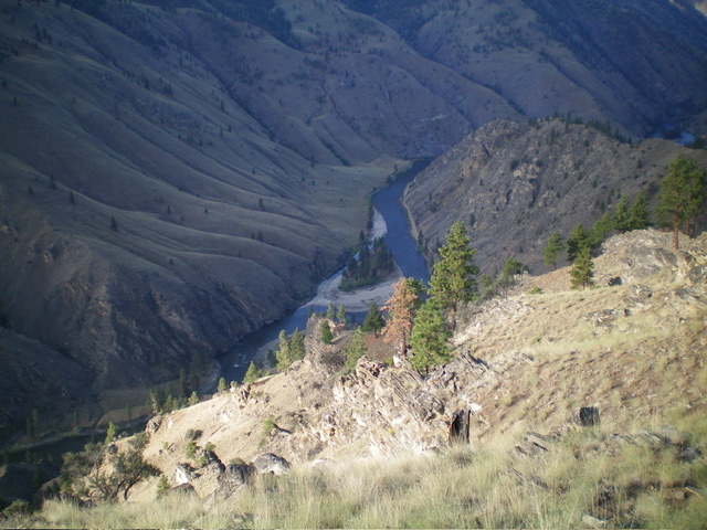
Looking down into the Salmon River Canyon from high on the southwest ridge of Peak 4788. Livingston Douglas Photo
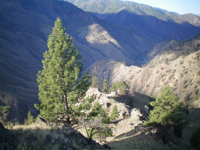
Looking down the upper southwest ridge of Peak 4788 from the summit. This was my ascent route. Livingston Douglas Photo
Additional Resources
Regions: Bitterroot Mountains->NORTHERN IDAHO
Mountain Range: Bitterroot Mountains
Longitude: -114.4644 Latitude: 45.3255