This peak is not in the book. Additional Danskin Mountains access information is in the book [(D)(1) on Pages 154-155 and (G)(1) on Page 156. Also see the following website page: Danskin Mountains OHV Trails. Information and the suggested name for this peak was first provided by Erik Pohlmann. I have added additional route information based on a 2019 ascent. Updated June 2019
Peak 5024 (Indian Peak) by Eric Pohlmann
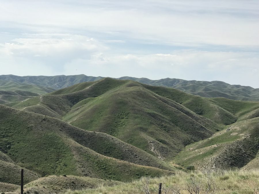
This peak is located near the middle of the Danskin OHV Ridge Trail/FST-500, a long way from all trailheads. There is nothing particularly unique and attractive about Indian Peak. Ascending the peak requires a long trek due to private property on its West Side, which blocks shorter approaches. Fortunately, its location in the middle of Danskin OHV Ridge Trail/FST-500 (a trail that traverses much of the northwestern Danskin Mountain Crest) provides good access. FST-500 is relatively long and undulating in nature. Thus, the round-trip elevation gain piles up faster than I anticipated. USGS The Roost
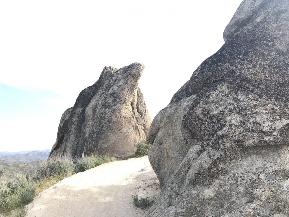
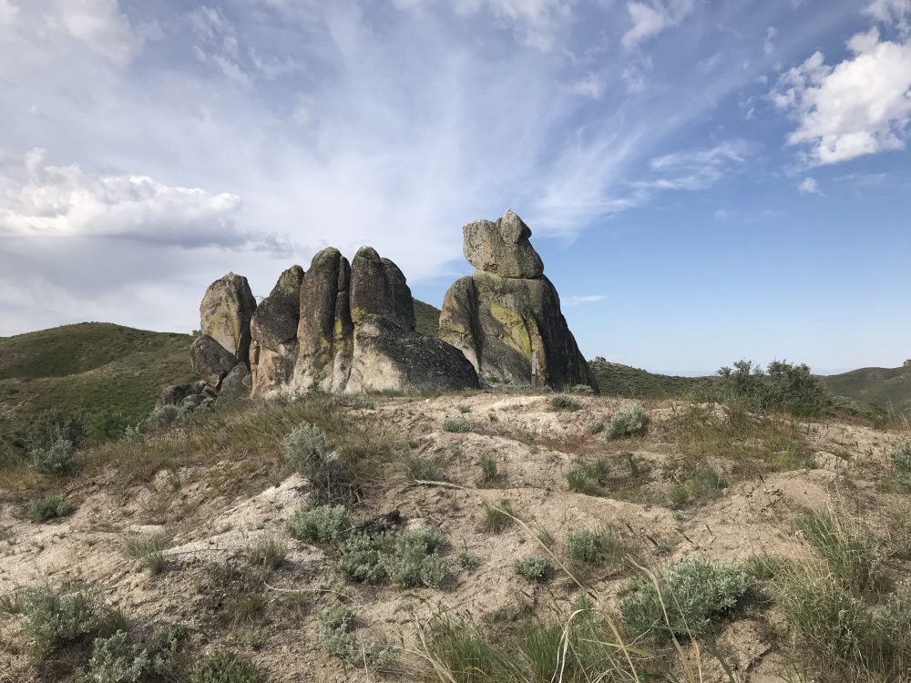
Peak 5024 as viewed from the east.
Access and Route, Class 1
Access is from I-84 and Blacks Creek Road [(G)(1) on Page 156].
FST-500, along with many of the spur trails that can be used to access it, is well used and is maintained often. Therefore, it is easy to follow from any of the 4 official Danskin trailheads: Three Point Mountain, Bender Creek, Willow Creek, and Case Creek. Many of these routes are easily mountain bike-able for the strong and skilled rider and contain very little hike-a-bike terrain, so that may be a good option to access Indian Peak due to the distances required. Beware that Willow Creek can be swollen during the Spring and requires MANY creek crossings if accessing from the Willow Creek trailhead.
For the easiest biking, stick to the double-track ATV trails. The single-track OHM trails become more technical. The 4 routes shown are the most direct from each of the 4 aforementioned trailheads; combine them for possible loop options. The three Bender Creek, Willow Creek, and Case Creek Routes consist of varying terrain and pass through enjoyable forested areas. The Three Point Mountain Route provides large views the entire trip, but is very exposed with no cover.
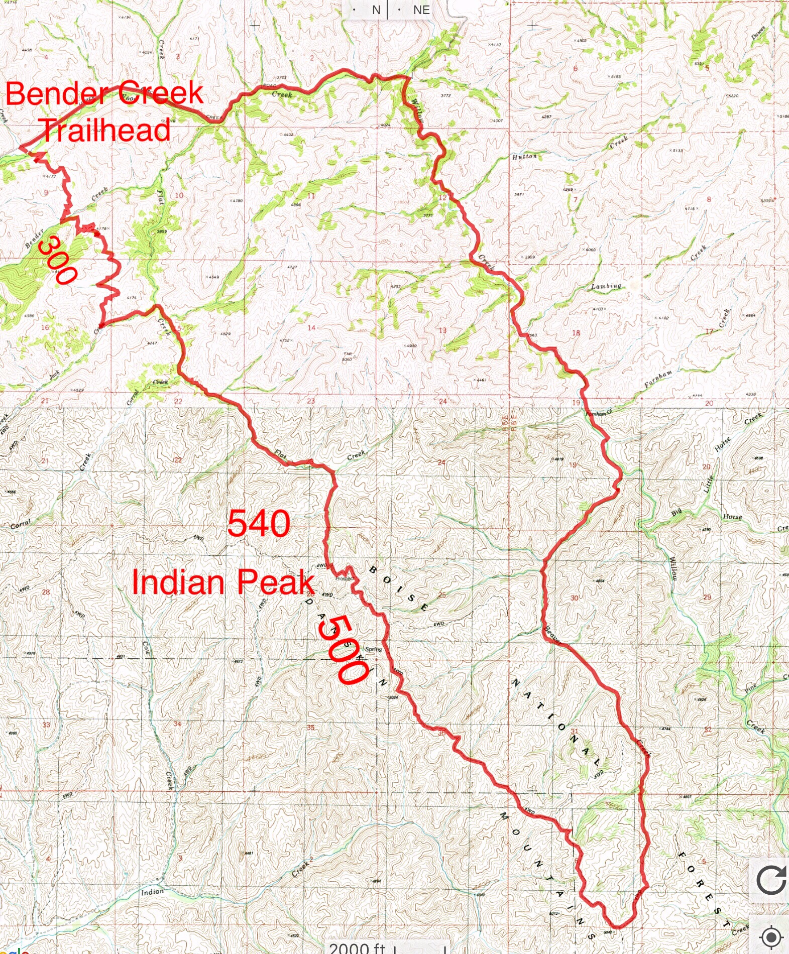
Start at the Bender Creek trailhead, follow Flat Creek Trail/FST-300 east to FST-+540. Take FST-540 up to FST-500 and follow it to the summit of Indian Peak. To complete the loop, continue on FST-500 to FST-560. Descend down Beaver Creek Trail/FST-316 to Beaver Creek Trail/FST-300. Alternatively, during periods of high Spring runoff when Willow Creek Trail/FST-400 is submerged, return via Flat Creek Trail/FST-300. Of course, you can always reverse your path and return to the Bender Creek trailhead without making the loop. This will save you significant distance.
Trails for accessing Indian Peak.
Three Point Mountain Trailhead Route, Class 1
Access
To reach the Three Point Mountain trailhead, leave I-84 at Exit 64. Drive north for 6.3 miles, turn left onto Blacks Creek Road and follow it for 4.0 miles to the the signed junction for FS-189A. Turn right and drive 0.2 miles to the trailhead.
FST-500 Route, Class 1-2
FST-500 traverses the southern escarpment of the Danskin Mountains, weaving its way along ridges and crossing drainages. This is an ATV trail which varies in quality but is easy to follow for its entire distance. The trail crosses the North Ridge of Peak 5024 roughly 200 feet below the summit, Follow the North Ridge to the summit. Round-trip stats: 18.4 miles with 2,286 feet of elevation gain. The entire route offers scenic views but no shade.
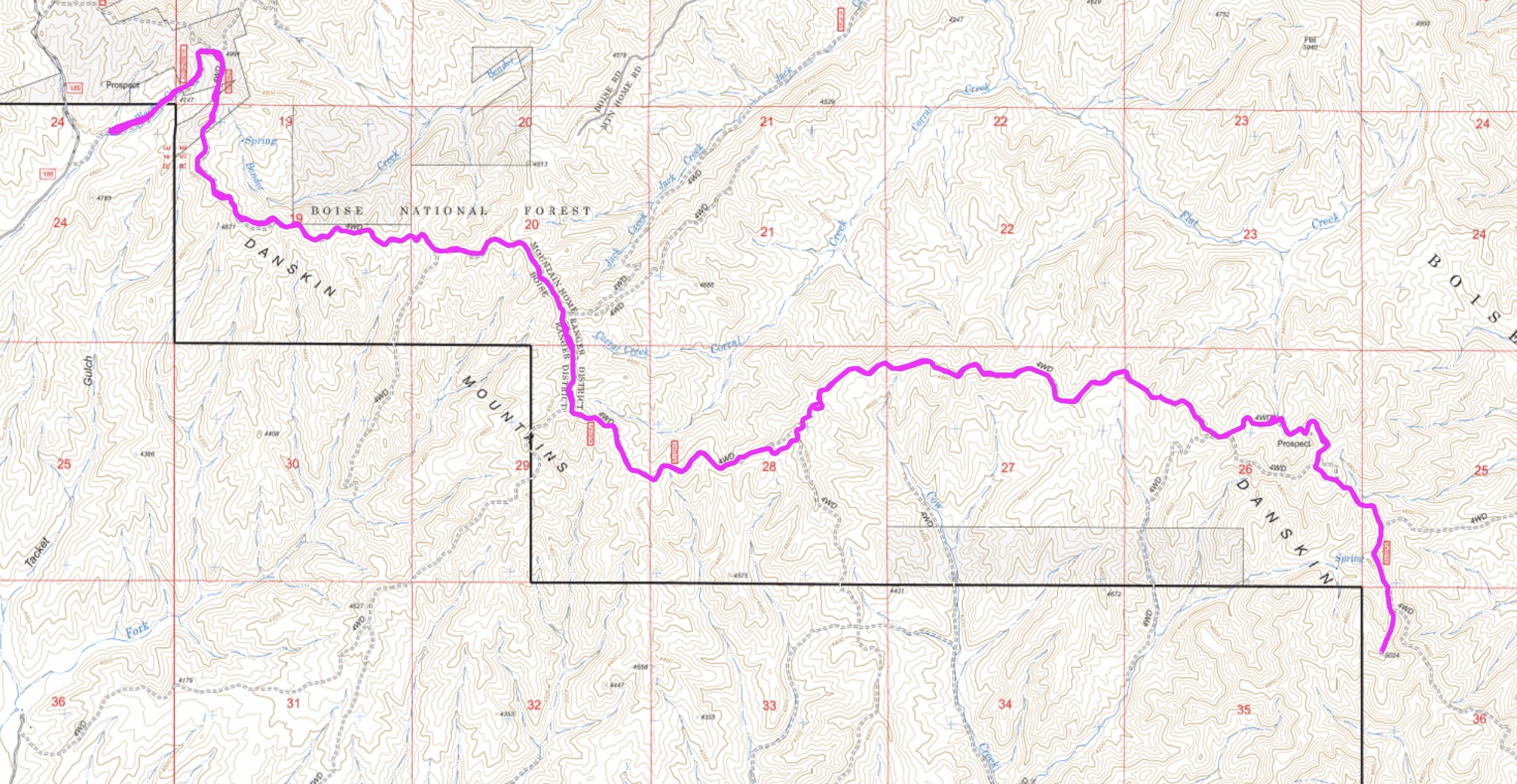
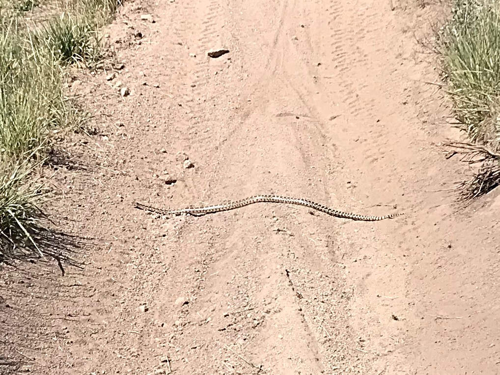
My GPS track. Many would consider this hike a “death march.” Take plenty of water and watch out for snakes.
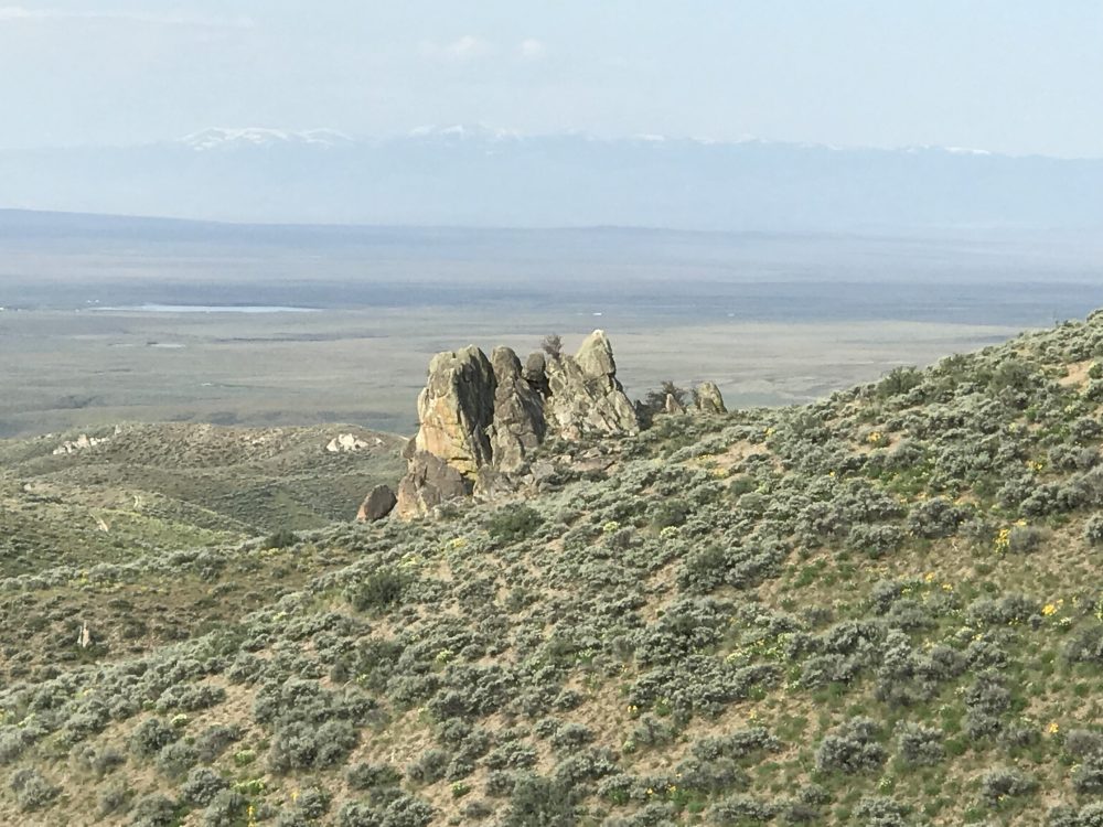
The Snake River Plain is always in view.
FST-500 varies in quality from wide and smooth to steep and loose.