Elevation: 5,030 ft
Prominence: 370
This peak is not in the book. Published November 2023
Peak 5030 is on a ridgeline that separates Ebenezer Creek from Poverty Flat in the Bitterroot Mountains. It towers over the Salmon River to its south. Peak 5030 is most easily climbed from the Salmon River Road. The crux is figuring out a way to surmount the cliff bands near the road. USGS Long Tom Mountain
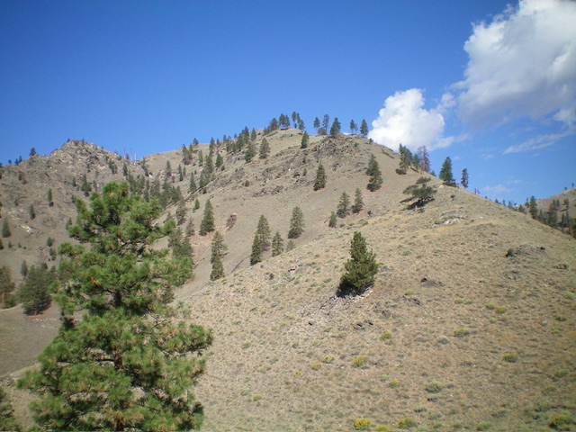
Peak 5030 as viewed from midway up the southeast ridge, my ascent route. The summit is in dead center. Livingston Douglas Photo
Access
From US-93 at North Fork, drive 32 miles west on FSR-030/Salmon River Road to a large pullout on the left/southwestside of the road. This pullout is 6 miles west of Panther Creek Road. Park here {3,145 feet; 45⁰18’27”N, 114⁰30’22”W). This area is a mix of private and public land, so be careful. This climb is entirely on National Forest land. You must avoid Poverty Flat which is privately owned.
Southeast Ridge, Class 2
The Climb
From the roadside pullout, cross to the north side of the road and scramble east up a grassy shoulder to reach a grassy ramp with a decent use trail. Follow this trail as it skirts below the left/west side of an ominous band of cliffs. At the top of this grassy ramp, there is a minor rib/shoulder that heads hard right/southeast and provides access to the top of the cliffs. The use trail takes you there. Once atop the cliff band, you are on the crest of the southeast ridge.
Follow the steep ridge crest northeast to a flat ridge area. The ridge bends left-ish north and climbs to Point 4082. From there, the ridge bends left/northwest and climbs to the summit. The southeast ridge has a few minor ups and downs (45 feet, 15 feet, 15 feet). The ridge terrain is a mix of short grass/srub, stable gravel, minor rocky outcrops, some underlying scree, and a few ridge pines (some alive, some dead). Nothing difficult. This is an enjoyable ridge scramble with magnificent views along the way.
The summit of Peak 5030 is in open terrain and provides a wonderful view down to nearby Poverty Flat and the Salmon River. There were no signs of previous ascent so I built a decent summit cairn on the highest ground boulder. Be very careful to carefully retrace the ascent route when you descend. If you get off course, you could either end up on private land or be cliffedout lower down.
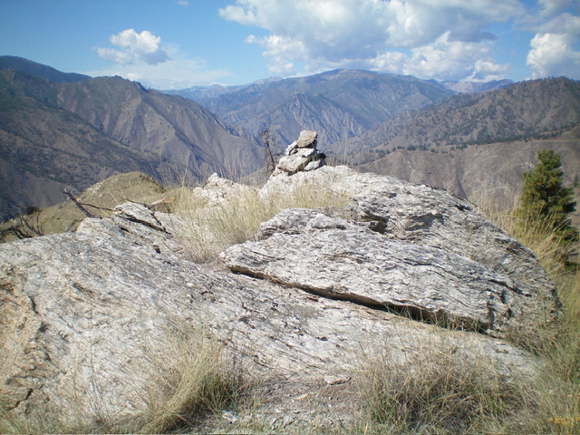
The massive ground boulder atop Peak 5030 with its newly-built summit cairn. Livingston Douglas Photo
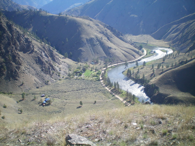
View of Poverty Flat and the Salmon River from midway up the southeast ridge. Livingston Douglas Photo
Additional Resources
Regions: Bitterroot Mountains->NORTHERN IDAHO
Mountain Range: Bitterroot Mountains
Longitude: -114.5077 Latitude: 45.3169