Elevation: 5,060 ft
Prominence: 320
This peak is not in the book. Published October 2023
Peak 5060 is a brushy hump that sits between Macks Creek and Pine Creek in the Boise Mountains. It is seldom climbed and is a tiresome, albeit short, bushwhack from Pine Creek Road to its south. This area is a mix of private and public land, so be careful. These routes are entirely on BLM land. USGS Shafer Butte
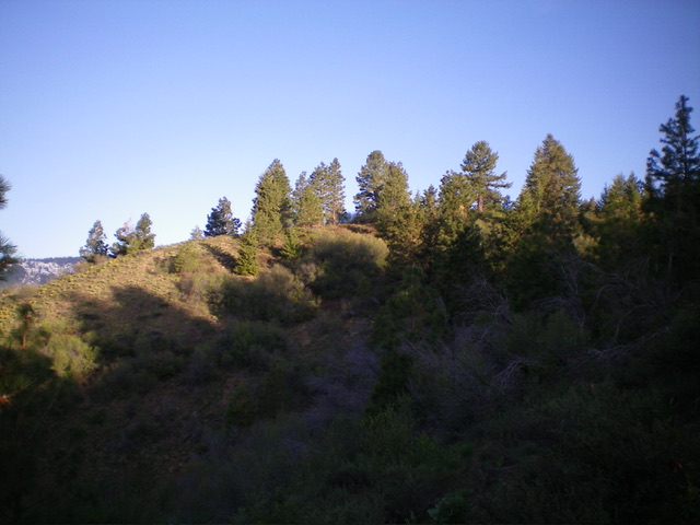
The summit hump of Peak 5060 as viewed from the southeast. Livingston Douglas Photo
Access
From ID-21 about 11 miles north of the Mores Creek bridge crossing, turn left/north onto [signed] FSR-364/Grimes Creek Road. Drive 3.4 miles north on FSR-364 to a signed junction with FSR-366/Pine Creek Road. Drive west up Pine Creek Road for 2.1 miles to a pullout on the right/north side of the road at a culvert. Park here (4,180 feet; 43⁰46’44”N, 116⁰00’44”W).
South Face/Southwest Ridge, Class 2
The Climb
From the parking pullout, bushwhack steeply north up a thick face of brush and unforgiving willows with some areas of semi-open terrain to reach the crest of the southwest ridge just east of Point 4967. Follow the ridge crest northeast then east (with two minor drops) to reach a final ridge saddle just below the summit hump. The ridge crest is somewhat thick with brush but has a few open spots. The summit is a thick mess of willows and a few scattered pines. Point 5055 is the east summit and is slightly lower than the official/west summit. There were no signs of previous ascent.
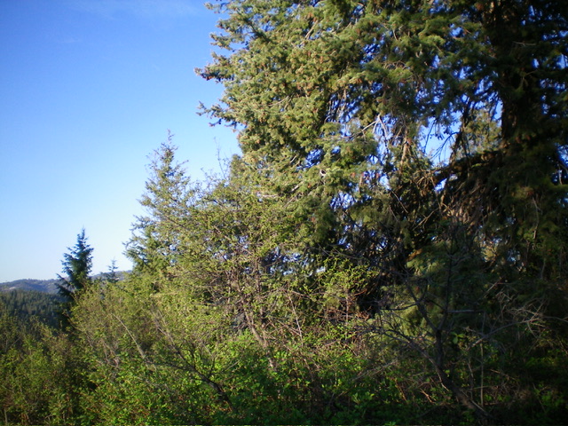
The brushy, forested summit of Peak 5060. Livingston Douglas Photo
South Ridge/South Gully, Class 2
From the west summit, bushwhack through thick brush and willows to Point 5055 (the east summit). From Point 5055, descend the south ridge to the south gully and then quickly reach Pine Creek Road about 100 yards east of the parking pullout. Walk a short distance west to the pullout and your awaiting vehicle. The descent route was a much easier bushwhack than the ascent route. Surprisingly, the south gully was easier and less thick than the south ridge.
Additional Resources
Regions: Boise Mountains->WESTERN IDAHO
Mountain Range: Boise Mountains
Longitude: -116.0102 Latitude: 43.7854