Elevation: 5,180 ft
Prominence: 400
This peak is not in the book. Published November 2023
Peak 5180 is the high point on a ridge that separates Fourth of July Creek from Kriley Creek. It overlooks the confluence of Fourth of July Creek and the North Fork Salmon River. Peak 5180 is most easily reached on public land from Kriley Gulch Road. However, the summit is on unposted, private land. USGS Bird Creek
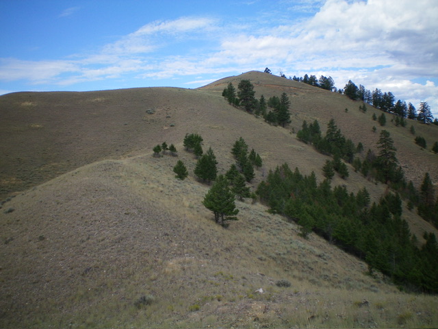
Peak 5180 as viewed from the south. The south shoulder is left of center. The east ridge is the skyline. The summit is at far left. Livingston Douglas Photo
Access
Kriley Gulch Road/BLM-100 is located along US-93 north of Salmon at MM319. This signed junction is 2.0 miles south of Fourth of July Creek Road. Drive 0.9 miles northeast up Kriley Gulch Road to a grassy pullout area where there is a BLM/FS information board. This is where BLM land begins. Park in the grassy pullout area (4,170 feet; 45⁰21’40”N, 113⁰54’42”W).
South Shoulder/East Ridge, Class 2
The Climb
From the parking pullout, scramble northeast in a grassy gully to reach the south shoulder. You have two options here. First, you can climb a gravelly slope directly onto the south shoulder (my ascent route). Second, you can follow a use trail that comes down to the right/east side of the gully from a prominent rocky outcrop that sits directly above Kriley Gulch Road at the toe of the south shoulder (my descent route).
Once on the south shoulder, head north up the shoulder in easy grass/scrub to reach a juncture with the east ridge. Skirt left/west of a ridge hump to angle left/northwest up onto the west ridge. Once on the west ridge, follow the easy grass/scrub on the ridge crest up over a final ridge hump then drop 65 vertical feet to a saddle. Scramble west then northwest up the easy grass on the ridge crest to reach the small summit area. There is a torn-down cairn on top with pines nearby on the north side of the peak. There is also an old, broken antenna on the summit.
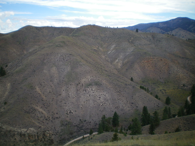
Peak 5180 as viewed from high on the east ridge. Livingston Douglas Photo
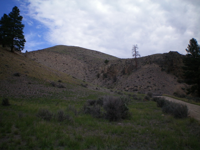
The south shoulder as viewed from the start of the climb. Climb the spur at far right to access the shoulder then head left/north to reach the east ridge. Livingston Douglas Photo
Additional Resources
Regions: Beaverhead Range->EASTERN IDAHO
Mountain Range: Beaverhead Range
Longitude: -113.9192 Latitude: 45.3698