Elevation: 5,180 ft
Prominence: 760

This peak is not in the book. Livingston Douglas added more detailed access and route information as well as new photos to this page. I replaced my entry with Livingston’s. My GPS track is set out below with comments on my climb. Updated October 2023
Peak 5180 is the northwestern-most ranked Danskin Mountains summit. Climb the peak from Deadman Creek which is midway between the Bender and Willow Creek trailheads on Blacks Creek Road. USGS Grape Mountain
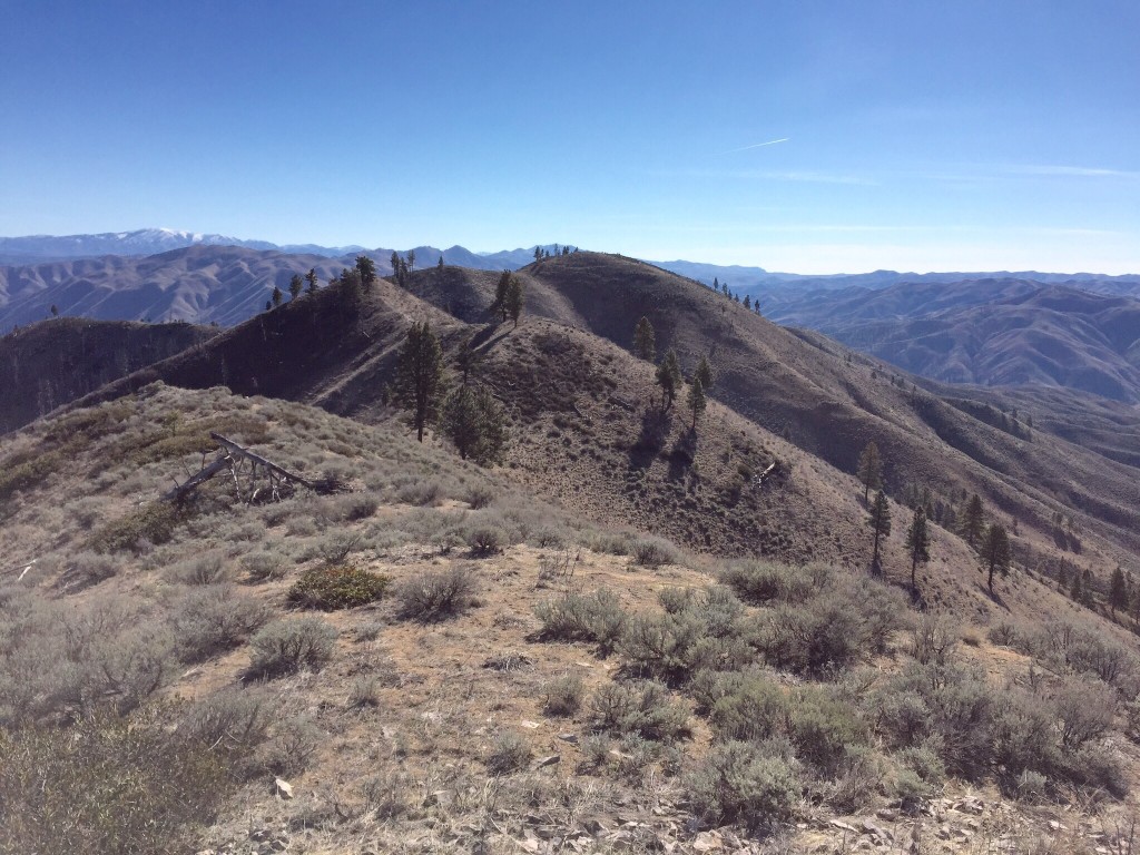
Peak 5180 as viewed from its west summit
Plan B Peak by Livingston Douglas
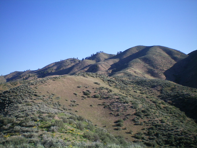
Plan B Peak as viewed from the southwest spur. Point 5137 is the small hump with scattered tall pines in dead center. The summit hump is not yet visible. Livingston Douglas Photo
Access
From Blacks Creek Pass (on Blacks Creek Road): At 3.5 miles, reach the Bender Creek trailhead (right). At 4.7 miles, reach the Deadman Creek trailhead/campsite (left). This trailhead is at 3,590 feet and 43⁰32’01”N, 115⁰50’51”W. This trailhead sits at the toe of the southwest spur of the south ridge of Plan B Peak.
Southwest Spur/South Ridge, Class 2
The Climb
This route differs from the Lopez route because it immediately leaves the Deadman Creek drainage to climb the southwest spur. From the Deadman Creek trailhead/campsite, jump across [small] Deadman Creek and scramble east up a steep, open slope of grass/scrub to reach the crest of the southwest spur. Weave through the large, gapped sagebrush on the ridge crest as it heads north then northeast, following the right/east side of the Deadman Creek drainage. There are a few ups and downs on the sometimes ill-defined ridge crest.
Higher up, the south ridge comes into view and the ridge/shoulder leading up to it becomes obvious. Contrary to the USGS topo map, there is no forest in this climb but there are a few large, scattered pines atop Point 5137. The summit of Plan B Peak measures only 15-20 feet higher than Point 5137 so the 5,180-foot summit elevation is dubious at best. In actuality, the summit is probably only 5,155 feet.
The short willows become dense from Point 5137 to the true summit and to the north summit hump. Either skirt them just below the ridge crest or bash/weave through them. There are two summit humps. The north summit hump is slightly lower so the LOJ placement of the true summit as the south summit appears to be correct.
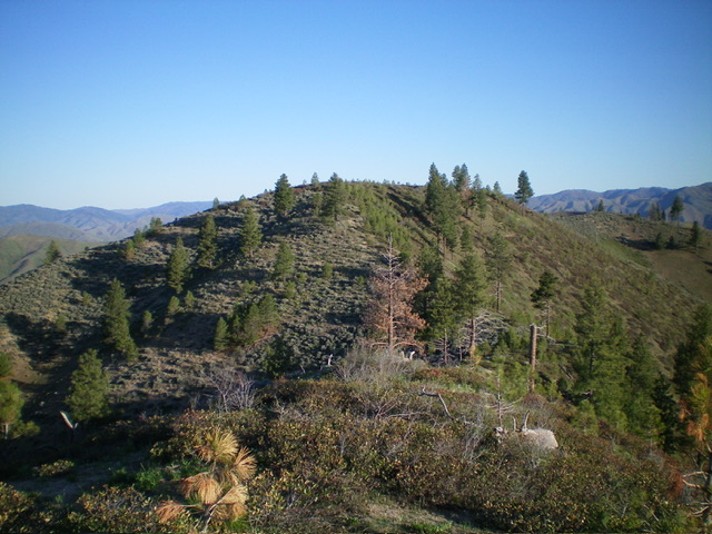
The elusive summit hump of Plan B Peak as viewed from Point 5137 to its southeast. Livingston Douglas Photo
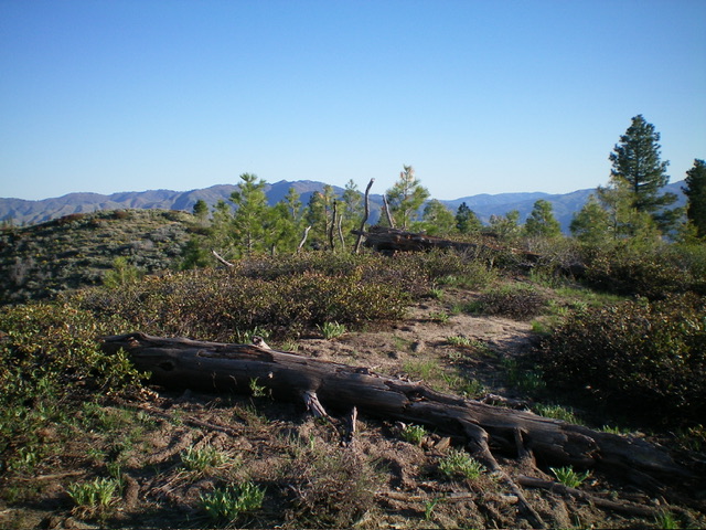
The summit of Plan B Peak with the [slightly-lower] north summit hump left of center. Livingston Douglas Photo
South Ridge/South Spur, Class 2
The Descent
From the summit, descend the south ridge then southwest spur back to a juncture at about 4,100 feet. Follow a spur ridge south-southeast then south back down to Blacks Creek Road then follow the road about ½ mile west to return to the Deadman Creek drainage and your parked vehicle. This route is a bit easier high up (as compared to the southwest spur route) but has more ups and downs and gets pretty steep as you approach Blacks Creek Road. I would stick with the Southwest Spur/South Ridge Route for both the ascent and descent for the most direct line to and from the Deadman Creek trailhead.
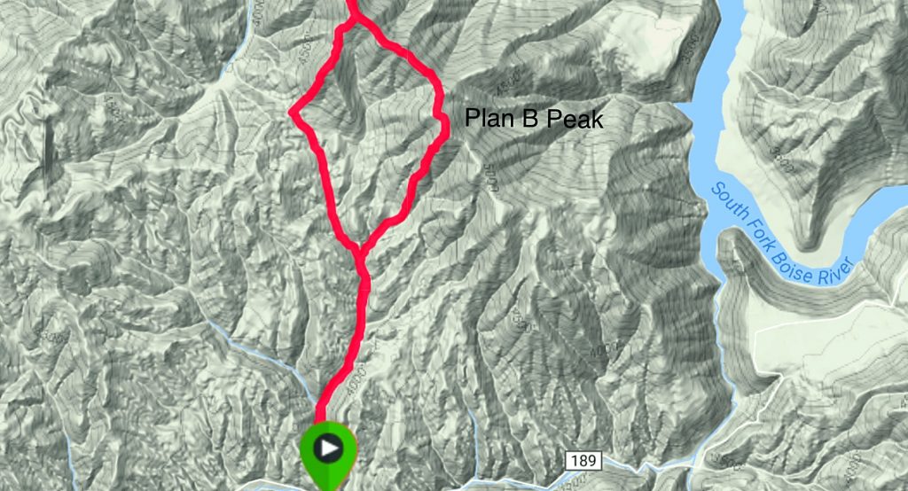
The area around Plan B Peak is open country with few trees and there are dozens of lines that will lead to the summit. I hiked to the divide southwest of the summit and then followed the ridge to the top. Our total trip was 7.5 miles with 2,100 feet of elevation gain. This included a side trip out to a viewpoint north of the peak. See the GPS track below. My GPS track.
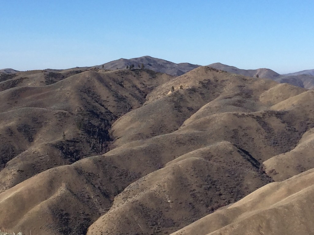
Kepros Mountain as viewed from Peak 5180. The Danskin Mountains cover a large swath of Idaho but are little known. As this view demonstrates, the range has a lot of ridges.
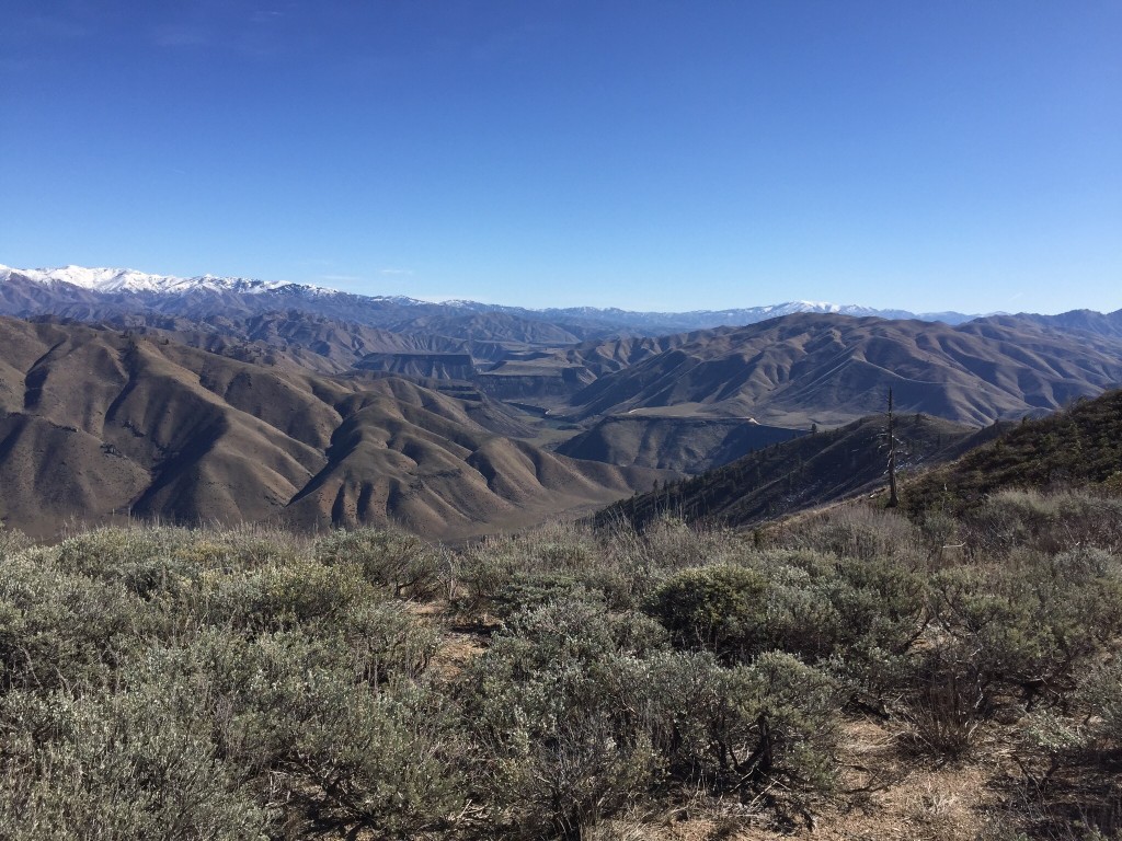
The views from the summit of Peak 5180 are big in every direction but the view into the South Fork Boise River Canyon is the most stunning.
Additional Resources
Regions: Boise Mountains->Danskin Mountains->WESTERN IDAHO
Mountain Range: Boise Mountains
Year Climbed: 2015
Longitude: -115.83609 Latitude: 43.56001