Elevation: 5,245 ft
Prominence: 380
This peak is not in the book. Published January 2023
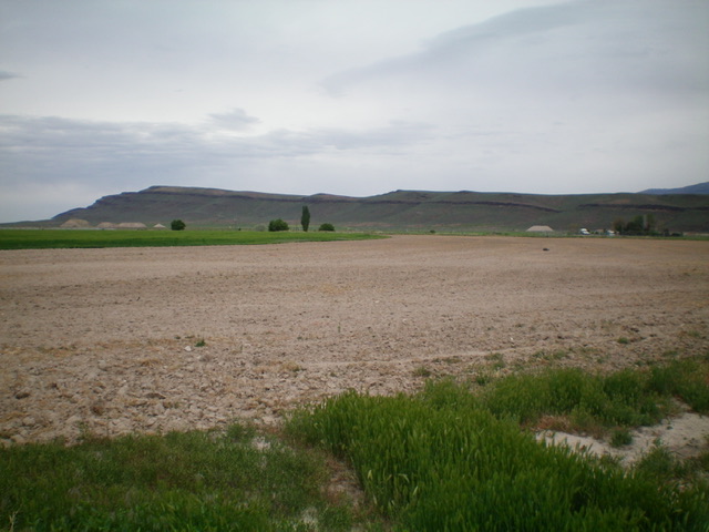
Peak 5245 is the high point on a long north-south ridge that is located northeast of Oakley, Idaho in the foothills of the Albion Mountains. This ridge looks like an elongated butte when viewed from ID-77 north of Oakley. This area is a mix of private and public land, so be careful. This hike is entirely on public land. USGS Marion SE
Peak 5245 as viewed from the southwest. It is a LONG ridge/butte. Livingston Douglas Photo
Access
From the south end of ID-77 at Main Street in Oakley, drive east on Main Street (which becomes Basin-Elba Road) for 2.6 miles to an unsigned junction with a dirt road that heads left/north along a fence row. Drive a short distance north on this dirt road to an unsigned junction and park at a fence gate (4,710 feet).This parking area is close to the base of the steep south face of Peak 5245.
South Face/South Ridge, Class 2
The Climb
From the fence gate, jump to the right/east side of the fence (to be sure to be on public land) and bushwhack north-northeast across thick sagebrush and two dry gullies (Mill Creek is often bone dry) to reach the base of the south face. Scramble up the steep face through short grass and loose gravel/talus/scree then skirt around some boulders/brush/sage to reach the top of the face/headwall. Once on the south ridge, follow the laborious, wide ridge north through gapped sagebrush (constant weaving required), field grass (which grabs at your feet and is clumpy), and underlying embedded talus.
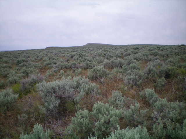
Looking up the south ridge of Peak 5245. Endless tedious sagebrush. Livingston Douglas Photo
Scramble up over two ridge humps (Point 5106 and Point 5079) to drop to two final saddles and then climb endless sagebrush to reach an old fence row. Cross the fence row and follow an old 2-track road to the summit area (just right/east of the summit hump). Leave the 2-track and bushwhack a short distance left/west to the well-cairned summit, which is not visible from the 2-track road. The summit has two cairns and a triangulation post laying on the ground nearby. This is an exhausting hike due to the tedious (and uneven) nature of the terrain, the distance, and the unending false summit humps.
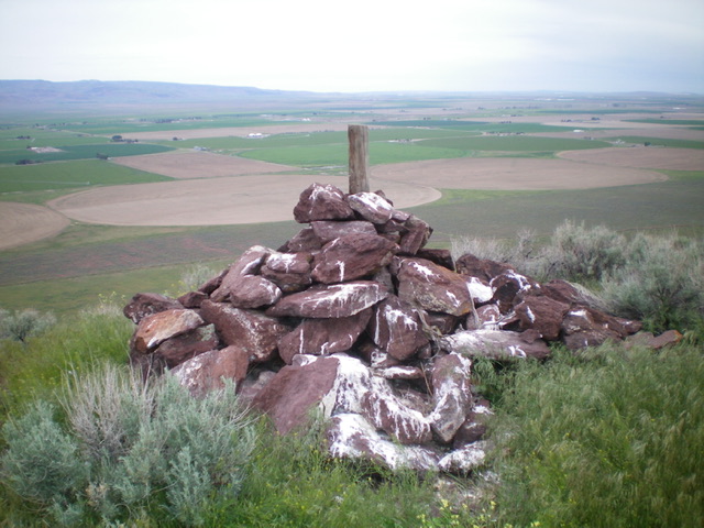
The large summit cairn atop Peak 5245, looking northwest. Livingston Douglas Photo
Additional Resources
Regions: Albion Range->SOUTHERN IDAHO
Mountain Range: Albion Range
Longitude: -113.8381 Latitude: 42.27569