Elevation: 5,268 ft
Prominence: 378

This peak is not in the book.
Peak 5268 is located in the Bennett Hills on the edge of the Snake River Plain northeast of Mountain Home, Idaho. It is a surprisingly nice, low-elevation peak which is best hiked in the early Spring or in the Fall. USGS Teapot Dome
Take US-20 north from Mountain Home. The highway crosses the flats for several miles and then makes a big left-hand bend, enters a canyon, and starts to climb. Almost immediately, you will reach a turnout on the right-hand side of the road. Pull off here and park. You are at the bottom of a small drainage at this point.
There is a fence with a gate. Go through the gate and follow a good trail upstream. The trail soon crosses a bridge. Soon after crossing the bridge, the canyon widens and easy slopes lead up on the right. Climb up this slope in a southeastern direction gaining around 200 feet of elevation and then turn due north. Hike north to the saddle between Point 4119 and Point 4671. From this saddle, hike east up the ridge, bypassing Point 4671 on its north side. You will then see the summit crown above you. It is comprised of a 30-50 foot rock wall. The easiest way to the top is to bypass the cliffs on their north side where the cliffs end. However, there is an easy route through the cliffs on the south side. Either way, this is a Class 2 route.
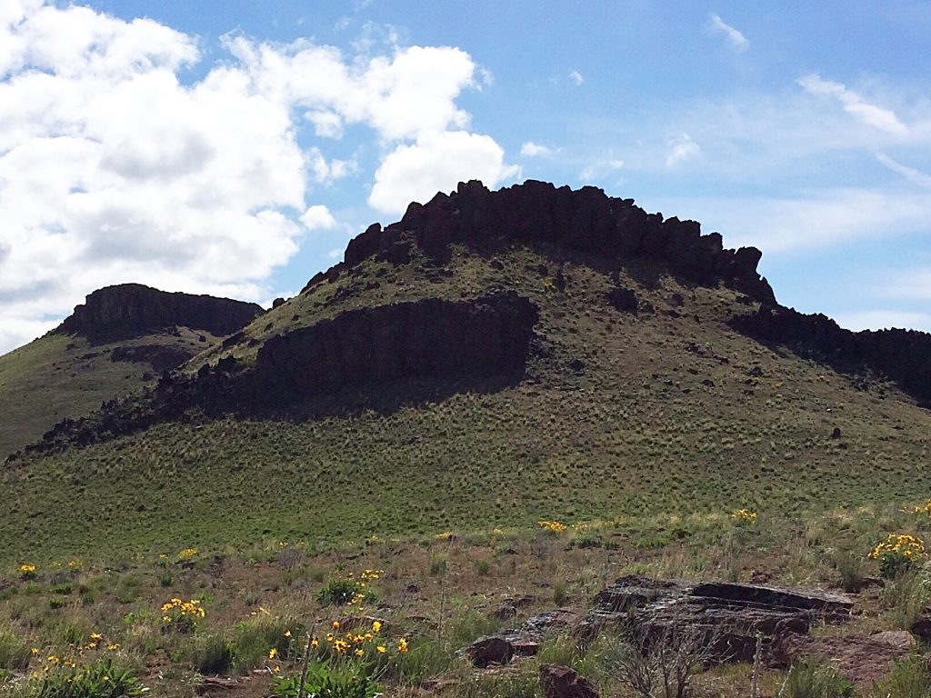
Looking up the West Ridge toward the summit.
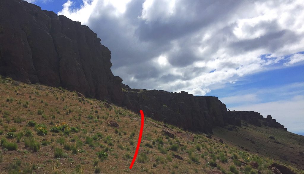
The cliff crown on the south side as viewed from the west. The red line leads to the Class 2 opening in the cliffs.
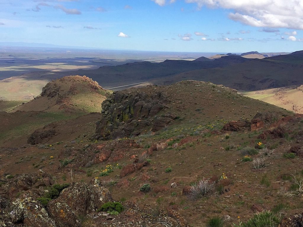
View from the summit, looking down the peak’s West Ridge and the line of ascent from the saddle.
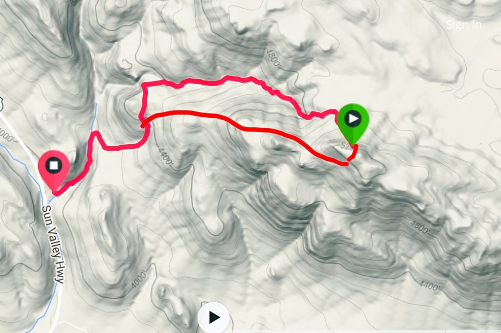
The loop route I followed with John and Tamara Fadgen.
Additional Resources
Regions: Bennett Mountain Hills->WESTERN IDAHO
Mountain Range: Bennett Mountain Hills
Year Climbed: 2016
Longitude: -115.5279 Latitude: 43.20919