Elevation: 5,362 ft
Prominence: 502
This peak is not in the book. Published November 2023
Peak 5362 is a scrub hump that is located between Burns Gulch and Little Thompson Gulch on the west side of Wagonhammer Creek. It is most easily climbed from the Wagonhammer Creek Trail. Burns Gulch is closed to the public due to a private residence at its mouth. USGS North Fork
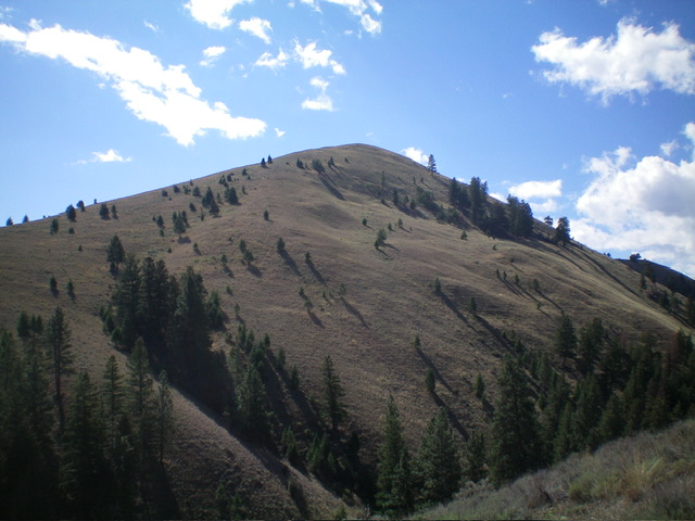
Peak 5362 (summit is left of center) as viewed from FST-130 to its north. Livingston Douglas Photo
Access
Wagonhammer Creek Road (signed) is located along US-93 just south of North Fork at virtual MM324.2. This junction is 1.9 miles south of the General Store in North Fork and is 3.3 miles north of [signed] Fourth of July Creek Road. From the junction, drive up a dirt road for 0.2 miles to the large trailhead parking area for FST-137/Wagonhammer Creek Trail. Park here (3,785 feet; 45⁰23’31”N, 113⁰57’40”W). This is the first leg of a 3-peak adventure that includes Peak 5362, Peak 5602, and Peak 5186. It covers 8.5 miles with 3,500 feet of elevation gain round trip.
Map Errors
Burns Gulch Trail/FST-211 (shown on maps) no longer exists. The Lewis and Clark Trail/FST-130 is completely misplaced on both the USGS topo map and the Salmon National Forest map in the area just west of Wagonhammer Creek. It actually heads north up Little Thompson Gulch to a ridge saddle high up. FST-130 (on the east side of Wagonhammer Creek) is not at the mouth of a narrow, forested gully (as maps indicate) though it does exist at the head of the gully. FSR-072/Wagonhammer Creek Road ends after 0.2 miles up from US-93. The USGS topo map incorrectly shows FSR-072 continuing up Wagonhammer Creek but it is now only a foot trail (FST-137).
Northeast Spur/North Ridge, Class 2
The Climb
From the trailhead, hike 1-1/4 miles east then northeast up FST-137/Wagonhammer Creek Trail to a signed junction with FST-130/Lewis and Clark Trail. Go left/north onto FST-130 and follow it for 1-1/4 miles up Little Thompson Gulch to the head of the gulch at a ridge crossing/saddle (4,860 feet). Leave the trail here and scramble south then southwest then south in short field grass on the ridge crest to reach the open summit of Peak 5362. There is an extra 85 feet of uphill along the way. The bare summit had no cairn so I built one.
East Shoulder, Class 2
The Descent
From the summit, descend east on a steep-ish shoulder of short field grass all the way down to intercept FST-130 in Little Thompson Gulch. Follow FST-130 for 0.3 miles back to its junction with FST-137. This concludes the first leg of today’s 3-peak adventure. Peak 5602 is up next.
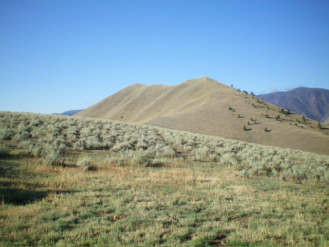
Peak 5362 as viewed from the northwest. Livingston Douglas Photo
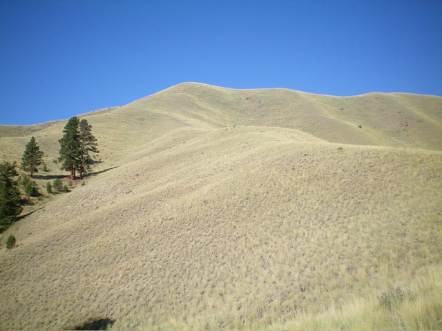
Peak 5362 (summit is left of center) as viewed from the east shoulder, my descent route. Livingston Douglas Photo
Additional Resources
Regions: Beaverhead Range->EASTERN IDAHO
Mountain Range: Beaverhead Range
Longitude: -113.9496 Latitude: 45.4048