Elevation: 5,380 ft
Prominence: 320
This peak is not in the book. Published November 2020
Peak 5380 is situated between White Valley to the west and Arbon Valley to the east. It is a relatively minor hump that sits between Hess Road and Arbon Valley Road and barely qualifies as a ranked summit. The easiest ascent route is via Arbon Valley Road and the east gully/east face. This area is a mix of BLM land and private ranch land so be careful. USGS Sheep Creek Spring
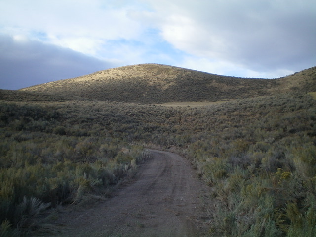
Peak 5380 (dead center) as viewed from the base of the northeast gully near Arbon Valley Road. The summit high point sits behind the hump in the photo. Livingston Douglas Photo
Access
From the [signed] junction of ID-38 and Arbon Valley Road a few miles east of Holbrook, ID, reset your odometer and drive northwest on [paved] Arbon Valley Road. At 4.7 miles, pass a gravel pit on the left/west side of the road. At 5.0 miles, reach a cattle guard/fence. Park on a spur road just south of the cattle guard (4,980 feet).
East Gully/East Face, Class 2
The Climb
From the spur road, bushwhack southwest up a dry gully through tall sagebrush. Some gaps and a few cattle trails will help you get through this section. Stay in the cattle trail in the center of the gully for the fastest going. Reach the head of the gully and a lateral cattle fence. Jump the fence and hike southwest across easy open grass/cut straw to reach a final section of steep terrain on the east face. Scramble up a final steep slope of scrub and grass to reach the summit plateau. Hike west for another two or three minutes to reach the high point of Peak 5380. There is a summit cairn on top.
This route is almost entirely on public land and can be done entirely on BLM land with a short jog south on the east face. There is no fencing, orange paint, or signage prohibiting entry or on the summit so I’m not entirely convinced that this is not ALL public land. There IS posted, fenced ranch land a short distance to the north of the cattle fence/guard along Arbon Valley Road.
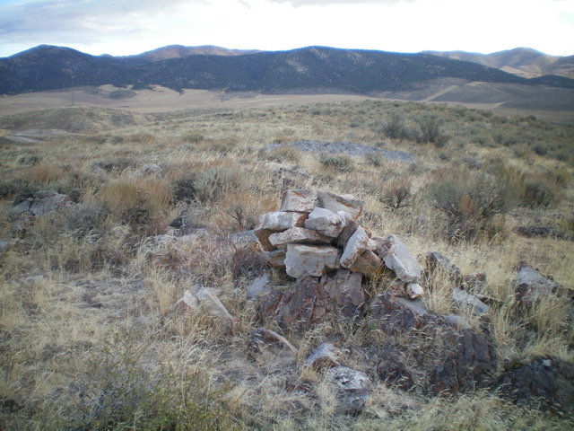
The summit area of Peak 5380. Livingston Douglas Photo
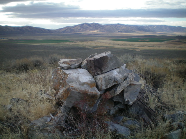
The summit cairn atop Peak 5380 with the North Hansel Mountains in the distance. Livingston Douglas Photo
Additional Resources
Regions: Deep Creek Mountains->SOUTHERN IDAHO
Mountain Range: Deep Creek Mountains
Longitude: -112.61829 Latitude: 42.22919