Elevation: 5,540 ft
Prominence: 360
This peak is not in the book. Published November 2023
Peak 5540 sits above Cummings Lake and separates the West Fork Hull Creek from the South Fork Hull Creek. It is most easily climbed from Hull Creek Road/FSR-005 to its north. This area is a mix of private and public land. This climb is entirely on National Forest land. USGS Ulysses Mountain
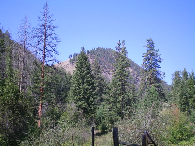
Peak 5540 (dead center) as viewed from Hull Creek Road to its east. Livingston Douglas Photo
Access
Hull Creek Road/FSR-005 is located along US-93 exactly 4.2 miles north of North Fork and 1.1 miles south of Hughes Creek Road. It is signed with a small sign for FSR-005 that can be difficult to see. There is a road sign for “Historical Monument” which is located immediately across the highway from this road junction. Drive 1.3 miles west up Hull Creek Road to a roadside pullout that is about 0.1 miles west of the toe of the east ridge of Peak 5540 and a major side drainage to the left/south. This pullout is at 4,315 feet and 45⁰28’19”N, 114⁰01’10”W. The aforementioned side drainage and toe of the ridge are a longer and much thicker bushwhack than my route.
East Ridge, Class 3
The Climb
From the roadside pullout, bushwhack briefly down into the Hull Creek drainage and cross it about 50 feet upstream from the pullout where the creek is underground. Once across the creek drainage, pick up a good (initially) game trail coming up from the drainage. This trail heads diagonally left/southeast up toward the crest of the east ridge. Higher up, the game trail ends. Bushwhack straight up the steep grass and scrub slope to reach the ridge crest. This is a short bushwhack but it certainly is not sweet.
Once on the crest of the east ridge, the going is much easier. Scramble west up the grassy, open ridge. It is rather steep so this is a slow grind. Higher up, some ridge rock emerges. Very high up, the ridge becomes a narrow, steep mix of ridge rock, boulders, and brush. It is tedious. The summit is a collection of large boulders with nearby pines and is semi-open. It is hard to say which boulder is highest so stand on all of them. There is another large boulder to the west but it is five feet lower.
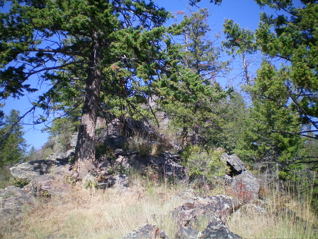
The rocky, upper section of the east ridge of Peak 5540. It is a tedious scramble/bushwhack. Livingston Douglas Photo
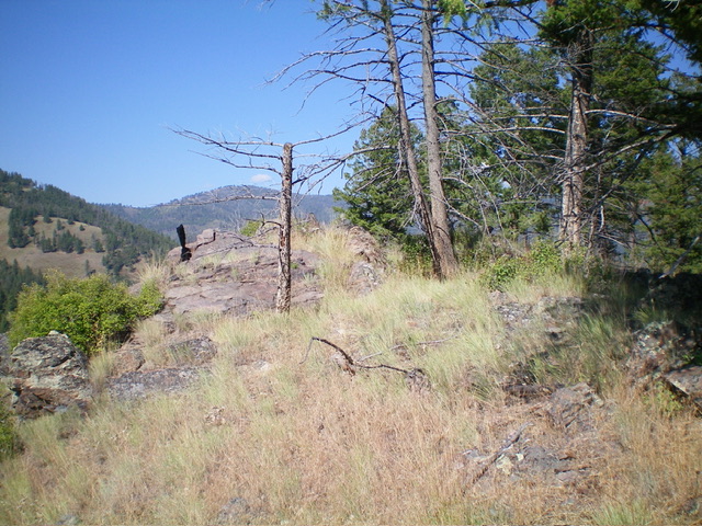
The rock-and-brush summit of Peak 5540. Livingston Douglas Photo
Additional Resources
Regions: Bitterroot Mountains->NORTHERN IDAHO
Mountain Range: Bitterroot Mountains
Longitude: -114.0309 Latitude: 45.4714