Elevation: 5,565 ft
Prominence: 345
This peak is not in the book. Published November 2023
Peak 5565 is a scrub hump that is located on a ridgeline that separates Kriley Creek from Tower Creek. Due to posted, private land, this peak cannot be climbed from Tower Creek Road. This area is a mix of private and public land, so be careful. This climb is entirely on BLM land. USGS Bird Creek
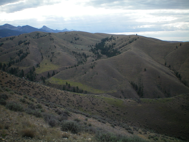
Peak 5565 and its west ridge (right of center) as viewed from the north. Livingston Douglas Photo
Access
Kriley Gulch Road/BLM-100 is located along US-93 north of Salmon at MM319. This signed junction is 2.0 miles south of Fourth of July Creek Road. Drive 0.9 miles northeast up Kriley Gulch Road to a grassy pullout area where there is a BLM/FS information board. This is where BLM land begins. Park in the grassy pullout area (4,170 feet; 45⁰21’40”N, 113⁰54’42”W).
West Ridge, Class 2+
The Climb
From the parking pullout, cross to the east side of Kriley Gulch Road and drop 10 feet to cross [dry] Kriley Creek. Scramble up a STEEP, grassy slope on the left/north side of a side gully to gain the open ridge crest just above a prominent rocky outcrop. Follow the open, grassy ridge crest east as it meanders its way toward Peak 5565. Upon reaching the base of the west face/shoulder of the summit hump (be sure to identify the correct hump), leave the ridge to drop 15 feet to cross a dry gully.
Scramble northeast then east in open grass/scrub to reach the gentle summit. The summit had no cairn so I built a small one with the few loose rocks that I could find. There is an old 2-track road (not shown on maps) that is on the ridge crest for a portion of the climb.
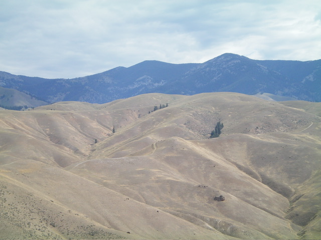
Peak 5565 (in mid-ground) as viewed from Comet Benchmark to its southwest. Livingston Douglas Photo
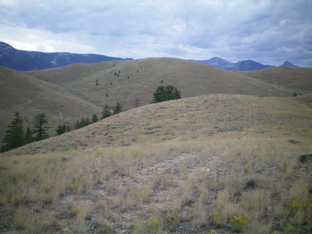
Peak 5565 (dead center) as viewed from high on the west ridge, my ascent route. Livingston Douglas Photo
Additional Resources
Regions: Beaverhead Range->EASTERN IDAHO
Mountain Range: Beaverhead Range
Longitude: -113.8835 Latitude: 45.3555