Elevation: 5,587 ft
Prominence: 447
This peak is not in the book. Livingston Douglas added updates on access, map errors, a new descent route, and new photos. Updated October 2025
Peak 5587 sits southeast of Grape Mountain and due south of Peak 5424. These 3 peaks surround the Trail Creek drainage. The peak was burned over at some point in the past. The forest is not recovering well but the brush is healthy. The summit has an outstanding view of the South Fork Boise River’s spectacular gorge. The peak is an easy ascent from the road that leads to Grape Mountain. USGS Long Gulch

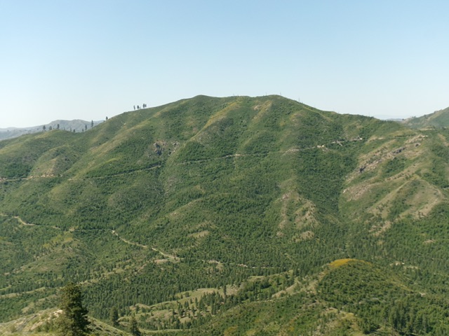
Peak 5587 as viewed from Peak 5424
Access
Access the peak by taking the Middle Fork Boise River Road to the Slide Gulch Road [(C)(1) on Page 154]. To climb the peak from Trail Creek, continue driving south on FS-113 over a pass and down into the Trail Creek drainage. Turn right onto Trail Creek Road/FS-221 and follow it west. Take a left-hand turn at the only major junction and park after the road crosses Trail Creek. The road continues and soon reaches a gate, closing the route to motorized vehicles.
Livingston Douglas adds “Grape Mountain Road is mostly unmapped and confusing. I add these key points to the comments by Lopez. Go right (stay on the main road) at an unsigned junction with a weak, 2-track connecting road about a mile up from the gated road closure and at about 4,620 feet. Stay on the weaving road after it crests then turns left/south and drops 100 vertical feet and weaves its way back toward Grape Mountain. Go right at an unsigned road junction where the communication tower-clad summit hump is now in view (to the right).”
Map Errors by Livingston Douglas
The USGS topo map has numerous errors with respect to the mountain roads (and their positions) in this area that still exist or no longer exist. Don’t rely on it. The Grape Mountain Road is mis-positioned and is missing its final section to the top of Grape Mountain.
The Climb via the Road and Northwest Ridge, Class 2
The peak can be climbed from any direction, but the brushy slopes will make the going difficult on most lines. I recommend following the gated road to peak’s Northwest Ridge and then ascending the ridge, which is mostly brush-free, to the summit. Follow the road which climbs up the mountain in one giant switchback. There is a junction where the road switches back. Keep to the right. We turned off the road at the point where it turned due south toward the Peak 5587/Grape Mountain saddle. From this point, we followed an old fence line to the Northwest Ridge proper and then climbed the ridge. My GPS recorded 3.1 miles and 1,381 feet of elevation gain one way.
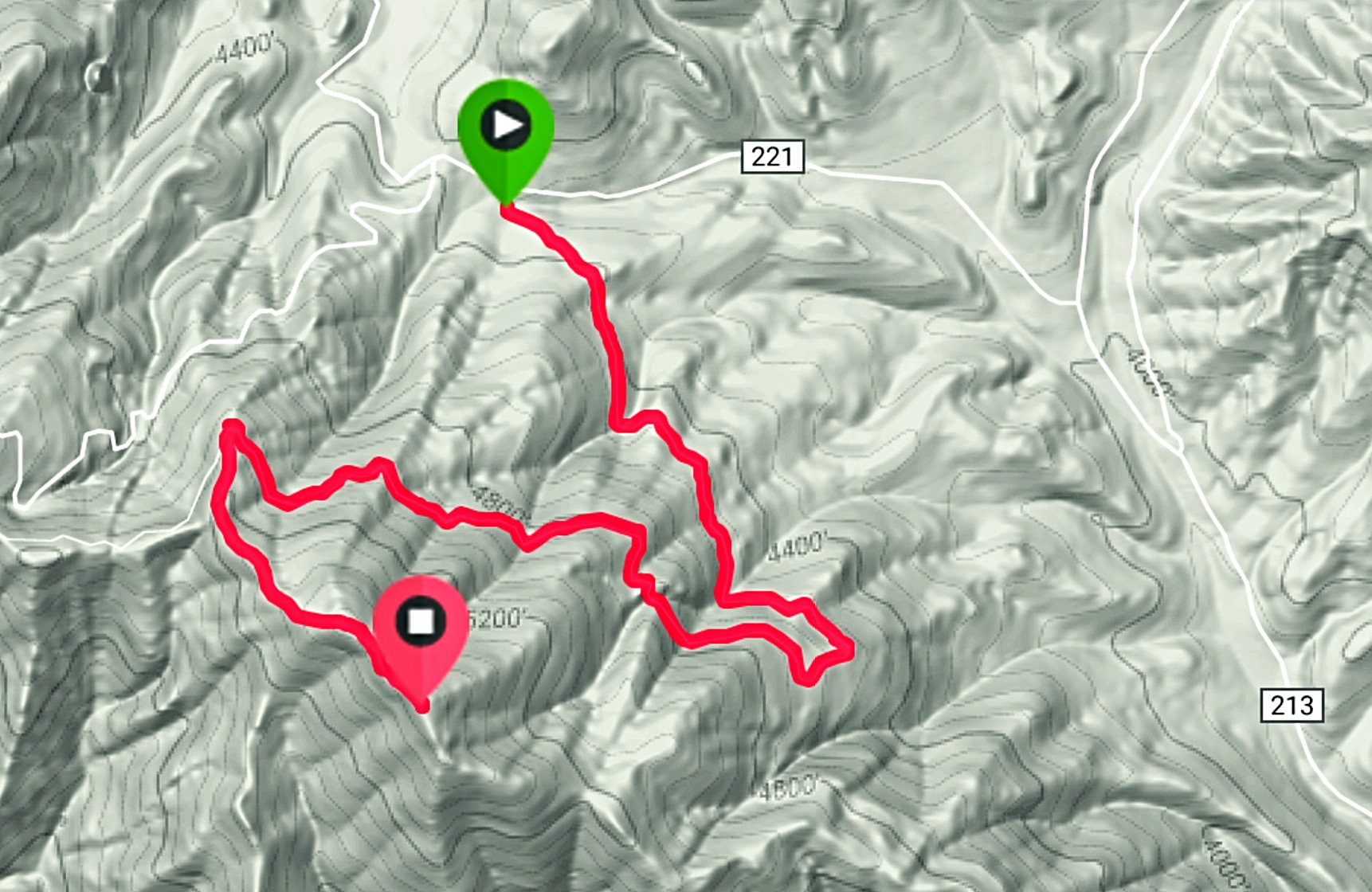
My GPS track.
Northeast Ridge, Class 2 by Livingston Douglas
The Descent
The summit of Peak 5587 has a quartzite rock cairn on top, surrounded by willows and veg. From the cairned summit, descend northeast on a ridge of thick-ish veg and other sagebrush/brush. This bushwhack is a bit tedious but is not too bad. Look for gaps and lanes and work around some downed timber in the brush. A final steep-ish descent in loose grave/dirt and leafy veg puts you back on Grape Mountain Road. Follow the road right/southeast briefly to reach a sharp left/northwest bend in the road. Continue northwest down the road for about a mile to return to the gated road closure.
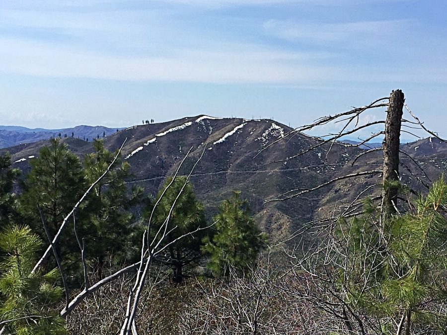
Peak 5587 as viewed from Peak 5424 to its north. Livingston Douglas Photo
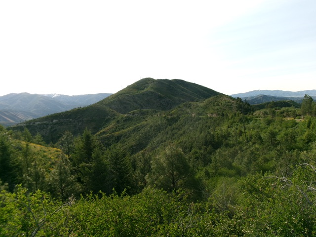
Peak 5587 as viewed from the northwest. Livingston Douglas Photo
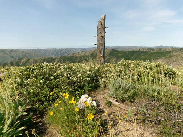
The veg-covered summit of Peak 5587. Livingston Douglas Photo
Additional Resources
Regions: Boise Mountains->WESTERN IDAHO
Mountain Range: Boise Mountains
Year Climbed: 2017
Longitude: -115.74149 Latitude: 43.5996