Elevation: 5,641 ft
Prominence: 621
This peak is not in the book. Published November 2023
Peak 5641 sits on a ridgeline that separates Burns Gulch from Big Silverlead Creek. Since both the Burns Gulch Trail and the Big Silverlead Creek Trail are blocked by private land along US-93, the only public access to Peak 5641 is from the Wagonhammer Creek Trailhead. This climb is entirely on National Forest land. USGS North Fork
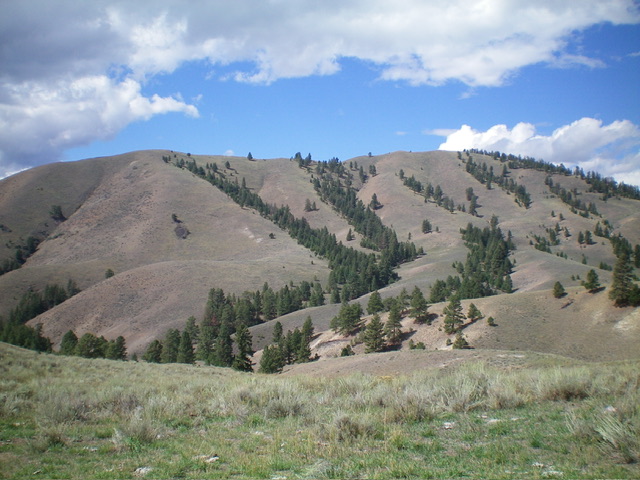
Peak 5641 as viewed from the east. The summit is right of center. Livingston Douglas Photo
Access
Wagonhammer Creek Road (signed) is located along US-93 just south of North Fork at virtual MM324.2. This junction is 1.9 miles south of the General Store in North Fork and is 3.3 miles north of [signed] Fourth of July Creek Road. From the junction, drive up a dirt road for 0.2 miles to the large trailhead parking area for FST-137/Wagonhammer Creek Trail. Park here (3,785 feet; 45⁰23’31”N, 113⁰57’40”W).
Map Errors
Burns Gulch Trail/FST-211 (shown on maps) no longer exists. The Lewis and Clark Trail/FST-130 is completely misplaced on both the USGS topo map and the Salmon National Forest map in the area just west of Wagonhammer Creek. It actually heads north up Little Thompson Gulch to a ridge saddle high up. FST-130 (on the east side of Wagonhammer Creek) is not at the mouth of a narrow, forested gully (as maps indicate) though it does exist at the head of the gully. FSR-072/Wagonhammer Creek Road ends after 0.2 miles up from US-93. The USGS topo map incorrectly shows FSR-072 continuing up Wagonhammer Creek but it is now only a foot trail (FST-137).
East Spur/South Ridge, Class 2
The Climb
From the trailhead, hike 1-1/4 miles east then northeast up FST-137/Wagonhammer Creek Trail to a signed junction with FST-130/Lewis and Clark Trail. Go left/north onto FST-130 and follow it for 1-1/4 miles up Little Thompson Gulch to the head of the gulch at a ridge crossing/saddle (4,860 feet). Leave the trail here and bushwhack west then southwest down a shoulder to reach a crossing of Burns Gulch at 4,600 feet. This shoulder is easy scrub/grass and leads to a cattle cistern (to the left) and a good cattle trail that leads down to Burns Gulch at a fork in the gulch.
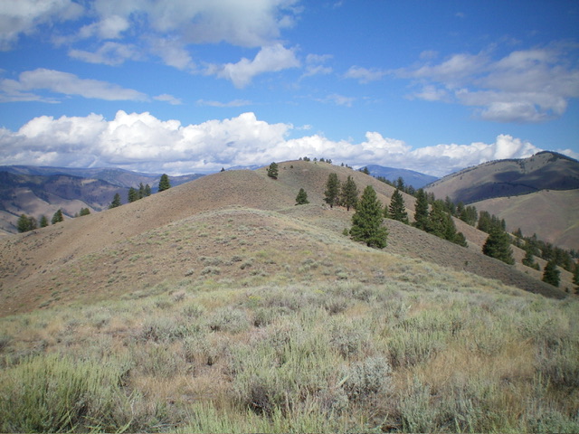
Looking up the south ridge of Peak 5641. The summit hump is in dead center. Livingston Douglas Photo
Cross to the west side of Burns Gulch then scramble west up onto a spur ridge of easy grass. Follow this ridge northwest then southwest as it weaves its way up to the south ridge of Peak 5641. Scramble north-northwest up the ridge to reach the summit hump. Cross over a few minor ridge humps in open grass on the way. The summit of Peak 5641 has a few pieces of rebar protruding from the ground and a broken-off steel pipe on the high point. I built a summit cairn and stuck the steel pipe in it.
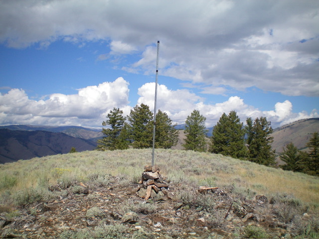
The summit of Peak 5641. Livingston Douglas Photo
East Shoulder, Class 2
The Descent
From the summit, descend east down a beautiful shoulder of short grass all the way to the fork in Burns Gulch at 4,600 feet. Retrace the ascent route from here back to the Wagonhammer Creek Trailhead.
Additional Resources
Regions: Beaverhead Range->EASTERN IDAHO
Mountain Range: Beaverhead Range
Longitude: -113.9651 Latitude: 45.4167