Elevation: 5,653 ft
Prominence: 313
This peak is not in the book. Published November 2023
Peak 5653 is a ridge hump on the long southwest ridge of Ulysses Mountain (7,649 feet). It towers over the nearby Salmon River. Peak 5653 is most easily climbed via its southwest ridge from the Salmon River Road. USGS Ulysses
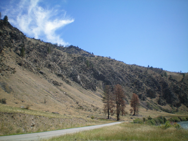
Peak 5653 (summit is indistinct and is left of center) and its long, steep southwest ridge (skyline in center) as viewed from the Salmon River Road to its west. Livingston Douglas Photo
Access
From US-93 at North Fork, drive west on FSR-030/Salmon River Road. At 9.5 miles, there is a small roadside pullout on the west side of the road. This pullout is 0.5 miles southeast of the Indianola Guard Station. Park here (3,495 feet; 45⁰23’48”N, 114⁰09’34”W).
Southwest Ridge, Class 3
The Climb
The roadside pullout is located at the base of a small gully that is just north of the toe of the southwest ridge. Cross the Salmon River Road and scramble northeast up STEEP field grass/gravel and scattered trees/deadfall (Class 2+) just right/east of the gully to reach the crest of the ridge. Use a game trail to assist you. Once on the narrow ridge crest, follow it east in steep grass and annoying ridge pines/deadfall to reach a critical ridge juncture with the south spur at about 4,200 feet. Remember to go hard right/west here on the descent.
Head left/northeast up the steep ridge as it wiggles a bit but generally heads in a northeasterly direction directly at the summit hump. The ridge terrain is a mix of grass/scrub and rocky outcrops. Skirt the rocky outcrops and grind your way up the persistently steep ridge crest. High up, reach the crux of this climb—a massive ridge buttress that blocks the way. Skirt its left/northwest side on angled grass/face rock/scree then return to the ridge crest at the top end of the buttress. This go-around is Class 3 work.
Descend 20 vertical feet from the top of the buttress to a sandy gray/black saddle. From the saddle, scramble up the ridge for the final push to the elusive summit. This final ridge section is a mix of scrub, ground boulders, easy ridge rock, and some deadfall. The summit hump is grassy and has a few large boulders on top. There is no summit cairn. There is a decent game trail on much of the southwest ridge to expedite the descent back down to the Salmon River Road.
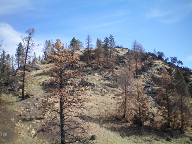
The summit hump of Peak 5653 as viewed from high on the southwest ridge. Livingston Douglas Photo
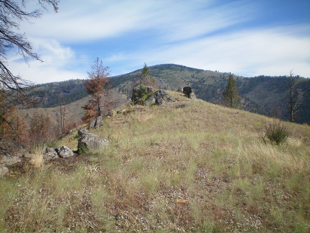
The summit of Peak 5653 with its scattered boulders. Livingston Douglas Photo
Additional Resources
Regions: Bitterroot Mountains->NORTHERN IDAHO
Mountain Range: Bitterroot Mountains
Longitude: -114.1428 Latitude: 45.4042