Elevation: 5,661 ft
Prominence: 281
This peak is not in the book. Published November 2022
Peak 5661 is an overlooked summit that towers over US-20 due west of Cat Creek Summit. This area is a mix of private and public land, so be careful. This climb is entirely on BLM land. The north side of the peak offers the only public access. The north ridge is a magnificent scramble. USGS Cat Creek Summit
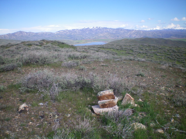
The summit of Peak 5661 with Anderson Reservoir in the distance. Livingston Douglas Photo
Access
This climb begins at the junction of US-20 and Castle Rock Road. Park about 0.1 miles east up Castle Rock Road at a pullout (4,985 feet). There is no safe place to park at the junction with US-20.
North Ridge, Class 2
The Climb
From the junction of US-20 and Castle Rock Road, cross to the southwest side of US-20 and drop 15 feet to a roadside meadow. Aim dead south at an obvious hump on the north ridge. Cross a stiff, high cattle fence (impossible to go under due to sheep mesh) then bash up through sagebrush to reach the first ridge hump. Drop slightly off that first hump (10 feet) then continue south-southwest over another ridge hump and some face sections of sagebrush to reach a false summit. Continue south up the ridge to reach the true summit. The summit is well hidden and sits back/south from the false summit. I rebuilt the torn-down summit cairn. The summit offers a nice view of Anderson Reservoir in the distance.
Additional Resources
Regions: Bennett Mountain Hills->WESTERN IDAHO
Mountain Range: Bennett Mountain Hills
Longitude: -115.34319 Latitude: 43.30849