Elevation: 5,687 ft
Prominence: 295
This peak is not in the book. Published October 2025
Peak 5687 sits above Wilson Flat on the west side of Anderson Ranch Reservoir. It separates Little Wilson Creek from Elk Creek. This area is entirely public land, mostly National Forest land. USGS House Mountain
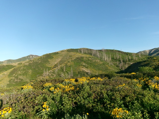
Peak 5687 (in center) as viewed from the east. Livingston Douglas Photo
Access
Same as for Peak 6005. From the north end of Anderson Ranch Dam, drive northeast on Fall Creek Road for 1.9 miles to a sharp bend and the [unsigned] Wilson Creek trailhead (FST-606). Park on the short spur road at the trailhead [4,277 feet; 43°22’51.7”N, 115°26’12.9”W]. This is the first leg of a 2-peak adventure that includes Peak 5687 and Granite Mountain (6,818 feet). It covers 10.0 miles with 3,350 feet of elevation gain round trip.
Map Updates
The “jeep trail” on the USGS topo map is now a poorly-maintained foot trail (FST-606). It doesn’t seem to join FST-609 at a sharp bend as the USGS topo map shows. FST-609/611/612 does exist as a single footpath that deteriorates as you go farther west. This trail is unsigned and is not maintained. It ends in a side drainage (the east gully of Granite Mountain) at about 5,515 feet, at the toe of a shoulder.
East Ridge, Class 2
The Climb
From the trailhead, hike north-northwest up the old road/trail as it follows the left/west side of Wilson Creek. At the first creek ford (jump on rocks to get across), either continue another 3-4 minutes upstream on the trail to a sharp left bend where the old road gets much steeper, rockier, and rougher (there is a second creek ford before the bend) OR find a decent climber’s trail at the first creek ford and follow it steeply, diagonally left/southwest up onto the plateau (a short cut) as I did on the ascent—where it rejoins FST-606.
Follow FST-606 south then west to a signed junction with FST-607, which is a much weaker foot trail heading right/north at a crossing of Little Wilson Creek. Stay on FST-606 and head west across Little Wilson Creek (yes, it is little) then south to the crossing of a minor ridge. This is the east ridge of Peak 5687. Bushwhack right/northeast up through thick-ish brush/scrub and quickly reach easier ridge terrain a bit higher up and to the right. Now the ridge is better defined and has easier, open scrub on its left/south side.
The ridge heads west then northwest. The summit ridge now comes into view. Leave the ridge and descend almost 100 feet to cross a gully in semi-open, easy gravel/veg to reach an easy scrub/gravel ridge heading left/west to a juncture with the high south ridge. Once on the south ridge, scramble right/north for a short distance in short scrub to reach the highest hump. There was no summit cairn so I built one.
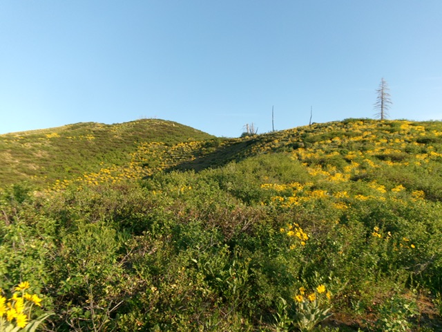
Peak 5687 as viewed from the southwest. The summit is left of center. The skyline right of center is the south ridge (my descent route). Livingston Douglas Photo
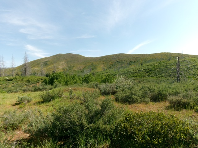
Looking up the veg-covered east ridge of Peak 5687 early on. This was my ascent route. Livingston Douglas Photo
South Ridge/West Face, Class 2
The Descent
From the summit, descend the south ridge briefly then leave it to head right/southwest down an easy veg shoulder to intercept the visible old road/trail below (this is FST-606). Walk briefly south on FST-606 and look for an easy, short drop to cross middling Elk Creek. I found a game trail through the brush. The crossing of Elk Creek is the low point between Peak 5687 and Granite Mountain. It concludes the first leg of today’s 2-peak journey. Granite Mountain is up next.
Additional Resources
Regions: Boise Mountains->WESTERN IDAHO
Mountain Range: Boise Mountains
Longitude: -115.46207 Latitude: 43.38198