Elevation: 5,709 ft
Prominence: 289
This peak is not in the book. Published November 2023
Peak 5709 is an elongated scrub hump that sits on the east side of the Little Lost River Highway just over 10 miles northwest of Howe. This seemingly unimportant, soft-ranked peak must have some relevance to surveyors since it has triangulation wreckage on its summit. My route is probably the shortest way to reach the summit. USGS Howe NE
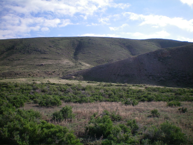
Peak 5709 (right of center) and its northwest ridge (the skyline) as viewed from the south. The summit is on the ridgeline at far right. Livingston Douglas Photo
Access
From ID-33 in Howe, drive 10.8 miles northwest on the [unsigned but paved] Little Lost River Highway to a large pullout on the right/east side of the highway. This is an old gravel pit area (shown on the USGS topo map). It is all BLM land. This pullout is at 5,175 feet and 43⁰55’12”N, 113⁰07’05”W.
Southwest Face/Northwest Ridge, Class 2
The Climb
From the pullout area, scramble north then northeast to skirt a narrow, low-elevation ridgeline hump and a gully on its east side. This north-south gully sits between the low-elevation hump and Peak 5709. Scramble directly northeast up an easy shoulder of grass/scrub with a solid base of talus/scree/gravel. Once on the ridge crest, head right/southeast over a minor ridge hump to reach a final, more consequential, ridge hump.
Drop 30 vertical feet southeast from this hump to a minor saddle then push to the summit hump. The summit of Peak 5709 has a cairn and triangulation posts/wiring. I stuck a nice post into the cairn to make the summit stand out. As an alternate route, you can follow an ATV trail (not shown on maps) on the east side of the aforementioned north-south gully to reach the northwest ridge much closer to the summit than my chosen route. Just be careful to avoid the thick brush in that gully in so doing.
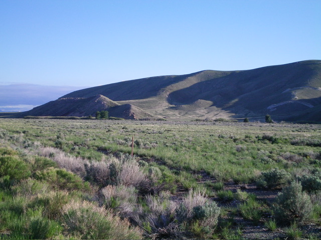
The southwest face of Peak 5709 (dead center in distance) as viewed from the gravel pit area (start of climb). Livingston Douglas Photo
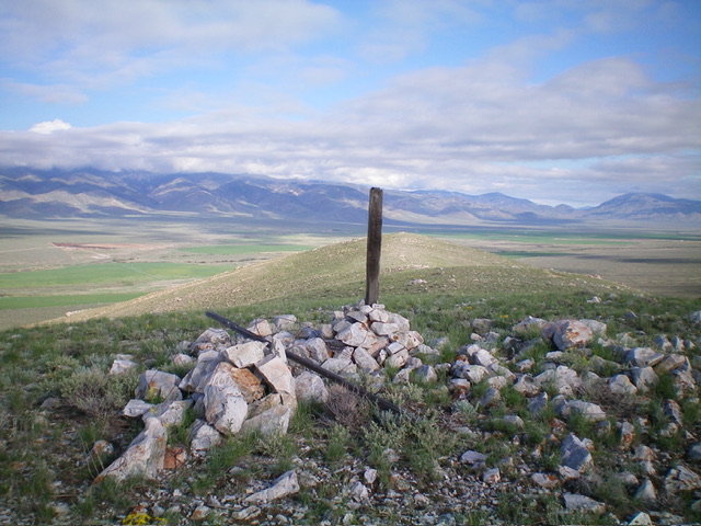
The summit of Peak 5709. Livingston Douglas Photo
Additional Resources
Regions: EASTERN IDAHO->Lemhi Range
Mountain Range: Lemhi Range
Longitude: -113.1070 Latitude: 43.9218