Elevation: 5,727 ft
Prominence: 337
This peak is not in the book. Published November 2021
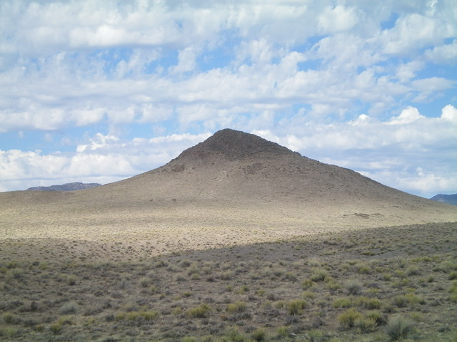
Peak 5727 is the highest hump of several humps that are located on the west side of Warm Spring Creek. It is the lowest ranked summit in Custer County and rarely has snow covering it. There is a lot of private ranch land in this area, so be careful to consult a land management map and follow the route described. USGS Bradbury Flat
Double-humped Peak 5727 as viewed from the north. The right/southwest summit is the high point by ten feet. Livingston Douglas Photo
Access
This is the first leg of a 2-peak adventure that includes Peak 5727 and Peak 5788. It covers 6.0 miles with 1,525 feet of elevation gain round trip. From the junction of US-93 and ID-75 two miles south of Challis, drive southeast on US-93 for 3.6 miles to an unsigned junction with Warm Spring Road. Drive a short distance south on Warm Spring Road to just past a cattle guard crossing. Park in a pullout near the cattle guard crossing (5,250 feet). There is a lot of private land in this area and this is the only public access to Peak 5727. This hike is entirely on BLM land.
East Face, Class 2
The Climb
From the parking pullout, walk south for about 0.3 miles to a wide gully on the right/west side of the road. Leave the road here and bushwhack southwest then west up the dry gully. Follow cattle trails through tall sagebrush initially. Leave the gully and scramble southwest at the east face of Peak 5727. Scramble up the steep talus and brush up the face and angle right-ish onto the summit ridge. Climb up over the [lower] northeast summit hump and drop slightly southwest to reach the [higher] southwest summit. The terrain on the summit ridge is a combination of brush and boulders/talus.
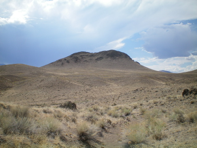
Peak 5727 as viewed from the east. The summit hump is hidden behind the northeast summit hump that is in view. Livingston Douglas Photo
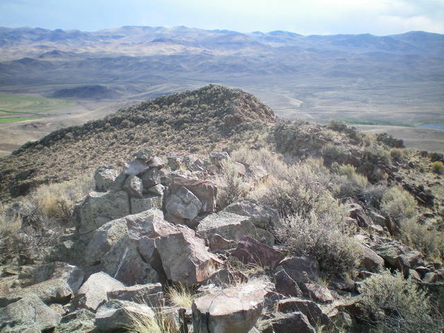
The summit cairn atop Peak 5727 with the [lower] northeast summit in the background. Livingston Douglas Photo
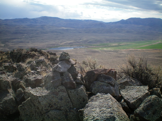
The summit of Peak 5727, looking east toward a small lake along US-93 at Warm Spring. Livingston Douglas Photo
South Face, Class 2
The Descent
From the summit, descend south down a narrow gully in sagebrush and some loose scree. Do not attempt to descend the west face as it is very steep, almost sheer. Once at the base of the gully, angle right-ish/northwest and bushwhack through sagebrush to reach a 5,380-foot saddle at the base of the southeast face of Point 5731. This is the low point in the traverse from Peak 5727 to Peak 5788 and concludes the first leg of today’s 2-peak journey. Peak 5788 is up next.
Additional Resources
Regions: Boulder Mountains->EASTERN IDAHO
Mountain Range: Boulder Mountains
Longitude: -114.15809 Latitude: 44.44059