Elevation: 5,820 ft
Prominence: 370
This peak is not in the book. Published November 2020
Peak 5820 is a forested hump with a cliffed summit block. It is located on the east side of North Canyon and most easily climbed from a road junction at the base of its west face. Peak 5820 is readily visible from a good distance thanks to the open sagebrush terrain in the surrounding area. This peak, however, is well forested with scattered junipers. USGS Holbrook
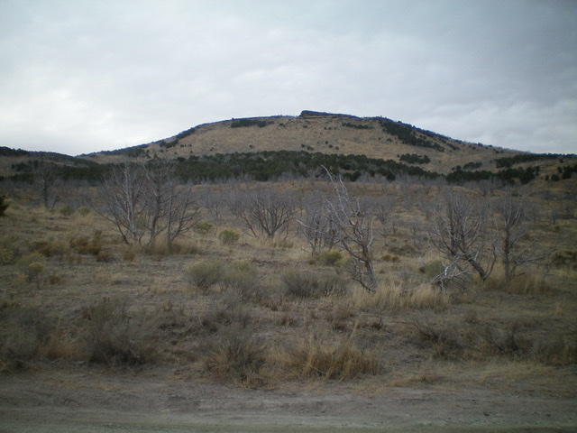
Peak 5820 and its west face/shoulder as viewed from the road junction along North Canyon Road. Notice the rocky summit block. Livingston Douglas Photo
Access
From the [signed] junction of Meadow Brook Road/BLM-027 at ID-37, drive 4.4 miles southwest then west to a [signed] junction with North Canyon Road/BLM-064. Please note that North Canyon Road is signed as “1000 South.” Turn left/south onto North Canyon Road and drive 2.7 miles south to a [signed] road junction with BLM-634. Park at this junction (5,035 feet).
West Shoulder/West Face, Class 3
The Climb
From the road junction, scramble east up a rounded shoulder of field grass and sagebrush to reach a patch of junipers. Continue upward through the junipers to reach a scrub slope. After that, the terrain is a mix of scattered junipers and scrub up a steeper face section to reach a minor headwall (Class 3). Climb over it to reach the base of the summit block. Go right/south to find a chute/notch to climb up onto the summit plateau (Class 3). Once atop the summit plateau, scramble left/north along a choppy combination of talus/boulders, dead junipers, and scrub to reach the summit of Peak 5820 at the north end of the tilted summit plateau.
There was no summit cairn so I built one. When you descend, look for a steep chute (Class 3+) to downclimb that is about 30-40 yards south of the summit high point. This will save some time in traversing the rocky, choppy summit plateau to the slightly-easier Class 3 chute farther south. This descent route is a bit shorter than the ascent route described. Follow the west face down to the west shoulder and back to the road junction.
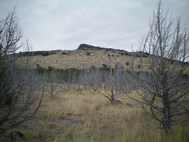
Looking at the summit block from midway up the west face. Livingston Douglas Photo
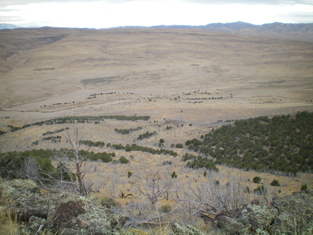
Looking down the west face of Peak 5820 from the summit. Livingston Douglas Photo
Additional Resources
Regions: SOUTHERN IDAHO->Sublett Range
Mountain Range: Sublett Range
Longitude: -112.74319 Latitude: 42.13589