Elevation: 5,869 ft
Prominence: 339
This peak is not in the book. Published May 2021
Phlox Hill is located west-northwest of South Mountain along the Idaho/Oregon border. The name reflects the extensive display of phlox which decorates the peak’s slopes. Although a short hike, like many peaks in this area, the view from the summit is delightful. USGS Parsnip Peak
Access
Take Yturri Boulevard east out of Jordan Valley, Oregon. This road quickly changes names, first to Trout Creek Road and then to Pleasant Valley Road. Follow the road south for 17.0 miles to an unsigned junction. These roads are part of the BLM’s Owyhee Uplands Backcountry Byway. Turn east and follow this 4WD road for roughly a mile to a saddle southeast of Point 5316. The road crosses through a range fence located approximately on the Idaho/Oregon border. The road does continue from this saddle by dropping down into the Lone Tree Creek drainage if you prefer to start your climb southeast of the summit.
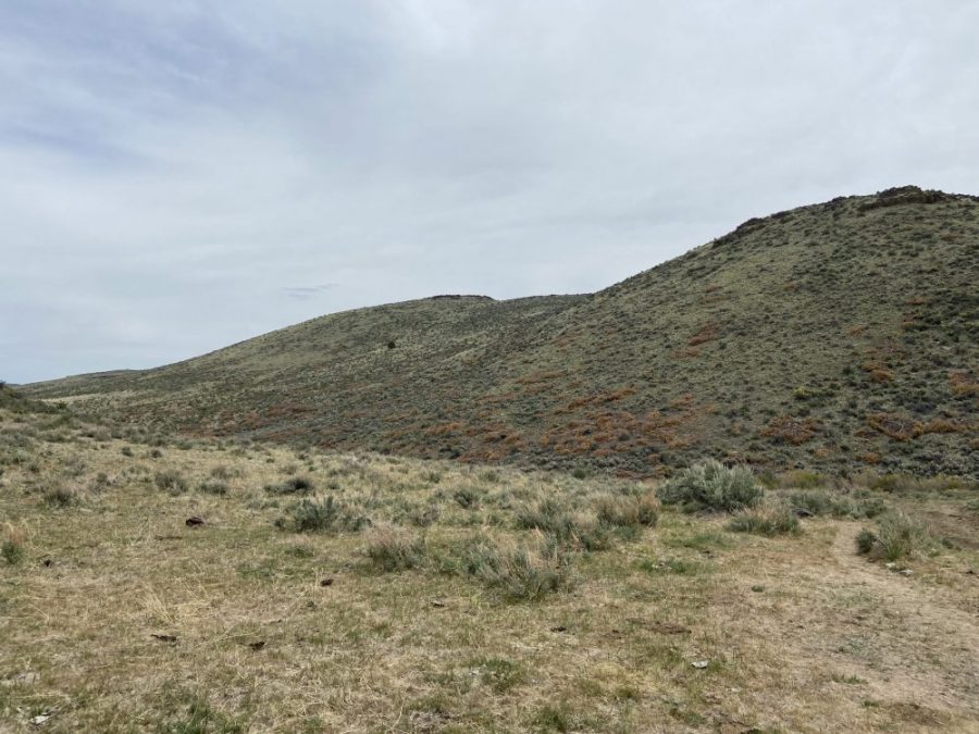
Phlox Peak (in dead-center) as viewed from the saddle southeast of Point 5316.
South Ridge, Class 2
From the saddle by Point 5316 or the end of road in the Lone Tree Creek drainage, hike up to the saddle north of Point 5604. The footing is fair through the brush. The BLM has cut down many juniper trees in this area to improve the habitat for sage grouse. The dead trees are scattered all over the hillside. From the saddle, hike up the peak’s broad south ridge to the summit. There are two high points. Although the northern summit looks as high or higher than the south summit, it is unquestionably lower. Jon Fredland left a summit register in 2021.
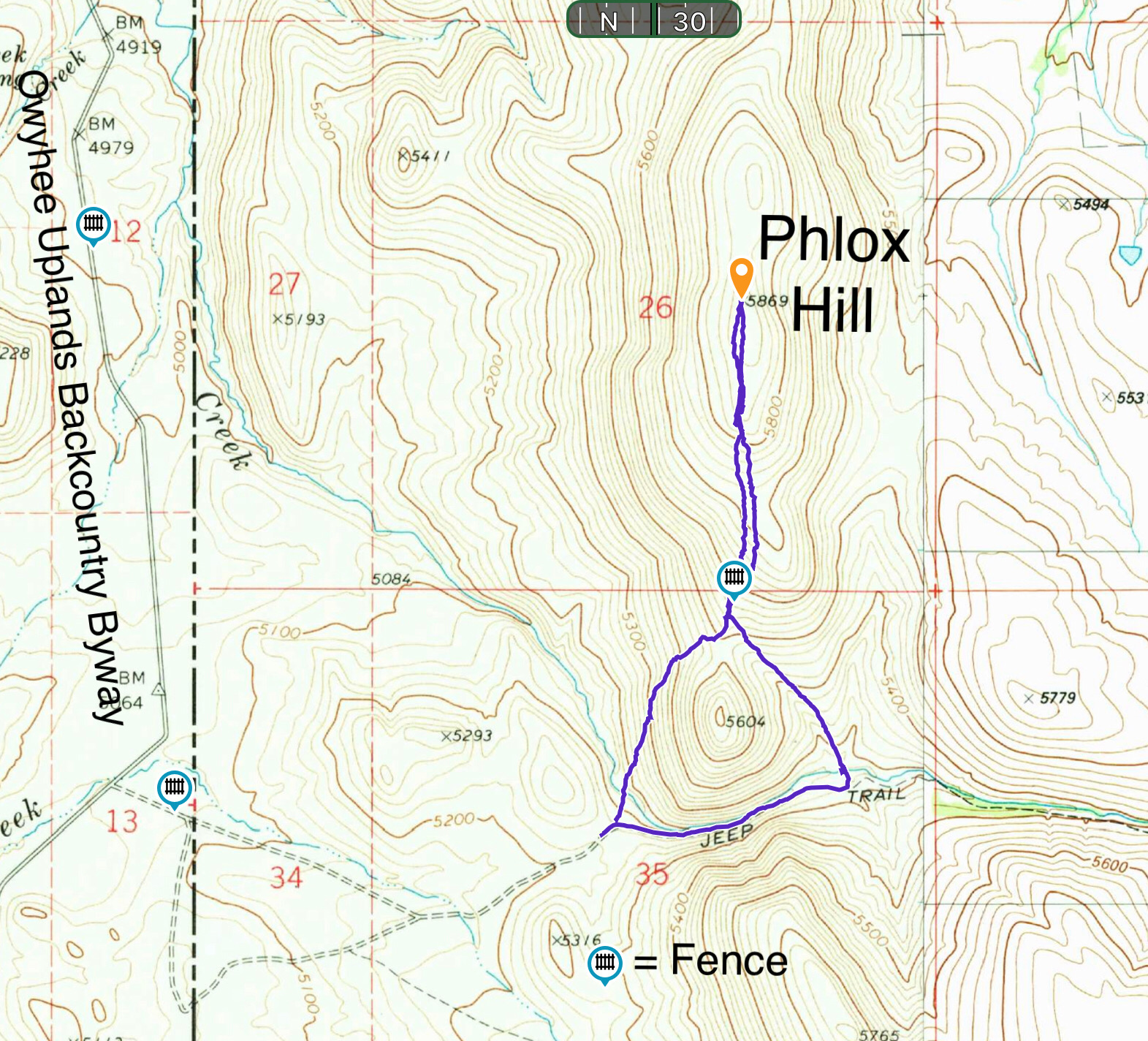
My GPS track. This route covers 2.5 miles with 650 feet of elevation gain.
Additional Resources
Regions: Owyhee Mountains->SOUTHERN IDAHO
Mountain Range: Owyhee Mountains
Longitude: -117.00729 Latitude: 42.78469