Elevation: 5,888 ft
Prominence: 388
This peak is not in the book. Livingston Douglas added a new description of the north side route to this entry. Updated November 2022
Peak 5888 is located in the far southwest corner of the Soldier Mountains. This peak is located on Boise National Forest land (surrounded by private land). As you travel along the Castle Creek Road (see below), you will not see any signs identifying the public land. Consequently, make sure you have a land status map so that you can identify a starting point on public land. USGS Cat Creek Summit

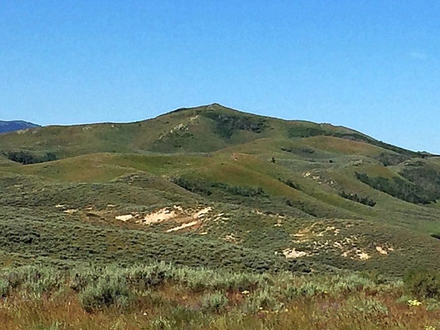
Peak 5888 as viewed from Peak 5919
Access and North Slope Route, Class 2
Climb the peak from the Castle Rock Road, which cuts between US-20 and Featherville Road. See Page 155 for information on the Featherville Road. Before it was a county road, this road was once used by Oregon Trail travelers. Follow the graded gravel road from either end to the saddle between this peak and Wood Creek Mountain. Park and you will immediately meet the crux of the climb–crossing the tall, rickety fence that parallels the road. The fence is built to hold in sheep so you cannot go through it. A step ladder with steps on both sides would eliminate this fence problem. From the other side of the fence, it is an easy Class 2 stroll up the peak’s north slopes to the summit, gaining 400 feet in just under a mile. The views on top are exceptional.
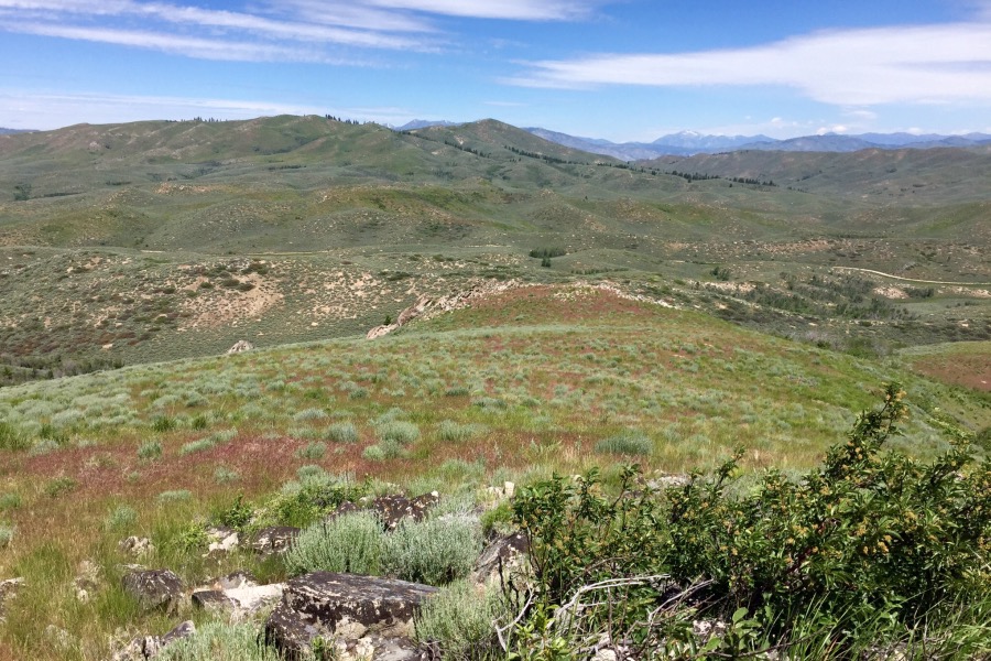
Looking north from the summit down the route of ascent. Wood Creek Mountain is in the background.
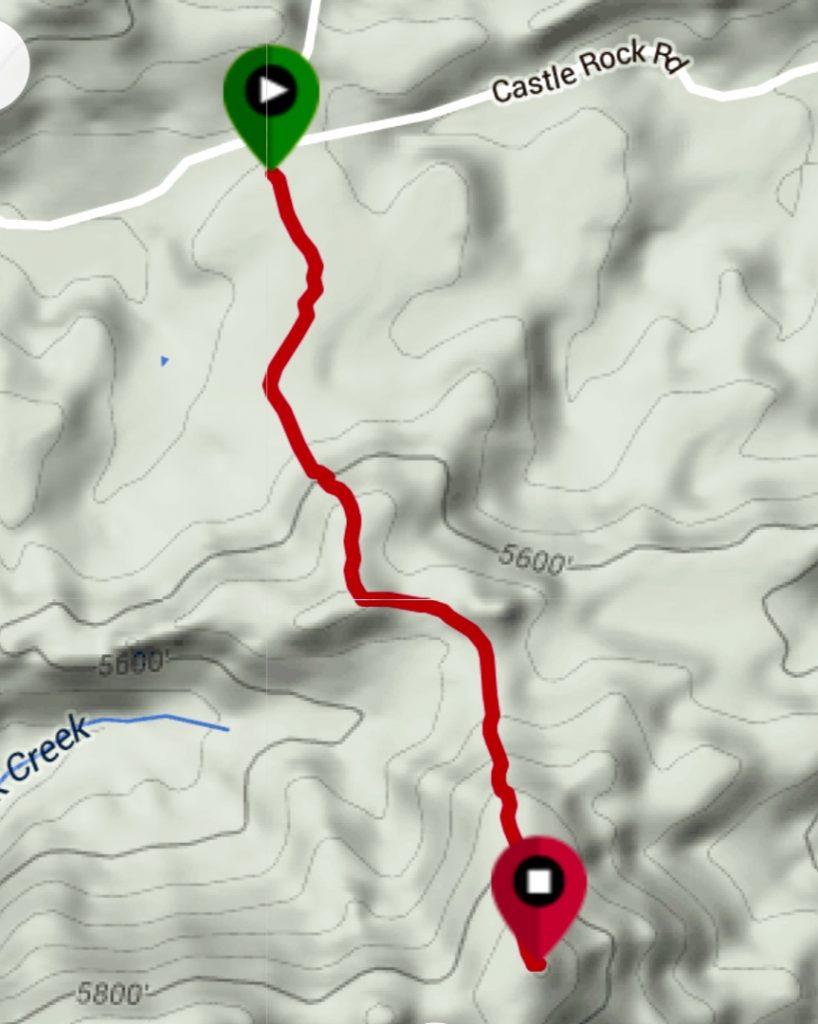
My GPS track.
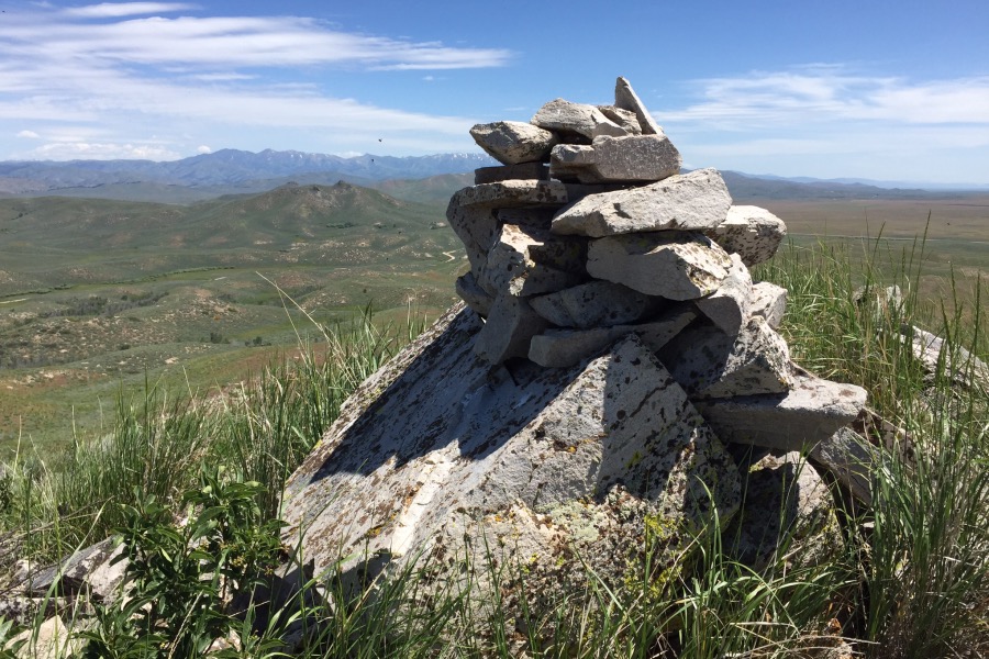
The summit cairn atop Peak 5888, looking northeast toward Peak 5915 and the Soldier Mountains.
Access for North Ridge Direct by Livingston Douglas
Park at the crest in Castle Rock Road on a saddle. This saddle is exactly 1.8 miles west of the Featherville Highway and is at 5,540 feet. GPS coordinates: 43⁰19’48”N, 115⁰17’24”W.
North Ridge, Class 2
The Climb
From the saddle, cross a stiff, high cattle fence early on (which you can’t go under due to sheep mesh) then bash south-southwest across a few sagebrush ridges and gullies. Higher up, move right/west to avoid a deeper gully. Midway up, the ridge bends left/southeast and then makes a final turn to the right/south to reach the summit. The north ridge weaves around and is ill-defined in areas. The sagebrush on this climb is pretty thick and includes dense willows in some areas (avoid them). The summit has a large cairn that is visible from Castle Rock Road. There is very little rock on this hike.
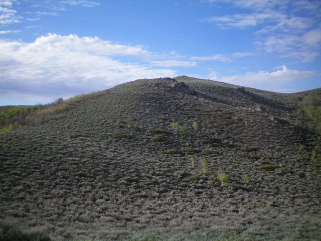
The final push up the north ridge of Peak 5888. Livingston Douglas Photo
Additional Resources
Regions: Soldier Mountains->WESTERN IDAHO
Mountain Range: Soldier Mountains
Year Climbed: 2016
Longitude: -115.28639 Latitude: 43.32129