Elevation: 5,927 ft
Prominence: 547
This peak is not in the book. Published January 2023
Peak 5927 towers over the confluence of Coal Banks Creek and Goose Creek in the South Hills. It is a handsome, ridgeline summit with an impressive north face. Peak 5927 is most easily climbed from FSR-681 to its north at a road junction. USGS Blue Hill
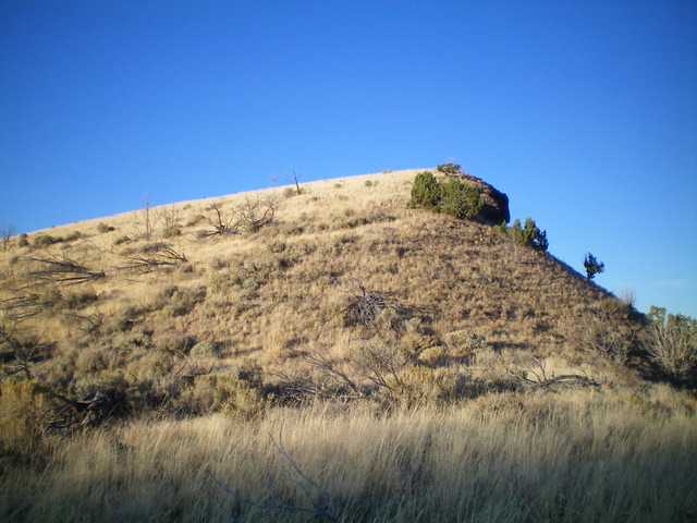
Peak 5927 as viewed from the north. The summit is the hump right of center. Livingston Douglas Photo
Access
From the end of ID-27 in downtown Oakley, turn right/west onto Main Street and drive 0.4 miles to a signed junction with Goose Creek Road (signed for the Oakley Reservoir, which is shown on maps as the Lower Goose Creek Reservoir). Turn left/south onto Goose Creek Road and reset your odometer. At 8.2 miles, reach [unsigned] Wilson Pass, the road crest for Goose Creek Road. There is an unsigned road junction here. Continue straight/south on Goose Creek Road.
At 10.0 miles, reach a signed junction with Wilson Gulch Road (right). Continue straight. At 13.9 miles, reach a signed junction with Emery Creek Road (left). Continue straight. At 15.8 miles, reach a signed junction with Coal Banks Creek Road/FSR-681. Turn right/west onto FSR-681 and drive 1.6 miles to an unsigned junction in a basin. Go right/north to stay on FSR-681 and drive 0.1 miles to a large parking area on the left/west side of the road. Park here (5,055 feet).
Please be aware that FSR-681 requires a fording of Goose Creek almost immediately after leaving Goose Creek Road. Do not attempt this fording until late Summer or Fall. And the shallowest place to ford the creek is not at the deeper, official road fording but about 50 feet downstream from the dispersed campsite that sits alongside Goose Creek.
North Face, Class 2
The Climb
From the parking area, bushwhack south through tall, but well-gapped, sagebrush to cross a westbound side road and reach the base of the north face. Scramble up the steep, but easy, face of short grass and sagebrush to reach a ridge saddle just east of Peak 5927. Scramble west then southwest up short scrub to the small, grassy summit. The summit has a nice cairn.
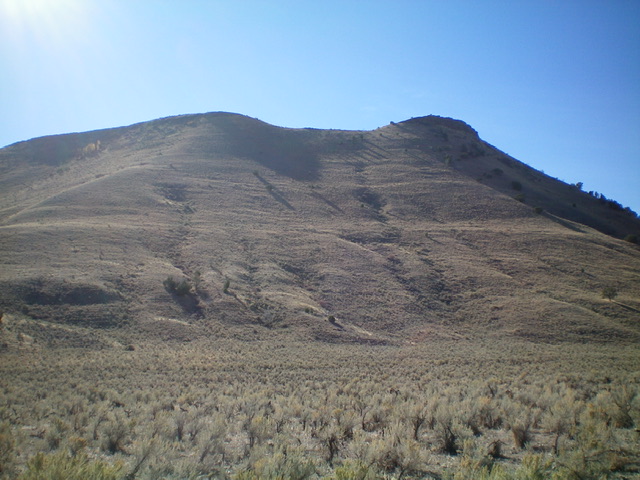
The summit hump of Peak 5927 as viewed from the high saddle to its east. Livingston Douglas Photo
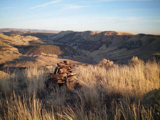
The summit cairn atop Peak 5927, looking north up the Coal Banks Creek drainage. Livingston Douglas Photo
Additional Resources
Regions: South Hills->SOUTHERN IDAHO
Mountain Range: South Hills
Longitude: -123.97501 Latitude: 42.04569