Elevation: 5,927 ft
Prominence: 547
This peak is not in the book. Published November 2019
The metropolis of Howe, ID has a collection of scrub hills on its west side. Peak 5927 is the high point of these hills. The southeast ridge makes for a fun early-season scramble. If you like USGS benchmarks, you can bag Lope Benchmark on the way up the ridge. USGS Howe
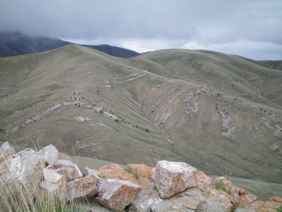
The upper section of the southeast ridge. Point 5801 is on the left and Peak 5927 is on the right. This shot was taken from Point 5572 on the ridge. Livingston Douglas Photo
Access
Park at the junction with a ranch road on the east side of ID-33 at Mile Marker 15, which is exactly 0.9 miles south of the junction of ID-33 and the Little Lost River Highway in Howe. This side road is at the base of the southeast ridge of Peak 5927. The elevation here is 4,845 feet. Please note that the USGS shows a BLM road on the west side of ID-33 at the base of the southeast ridge—in actuality, no such road exists.
Southeast Ridge, Class 2
Cross to the west side of ID-33 and climb northwest up the ridge crest to quickly find Lope Benchmark (5,204 feet). This scramble is up a grass/sage slope with a rocky base and some rocky outcrops mixed in. There is a cairn, triangulation posts, and guywires here so the benchmark is easy to locate. The actual benchmark is in a large ground boulder about 20 feet away.
From here, follow the meandering ridge northwest then west then southwest then northwest as it does a series of ups and downs over gentle ridge humps on its way to Peak 5927. The terrain on the ridge is easy open grass/sage with a broken rock base. There are a few rocky outcrops along the way but nothing to be concerned about. The summit of Peak 5927 is a gentle hump. It has a modest cairn and a large round boulder next to it (unusual).
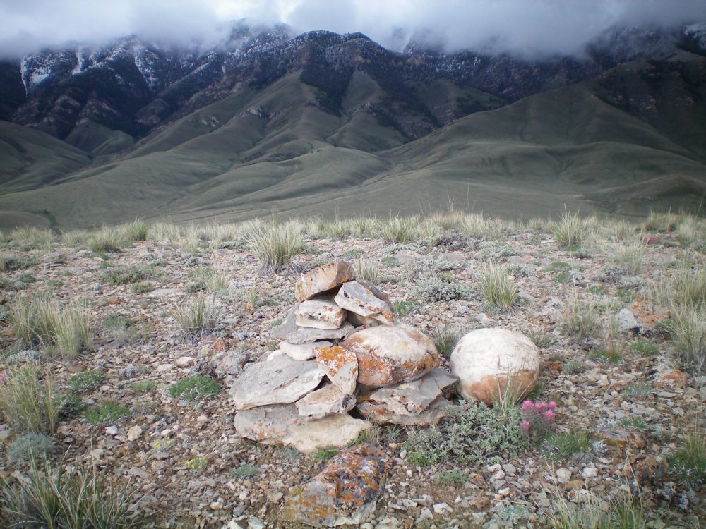
The summit cairn (and strange, very ROUND, cannonball-like boulder) atop Peak 5927. The snow-dusted Lost River Range is in the background. Livingston Douglas Photo
Additional Resources
Regions: EASTERN IDAHO->Lost River Range
Mountain Range: Lost River Range
Longitude: -113.04349 Latitude: 43.78601