Elevation: 5,940 ft
Prominence: 320
This peak is not in the book. Published December 2019
Peak 5940 is a ranked summit but barely so. It would be easy to drive by this one and never know that it is a ranked peak. It is tucked behind several peaks to the southeast. Fish Creek Reservoir is about 2 miles to its south. All of that being said, it is on public land and is an easy scramble from West Fork Fish Creek Road. USGS Fish Creek Reservoir
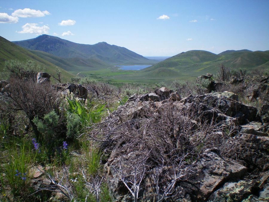
The summit boulders and brush atop Peak 5940. Fish Creek Reservoir is in the distance. Livingston Douglas Photo
East Face, Class 2
Access
From US-20, drive north up Fish Creek Road for 5.5 miles to a junction signed for the “Boat Ramp.” Turn left/west here and drive 4.2 miles, crossing two cattle gates on the way. This is a curvy, narrow road with some blind spots so be careful when driving it. Immediately after crossing to the west side of the West Fork Fish Creek, park at an unsigned road junction on the left/south side of the road at a sharp turn. The elevation here is 5,435 feet.
The Climb
From the small parking pullout at the road junction, scramble west up the steep east face through sagebrush with decent gaps in it. You should pop out on the ridge crest very close to the summit. The summit high point is located at the north end of a 0.2-mile long, scrub-covered summit plateau. A large boulder serves as the high point. A summit cairn is located on a nearby, lower boulder. The immediate area around the summit is a combination of large boulders and brush.
North Ridge, Class 2
Access
Same as for the east face
The Descent
From the summit, descend the north ridge to a meadow. The north ridge is a mix of brush and rocky outcrops and isn’t much fun, but the discomfort won’t last for long. When you reach the cattle meadow below, you can cruise east across cattle trails to reach the West Fork Fish Creek Road. Follow the road south for about ¼ mile to your parked vehicle.
Additional Resources
Regions: EASTERN IDAHO->Pioneer Mountains
Mountain Range: Pioneer Mountains
Longitude: -113.84169 Latitude: 43.46701